Toggle navigation
LMEC Home
Exhibitions
Georeferencing
Tools for Teachers
Collections
My Favorites
Sign Up / Log In
Search
Search the map portal
Map Collection
Map Collection
Map Sets
Search
Search
Search for
Search In
All Fields
Creator
Title
Subject
Place
Search All Digital Collections
Advanced Search
2888 Results
My Search
Start Over
atlas
Remove constraint atlas
Filter your Search
Place
North and Central America
1,673
United States
1,009
Europe
470
Massachusetts
359
Canada
271
South America
193
Asia
192
Suffolk (county)
165
more
Place
»
Topic
Landowners--Massachusetts--Boston--Maps
115
Real property--Massachusetts--Boston--Maps
106
United States--Maps
87
Boston (Mass.)--Maps
64
United States--History--French and Indian War, 1754-1763--Maps
63
Saint Lawrence River--Maps
41
Nautical charts--Early works to 1800
39
North America--Maps--Early works to 1800
36
more
Topic
»
Date
Date range begin
–
Date range end
Current results range from
1482
to
2023
View distribution
Creator
United States. Hydrographic Office
584
Des Barres, Joseph F. W. (Joseph Frederick Wallet), 1722-1824
118
Ptolemy, 2nd cent
100
Bromley, George Washington
99
Bromley, Walter Scott
97
G.W. Bromley & Co.
75
Carey, Mathew, 1760-1839
74
Paullin, Charles Oscar, 1868 or 1869-1944
70
more
Creator
»
Format
Maps/Atlases
2,872
Manuscripts
58
Books
37
Prints
8
Documents
5
Drawings/Illustrations
1
Georeferenced
Yes
142
No
2,746
Collection
Norman B. Leventhal Map & Education Center Collection
2,431
Maritime Charts and Atlases
1,169
American Revolutionary War-Era Maps
504
Boston and New England Maps
386
Urban Maps
271
Massachusetts Real Estate Atlases
144
William L. Clements Library Collection
92
Mapping Boston Collection
61
more
Collection
»
Available to use
No known restrictions
2,337
Creative Commons license
158
Search Constraints
Sort by relevance
relevance
title
date (asc)
date (desc)
Number of results to display per page
20 per page
10
per page
20
per page
50
per page
100
per page
View results as:
grid view
map view
Search Results
741.
Taunton
742.
Tennassee : lately the S. Wn. Territory
743.
United Provinces
744.
The United States of America
745.
Vermont from actual survey
746.
Virginia
747.
A chart of the South Sea
748.
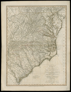
The marches of Lord Cornwallis in the Southern Provinces, now states of North America : comprehending the two Carolinas, with...
749.
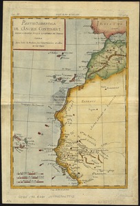
Partie occidentale de l'ancien continent depuis Lisbonne jusquà la Riviere de Sierra Leona : avec l'Isle Madere, les Isles...
750.
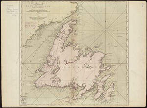
A general chart of the island of Newfoundland with the rocks & soundings
751.
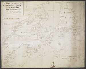
A CHART of the COAST OF NEWFOUND-LAND NEW SCOTLAND NEW ENGLAND &c. 1711
752.
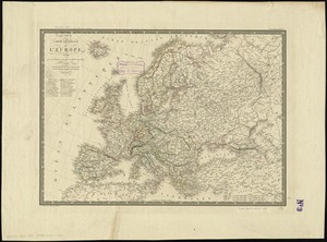
Carte générale de l'Europe, en 1824
753.
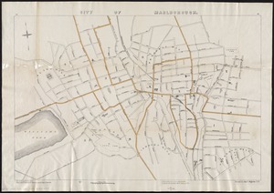
City of Marlborough
754.
Course of the river Mississipi, from the Balise to Fort Chartres : taken on an expedition to the Illinois, in the latter end of...
755.
Maine
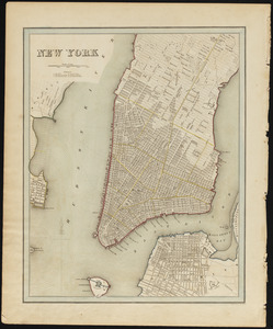
756.
New York
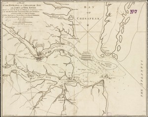
757.
A plan of the entrance of Chesapeak Bay, with James and York rivers : wherein are shewn the respective positions (in the...
758.
Rhode Island
759.
Carte de la coste de la Louisiane, depuis la Baye de St. Bernard jusqu'a celle de Saint Joseph : ou tous les ports, rades, et...
760.
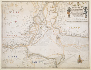
A new Mappe of a part of Hutsons or the North River, Rareton River which have there aiet lett in to the Sea by Sandy hoocke,...
‹ Prev
Next ›
1
2
…
34
35
36
37
38
39
40
41
42
…
144
145