Toggle navigation
LMEC Home
Exhibitions
Georeferencing
Tools for Teachers
Collections
My Favorites
Sign Up / Log In
Search
Search the map portal
Map Collection
Map Collection
Map Sets
Search
Search
Search for
Search In
All Fields
Creator
Title
Subject
Place
Search All Digital Collections
Advanced Search
2843 Results
My Search
Start Over
atlas
Remove constraint atlas
Date facet yearly ssim
2000
Remove constraint Date facet yearly ssim: <span class='single'>2000</span>
Filter your Search
Place
North and Central America
1,647
United States
987
Europe
464
Massachusetts
348
Canada
271
Asia
190
South America
189
Suffolk (county)
163
more
Place
»
Topic
Landowners--Massachusetts--Boston--Maps
115
Real property--Massachusetts--Boston--Maps
106
United States--Maps
87
Boston (Mass.)--Maps
63
United States--History--French and Indian War, 1754-1763--Maps
63
Saint Lawrence River--Maps
41
Nautical charts--Early works to 1800
39
North America--Maps--Early works to 1800
36
more
Topic
»
Date
Date range begin
–
Date range end
Current results range from
1482
to
2023
View distribution
Creator
United States. Hydrographic Office
582
Des Barres, Joseph F. W. (Joseph Frederick Wallet), 1722-1824
118
Ptolemy, 2nd cent
100
Bromley, George Washington
99
Bromley, Walter Scott
97
G.W. Bromley & Co.
75
Carey, Mathew, 1760-1839
74
Paullin, Charles Oscar, 1868 or 1869-1944
70
more
Creator
»
Format
Maps/Atlases
2,827
Manuscripts
58
Books
37
Prints
8
Documents
5
Drawings/Illustrations
1
Georeferenced
Yes
142
No
2,701
Collection
Norman B. Leventhal Map & Education Center Collection
2,386
Maritime Charts and Atlases
1,150
American Revolutionary War-Era Maps
504
Boston and New England Maps
374
Urban Maps
250
Massachusetts Real Estate Atlases
144
William L. Clements Library Collection
92
Mapping Boston Collection
61
more
Collection
»
Available to use
No known restrictions
2,292
Creative Commons license
158
Search Constraints
Sort by relevance
relevance
title
date (asc)
date (desc)
Number of results to display per page
20 per page
10
per page
20
per page
50
per page
100
per page
View results as:
grid view
map view
Search Results
661.
Canada
662.
Hydrographical map of the Atlantic Ocean, extending from the southermost part of North America to Europe : Shewing the differt....
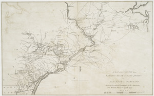
663.
A map of the country from Rariton River in East Jersey to Elk Head in Maryland : shewing the several operations of the American...
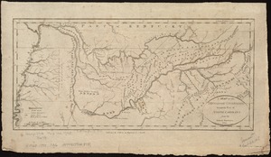
664.
A map of the Tennassee Government formerly a part of North Carolina from the latest surveys
665.
Nord America
666.
The state of Rhode Island : compiled from the surveys and observations of Caleb Harris
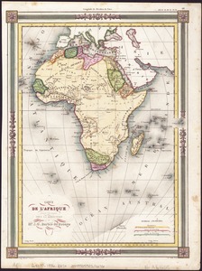
667.
Carte de l'Afrique
668.
An accurate map of the British Empire in Nth. America as settled by the preliminaries in 1762
669.
Amérique Septentrionale publiée sous les auspices de Monseigneur le Duc d'Orleans prémier prince du sang
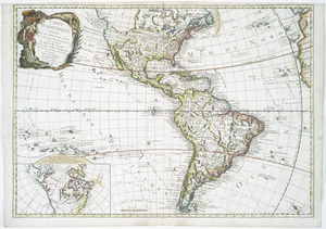
670.
Carte d'Amerique : divisée en ses principaux etats avec les nouvelles decouvertes faites au Nord et dans la Mer du Sud par les...
671.
Carte de la Louisiane et des pays voisins : dédiée à M. Rouillé, sécretaire d'État, ayant le Département de la marine
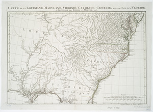
672.
Carte de la Louisiane, Maryland, Virginie, Caroline, Georgie, avec une partie de la Floride
673.
A map of Maryland with the Delaware counties and the southern part of New Jersey &c
674.
Mappa geographica Provinciæ Nova Eboraci ab Anglis New-York : dictæ ex ampliori delineatione ad exactas dimensiones concinnata...
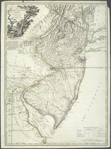
675.
A new and accurate map of New Jersey, Pensilvania, New York and New England : with the adjacent countries. Drawn from surveys,...
676.
A new and accurate map of North America : laid down according to the latest, and most approved observations and discoveries
677.
A new and accurate map of North America : laid down according to the latest, and most approved observations and discoveries
678.
Nouveau Mexique, Louisiane, Canada, et les Etats Unis
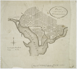
679.
Plan of the city of Washington
680.
The Province of New Jersey : divided into East and West, commonly called the Jerseys
‹ Prev
Next ›
1
2
…
30
31
32
33
34
35
36
37
38
…
142
143