Toggle navigation
LMEC Home
Exhibitions
Georeferencing
Tools for Teachers
Collections
My Favorites
Sign Up / Log In
Search
Search the map portal
Map Collection
Map Collection
Map Sets
Search
Search
Search for
Search In
All Fields
Creator
Title
Subject
Place
Search All Digital Collections
Advanced Search
14164 Results
Filter your Search
Place
North and Central America
10,832
United States
8,868
Massachusetts
2,832
Suffolk (county)
1,688
Boston
1,644
Europe
1,428
Canada
1,010
New York
684
more
Place
»
Topic
Boston (Mass.)--Maps
753
City planning--Massachusetts--Boston--Maps
419
United States--History--Revolution, 1775-1783--Maps
331
United States--Maps
331
Real property--Massachusetts--Boston--Maps
254
Urban renewal--Massachusetts--Boston--Maps
254
North America--Maps--Early works to 1800
241
Massachusetts--Maps
236
more
Topic
»
Date
Date range begin
–
Date range end
Current results range from
1482
to
2023
View distribution
Creator
United States. Hydrographic Office
597
Boston Redevelopment Authority
404
Des Barres, Joseph F. W. (Joseph Frederick Wallet), 1722-1824
247
Jefferys, Thomas, -1771
172
United States. National Ocean Service
170
Royal United Services Institute for Defence and Security Studies
160
George, III, King of Great Britain, 1738-1820
152
George, IV, King of Great Britain, 1762-1830
151
more
Creator
»
Format
Maps/Atlases
13,978
Manuscripts
985
Prints
102
Books
53
Drawings/Illustrations
44
Photographs
15
Objects/Artifacts
13
Documents
7
more
Format
»
Georeferenced
Yes
979
No
13,185
Collection
Norman B. Leventhal Map & Education Center Collection
9,162
American Revolutionary War-Era Maps
3,629
Boston and New England Maps
2,936
Urban Maps
2,511
Maritime Charts and Atlases
1,169
William L. Clements Library Collection
910
Library of Congress Collection
618
Boston Redevelopment Authority Collection
475
more
Collection
»
Available to use
No known restrictions
10,408
Creative Commons license
1,678
Search Constraints
Sort by relevance
relevance
title
date (asc)
date (desc)
Number of results to display per page
20 per page
10
per page
20
per page
50
per page
100
per page
View results as:
grid view
map view
Search Results
6701.
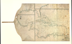
Map showing Caribbean area including West Indies and Gulf of Mexico
6702.
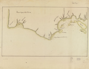
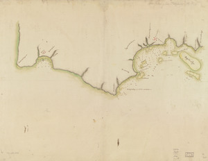
Map showing coast in the regions of Aguadilla, Añasco, and Mayagüez
6703.
Map showing coast in the regions of Aguadilla, Añasco, and Mayagüez
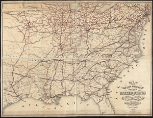
6704.
Map showing cotton growing region of the United States and means of transportation by water and rail
6705.
Map showing distribution of indian stocks and tribes, between 1710-1720
6706.
Map showing drives from the Walker-Gordon Laboratory, 203 Claredon St., Boston, to the Laboratory Farm in Wellesley
6707.
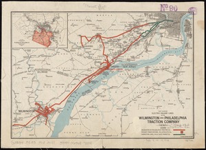
Map showing electric railway lines of the Wilmington and Philadelphia Traction Company
6708.
Map showing elevators in Manitoba, Saskatchewan and Alberta
6709.
[Map showing Fort Pitt, Fort Duquesne and Fort Mercer]
6710.
[Map showing Fort William Henry, Fort Carillon, Fort St Frederic, and the upper reaches of the Connecticut River]
6711.
Map showing horse rail roads and the surface steam roads with 104 stations in and around Boston : including 91 surface steam...
6712.
Map showing in five degrees of density the distribution of woodland within the territory of the United States, 1873
6713.
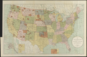
Map showing Indian reservations within the limits of the United States
6714.
Map showing Indian reservations within the limits of the United States, 1901
6715.
Map showing Indian reservations within the limits of the United States, 1903
6716.
Map showing Indian reservations within the limits of the United States, 1904
6717.
Map showing Indian reservations within the limits of the United States, 1905
6718.
Map showing Indian reservations within the limits of the United States, 1906
6719.
Map showing Japanese-Chinese warfre [sic] now in Shanghai
6720.
[Map showing Jonathan Carver's travels west of the Great Lakes.]
‹ Prev
Next ›
1
2
…
332
333
334
335
336
337
338
339
340
…
708
709


![[Map showing Fort Pitt, Fort Duquesne and Fort Mercer]](https://bpldcassets.blob.core.windows.net/derivatives/images/commonwealth:hx11z222w/image_thumbnail_300.jpg)
![[Map showing Fort William Henry, Fort Carillon, Fort St Frederic, and the upper reaches of the Connecticut River]](https://bpldcassets.blob.core.windows.net/derivatives/images/commonwealth:hx11z1735/image_thumbnail_300.jpg)


![Map showing Japanese-Chinese warfre [sic] now in Shanghai](https://bpldcassets.blob.core.windows.net/derivatives/images/commonwealth:9s161h819/image_thumbnail_300.jpg)
![[Map showing Jonathan Carver's travels west of the Great Lakes.]](https://bpldcassets.blob.core.windows.net/derivatives/images/commonwealth:hx11z299h/image_thumbnail_300.jpg)