Toggle navigation
LMEC Home
Exhibitions
Georeferencing
Tools for Teachers
Collections
My Favorites
Sign Up / Log In
Search
Search the map portal
Map Collection
Map Collection
Map Sets
Search
Search
Search for
Search In
All Fields
Creator
Title
Subject
Place
Search All Digital Collections
Advanced Search
2888 Results
My Search
Start Over
atlas
Remove constraint atlas
Filter your Search
Place
North and Central America
1,673
United States
1,009
Europe
470
Massachusetts
359
Canada
271
South America
193
Asia
192
Suffolk (county)
165
more
Place
»
Topic
Landowners--Massachusetts--Boston--Maps
115
Real property--Massachusetts--Boston--Maps
106
United States--Maps
87
Boston (Mass.)--Maps
64
United States--History--French and Indian War, 1754-1763--Maps
63
Saint Lawrence River--Maps
41
Nautical charts--Early works to 1800
39
North America--Maps--Early works to 1800
36
more
Topic
»
Date
Date range begin
–
Date range end
Current results range from
1482
to
2023
View distribution
Creator
United States. Hydrographic Office
584
Des Barres, Joseph F. W. (Joseph Frederick Wallet), 1722-1824
118
Ptolemy, 2nd cent
100
Bromley, George Washington
99
Bromley, Walter Scott
97
G.W. Bromley & Co.
75
Carey, Mathew, 1760-1839
74
Paullin, Charles Oscar, 1868 or 1869-1944
70
more
Creator
»
Format
Maps/Atlases
2,872
Manuscripts
58
Books
37
Prints
8
Documents
5
Drawings/Illustrations
1
Georeferenced
Yes
142
No
2,746
Collection
Norman B. Leventhal Map & Education Center Collection
2,431
Maritime Charts and Atlases
1,169
American Revolutionary War-Era Maps
504
Boston and New England Maps
386
Urban Maps
271
Massachusetts Real Estate Atlases
144
William L. Clements Library Collection
92
Mapping Boston Collection
61
more
Collection
»
Available to use
No known restrictions
2,337
Creative Commons license
158
Search Constraints
Sort by relevance
relevance
title
date (asc)
date (desc)
Number of results to display per page
20 per page
10
per page
20
per page
50
per page
100
per page
View results as:
grid view
map view
Search Results
621.
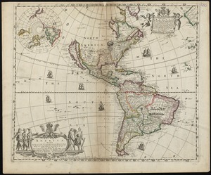
A new mapp of America devided according to the best and latest observations and discoveries wherein are described by thear...
622.
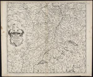
A new mapp of the upper part of the Rhine containing all Switzerland the circle of Swabia Alsatia the Palatine of the Rhine...
623.
The Spainish Netherlands, vulgarly called Flanders, devided into its X provinces, wherein are delineated the fortified towns...
624.
Amérique Septentrionale : dressée sur les relations les plus modernes des voyageurs et navigateurs, et divisée suivant les...
625.
Amerique septentrionale divisée en ses principales parties
626.
Carte nouvelle de l'Amérique Angloise contenant tout ce que les Anglois possédent sur le continent de l'Amérique...
627.
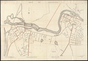
City of Chicopee
628.
Map of Maine, New Hampshire, Vermont, Massachusetts, Rhode Island, and Connecticut : exhibiting the post offices, post roads,...
629.
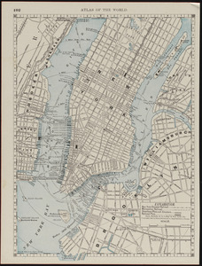
Map of New York City
630.
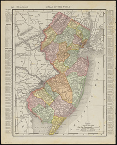
New Jersey
631.
New Jersey
632.
North America, as divided amongst the European powers
633.
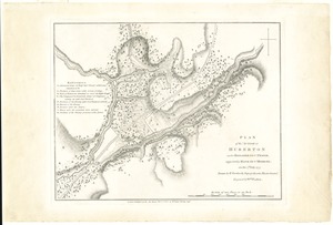
Plan of the action at Huberton under Brigadier Genl. Frazer, supported by Major Genl. Reidesel, on the 7th July 1777
634.
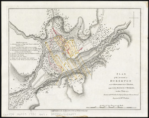
Plan of the action at Huberton under Brigadier Genl. Frazer, supported by Major Genl. Reidesel, on the 7th July 1777
635.
Spain and Portugal
636.
Vereinigte Staaten Von Nordamerika
637.
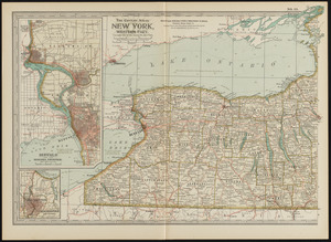
New York, western part
638.
New York, western part
639.
Map of the city of San Francisco, California (eastern half) ; map of the city of Seattle, Washington
640.
Venice (Venezia)
‹ Prev
Next ›
1
2
…
28
29
30
31
32
33
34
35
36
…
144
145