Toggle navigation
LMEC Home
Exhibitions
Georeferencing
Tools for Teachers
Collections
My Favorites
Sign Up / Log In
Search
Search the map portal
Map Collection
Map Collection
Map Sets
Search
Search
Search for
Search In
All Fields
Creator
Title
Subject
Place
Search All Digital Collections
Advanced Search
85 Results
My Search
Start Over
Date
1915
Remove constraint Date: <span class='single'>1915</span>
Filter your Search
Place
North and Central America
48
United States
40
Europe
22
Massachusetts
14
Boston
10
Canada
10
Suffolk (county)
10
Asia
7
more
Place
»
Topic
Europe--Maps
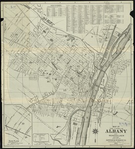
7
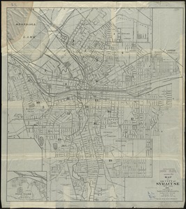
World War, 1914-1918--Europe--Maps
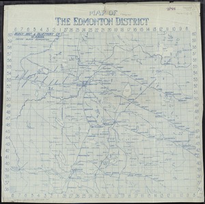
6
Austria--Maps
5
Boston (Mass.)--Maps
5
Hungary--Maps
4
Real property--Massachusetts--Boston--Maps
4
Balkan Peninsula--Maps
3
Europe, Central--Maps
3
more
Topic
»
Date
1915
[remove]
85
Date range begin
–
Date range end
Current results range from
1770
to
1999
1915
to
1915
85
Creator
Gross, Alexander, 1879-1958
11
American Geographical Society of New York
6
Army Service Schools (U.S.)
4
Canada. Railway Lands Branch
3
Bromley, George Washington
2
Bromley, Walter Scott
2
Bullard, G. E.
2
C.S. Hammond & Company
2
more
Creator
»
Format
Maps/Atlases
84
Manuscripts
1
Photographs
1
Georeferenced
Yes
10
No
75
Collection
Norman B. Leventhal Map & Education Center Collection
80
Urban Maps
5
Boston and New England Maps
4
Massachusetts Real Estate Atlases
2
Robert E. Diefenbach Map Collection at Phillips Academy
2
American Revolutionary War-Era Maps
1
Sidney R. Knafel Map Collection at Phillips Academy
1
Available to use
No known restrictions
81
Creative Commons license
1
Search Constraints
Sort by relevance
relevance
title
date (asc)
date (desc)
Number of results to display per page
20 per page
10
per page
20
per page
50
per page
100
per page
View results as:
grid view
map view
Search Results
41.
Map no. 245
42.
Map of Manitoba
43.
Map of Manitoba, Saskatchewan and Alberta : showing the number of quarter-sections available for homestead entry in each...
44.
A map of New England and New York
45.
[Map of parts of Venezuela and Colombia]
46.
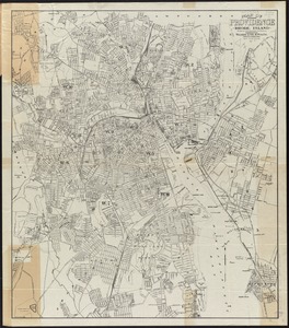
Map of Providence, Rhode Island
47.
Map of St. Paul
48.
Map of the Back Bay Fens showing the public ways bordering and crossing them and the neighboring newly laid out parts of...
49.
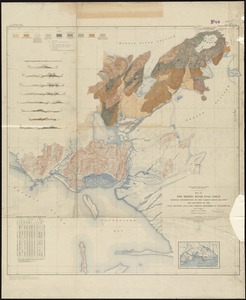
Map of the Bering River Coal Field : showing distribution of the various kinds of coal and location of the coal sections and...
50.
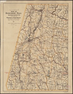
Map of the Berkshire Hills Massachusetts
51.
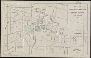
Map of the borough of Princeton, Mercer County, New Jersey
52.
Map of the Boston Elevated Ry. 1915
53.
Map of the cities of Albany and Rensselaer, New York
54.
Map of the City of Syracuse, New York
55.
Map of the Edmonton District
56.
Map showing elevators in Manitoba, Saskatchewan and Alberta
57.
A mapp of New England
58.
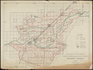
Minidoka Project, Idaho
59.
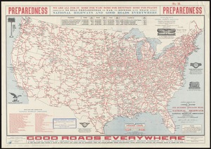
National highways map of the United States showing one hundred thousand miles of national highways proposed by the National...
60.
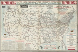
National highways map of the United States showing principal transcontinental highways and connecting system of one hundred...
‹ Prev
Next ›
1
2
3
4
5


![[Map of parts of Venezuela and Colombia]](https://bpldcassets.blob.core.windows.net/derivatives/images/commonwealth:4m90fm18q/image_thumbnail_300.jpg)