Toggle navigation
LMEC Home
Exhibitions
Georeferencing
Tools for Teachers
Collections
My Favorites
Sign Up / Log In
Search
Search the map portal
Map Collection
Map Collection
Map Sets
Search
Search
Search for
Search In
All Fields
Creator
Title
Subject
Place
Search All Digital Collections
Advanced Search
75 Results
My Search
Start Over
Date
1730
to
1734
Remove constraint Date: <span class='from'>1730</span> to <span class='to'>1734</span>
Filter your Search
Place
North and Central America
35
United States
21
Europe
15
New York
8
South America
8
Africa
7
North America
7
World
6
more
Place
»
Topic
World maps--Early works to 1800
6
North America--Maps--Early works to 1800
5
South America--Maps--Early works to 1800
4
Western Hemisphere--Maps--Early works to 1800
3
Africa--Maps--Early works to 1800
2
America--Maps--Early works to 1800
2
Architecture--Louisiana--New Orleans--Early works to 1800
2
Brazil--Maps--Early works to 1800
2
more
Topic
»
Date
1730
to
1734
[remove]
75
Date range begin
–
Date range end
Current results range from
1699
to
1800
1730
to
1730
43
1731
to
1731
26
1732
to
1732
50
1733
to
1733
34
1734
to
1734
29
Creator
Moll, Herman, d. 1732
27
L'Isle, Guillaume de, 1675-1726
10
Bowles, John, 1701-1779
9
Bowles, Thomas, 1694-1773
9
Seutter, Matthaeus, 1678-1756
5
Nolin, Jean Baptiste, 1686-1762
3
Royal United Services Institute for Defence and Security Studies
3
Burghers, M.
2
more
Creator
»
Format
Maps/Atlases
75
Manuscripts
3
Georeferenced
Yes
7
No
68
Collection
Norman B. Leventhal Map & Education Center Collection
55
American Revolutionary War-Era Maps
10
William L. Clements Library Collection
7
British Library Collection
3
MacLean Collection Map Library
3
Urban Maps
3
Maritime Charts and Atlases
2
New York Public Library Collection
2
more
Collection
»
Available to use
No known restrictions
57
Creative Commons license
6
Search Constraints
Sort by relevance
relevance
title
date (asc)
date (desc)
Number of results to display per page
20 per page
10
per page
20
per page
50
per page
100
per page
View results as:
grid view
map view
Search Results
41.
A new map of North America shewing its principal divisions, chief cities, townes, rivers, mountains &c
42.
A new map of the terraqueous globe according to the latest discoveries and most general divisions of it into continents and oceans
43.
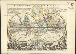
A new map of the whole world with the trade winds according to ye latest and most exact observations
44.
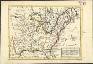
A new map of ye north parts of America claimed by France under ye names of Louisiana, Mississipi, Canada & new France with the...
45.
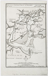
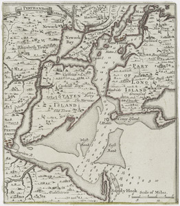
New York and Perthamboy Harbours
46.
Nobmo. prudmoq[ue] viro Joanni Six Wimnae Toparchae, Vronmadae Domino, Consuli et Senatori Amstelaedamensi, hanc novissimam...
47.
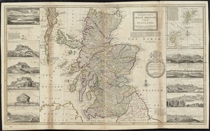
The north part of Great Britain called Scotland : with considerable inprovements [sic] and many remarks not extant in any map,...
48.
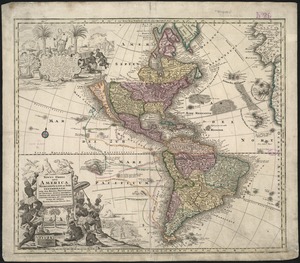
Novus orbis sive America Meridionalis et Septentrionalis, per sua regna, provincias et insulas iuxta observationes et...
49.
Part of modern Orange County
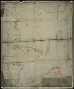
50.
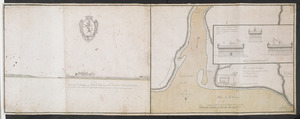
Plan du fort de Chouéghen de la Riviere Et de terrain aux Environs au Sud du Lac Ontario
51.
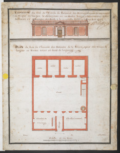
PLAN du Rex de Chausee des Batiments de la Prison, ayant dix Toises de largeur et Treize toises et demi de longeur
52.
Plan of north precinct, Reading, 1732 : showing precinct boundaries, rivers, and location of meeting house
53.
A plan of Port Royal harbour in Carolina with the proposed forts, depth of water &c
54.
A pocket companion of Ireland : containing all the cities, market towns, boroughs, all ye great roads, and principal cross...
55.
Ports de la Nouvelle York et Pertamboy : aux anglois
56.
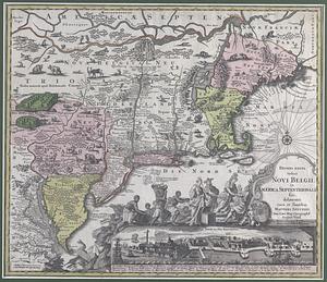
Recens edita totius Novi Belgii in America Septentrionali fiti
57.
Recens edita totius Novi Belgii in America Septentrionali siti
58.
Recens elaborata mappa geographica regni Brasiliae in America Meridionali maxime celebris
59.
Recentis Romae ichnographia et hypsographia sive planta et facies ad magnificentiam qua sub Alexandro VII P.M. urbs ipsa...
60.
River valley with several foothills and swamp
‹ Prev
Next ›
1
2
3
4


![Nobmo. prudmoq[ue] viro Joanni Six Wimnae Toparchae, Vronmadae Domino, Consuli et Senatori Amstelaedamensi, hanc novissimam Britanniae, olim Armoricae tabulam](https://bpldcassets.blob.core.windows.net/derivatives/images/commonwealth:cj82ks229/image_thumbnail_300.jpg)