Toggle navigation
LMEC Home
Exhibitions
Georeferencing
Tools for Teachers
Collections
My Favorites
Sign Up / Log In
Search
Search the map portal
Map Collection
Map Collection
Map Sets
Search
Search
Search for
Search In
All Fields
Creator
Title
Subject
Place
Search All Digital Collections
Advanced Search
140 Results
My Search
Start Over
vermont
Remove constraint vermont
Filter your Search
Place
North and Central America
132
Vermont
58
United States
53
New England
32
New York
21
New Hampshire
18
Massachusetts
13
Canada
8
more
Place
»
Topic
Vermont--Maps
30
New England--Maps
22
Railroads--New England--Maps
12
New Hampshire--Maps
11
Long Trail (Vt.)--Maps
9
New York (State)--Maps
9
Trails--Vermont--Maps
9
Vermont--Maps--Early works to 1800
8
more
Topic
»
Date
Date range begin
–
Date range end
Current results range from
1744
to
2015
View distribution
Creator
Burleigh, L. R., 1853-1923
10
Congdon, Herbert Wheaton, 1876-1965
9
United States. Post Office Dept
7
Faden, William, 1749-1836
5
Walling, Henry Francis, 1825-1888
5
Cram, George Franklin, 1841-1928
4
Doolittle, Amos, 1754-1832
4
Green Mountain Club
4
more
Creator
»
Format
Maps/Atlases
139
Manuscripts
13
Objects/Artifacts
1
Prints
1
Georeferenced
Yes
18
No
122
Collection
Norman B. Leventhal Map Center Collection
102
Boston and New England Maps
68
American Revolutionary War-Era Maps
49
Urban Maps
17
William L. Clements Library Collection
7
American Antiquarian Society Collection
6
British Library Collection
5
Library of Congress Collection
5
more
Collection
»
Available to use
No known restrictions
103
Creative Commons license
18
Search Constraints
Sort by relevance
relevance
title
date (asc)
date (desc)
Number of results to display per page
20 per page
10
per page
20
per page
50
per page
100
per page
View results as:
grid view
map view
Search Results
41.
Map of Maine, New Hampshire and Vermont, from the most authentic sources
42.
The Above is a plan of the town of Cabot, State of Vermont
43.
Map of the states of Maine, New Hampshire, Vermont, Massachusetts, Connecticut & Rhode Island
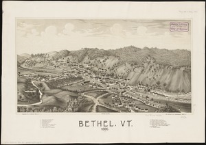
44.
Bethel, Vt : 1886
45.
Brattleboro, Vt : 1876
46.
Brattleboro, Vt : 1886
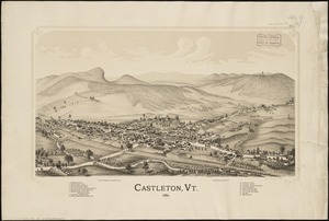
47.
Castleton, Vt : 1889
48.
Ludlow, Vt
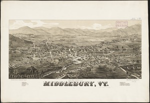
49.
Middlebury, Vt
50.
Rutland, Vt
51.
Springfield, Vt
52.
Bellows Falls, Vt
53.
West Randolph, Vt : 1886
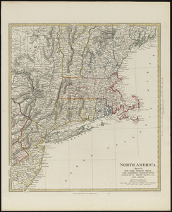
54.
North America, sheet VI, New-York, Vermont, Maine, New-Hampshire, Massachusetts, Connecticut, Rhode-Island, and New-Jersey
55.
Rand McNally official 1924 auto trails map Maine ; Rand McNally official 1924 auto trails map New Hampshire, Vermont
56.
Barre, Washington County, Vt : 1884
57.
Complete map of Vermont showing highways & natural features with an index of all cities, villages, post-offices and railroad...
58.
Carte de la Nouvelle York, y-compris les terres cédées du N. Hamp-Shire, sous le nom d'etat de Vermont
59.
A map of the province of Massachusets Bay and colony of Rhode Island, with part of Connecticut, New Hampshire, and Vermont
60.
A map of the province of Massachusets Bay and colony of Rhode Island, with part of Connecticut, New Hampshire, and Vermont
‹ Prev
Next ›
1
2
3
4
5
6
7