Toggle navigation
LMEC Home
Exhibitions
Georeferencing
Tools for Teachers
Collections
My Favorites
Sign Up / Log In
Search
Search the map portal
Map Collection
Map Collection
Map Sets
Search
Search
Search for
Search In
All Fields
Creator
Title
Subject
Place
Search All Digital Collections
Advanced Search
69 Results
My Search
Start Over
1907
Remove constraint 1907
Filter your Search
Place
North and Central America
59
United States
54
Massachusetts
23
Boston
6
Essex (county)
6
Michigan
6
Suffolk (county)
6
Middlesex (county)
5
more
Place
»
Topic
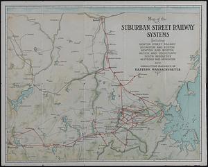
United States--History--French and Indian War, 1754-1763--Maps, Manuscript--Early works to 1800
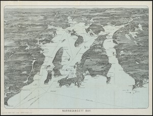
4
Beverly (Mass.)--Maps
3
Franco-Prussian War, 1870-1871
3
Landowners--Massachusetts--Beverly--Maps
3
Massachusetts--Maps
3
Nautical charts--Superior, Lake
3
Quincy (Mass.)--Maps
3
Agate Harbor (Mich.)--Maps
2
more
Topic
»
Date
Date range begin
–
Date range end
Current results range from
1756
to
1912
View distribution
Creator
Dougal, William H., 1822-1895
6
U.S. Lake Survey
6
Board of Harbor and Land Commissioners of Massachusetts
5
Henry, D. F. (Daniel Farrand), 1833-1907
5
Macomb, J. N. (John N.), 1810 or 1811-1889
5
Meade, George Gordon, 1815-1872
5
Raynolds, W. F. (William Franklin), 1820-1894
5
Wallace, J.
5
more
Creator
»
Format
Maps/Atlases
69
Manuscripts
5
Georeferenced
Yes
6
No
63
Collection
Norman B. Leventhal Map & Education Center Collection
54
Boston and New England Maps
12
American Revolutionary War-Era Maps
6
British Library Collection
4
Urban Maps
4
Lucius Beebe Memorial Library Historic Maps
3
Massachusetts Real Estate Atlases
3
Maritime Charts and Atlases
2
more
Collection
»
Available to use
No known restrictions
59
Creative Commons license
4
Search Constraints
Sort by relevance
relevance
title
date (asc)
date (desc)
Number of results to display per page
20 per page
10
per page
20
per page
50
per page
100
per page
View results as:
grid view
map view
Search Results
41.
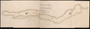
LAKE GEORGE
42.
A Draught of the Fortress building at Crown Point 22.d Oct.t 1759
43.
Copy of a map presented to the Congres [sic]
44.
The Course of the Wood Creek from the Mowhock River at the Onoida or Great Carrying Place to The Onoida Lake. Representing the...
45.
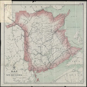
Map of the province of New Brunswick
46.
The world upon globular projection and with a gazetteer of information
47.
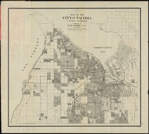
Map of the city of Tacoma & vicinity, Washington
48.
Atlas of the city of Quincy, Norfolk County, Massachusetts
49.
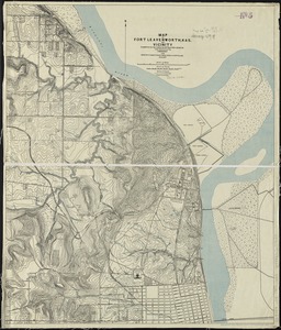
Map of Fort Leavenworth, Kas. and vicinity
50.
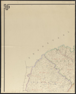
Map of the Orange River Colony
51.
Map of the suburban street railway systems : including Newton Street Railway, Lexington and Boston, Newton and Boston, Natick...
52.
Narragansett Bay
53.
New commercial, sportsmen's and route survey of Maine : showing all postoffices, railroads, electric roads, principal highways,...
54.
The New England commercial and route survey : showing all postoffices, railroads, electric roads in operation and proposed,...
55.
Traffic for Birkenhead
56.
Atlas of the city of Beverly, Essex County, Massachusetts
57.
Atlas of the city of Beverly, Essex County, Massachusetts
58.
Atlas of the city of Newton, Massachusetts
59.
Atlas of the city of Quincy, Norfolk County, Massachusetts
60.
Atlas of the town of Brookline, Norfolk County, Massachusetts : from actual surveys and official plans
‹ Prev
Next ›
1
2
3
4

![Copy of a map presented to the Congres [sic]](https://bpldcassets.blob.core.windows.net/derivatives/images/commonwealth:z603vn16x/image_thumbnail_300.jpg)