Toggle navigation
LMEC Home
Exhibitions
Georeferencing
Tools for Teachers
Collections
My Favorites
Sign Up / Log In
Search
Search the map portal
Map Collection
Map Collection
Map Sets
Search
Search
Search for
Search In
All Fields
Creator
Title
Subject
Place
Search All Digital Collections
Advanced Search
14164 Results
Filter your Search
Place
North and Central America
10,832
United States
8,868
Massachusetts
2,832
Suffolk (county)
1,688
Boston
1,644
Europe
1,428
Canada
1,010
New York
684
more
Place
»
Topic
Boston (Mass.)--Maps
753
City planning--Massachusetts--Boston--Maps
419
United States--History--Revolution, 1775-1783--Maps
331
United States--Maps
331
Real property--Massachusetts--Boston--Maps
254
Urban renewal--Massachusetts--Boston--Maps
254
North America--Maps--Early works to 1800
241
Massachusetts--Maps
236
more
Topic
»
Date
Date range begin
–
Date range end
Current results range from
1482
to
2023
View distribution
Creator
United States. Hydrographic Office
597
Boston Redevelopment Authority
404
Des Barres, Joseph F. W. (Joseph Frederick Wallet), 1722-1824
247
Jefferys, Thomas, -1771
172
United States. National Ocean Service
170
Royal United Services Institute for Defence and Security Studies
160
George, III, King of Great Britain, 1738-1820
152
George, IV, King of Great Britain, 1762-1830
151
more
Creator
»
Format
Maps/Atlases
13,978
Manuscripts
985
Prints
102
Books
53
Drawings/Illustrations
44
Photographs
15
Objects/Artifacts
13
Documents
7
more
Format
»
Georeferenced
Yes
979
No
13,185
Collection
Norman B. Leventhal Map & Education Center Collection
9,162
American Revolutionary War-Era Maps
3,629
Boston and New England Maps
2,936
Urban Maps
2,511
Maritime Charts and Atlases
1,169
William L. Clements Library Collection
910
Library of Congress Collection
618
Boston Redevelopment Authority Collection
475
more
Collection
»
Available to use
No known restrictions
10,408
Creative Commons license
1,678
Search Constraints
Sort by relevance
relevance
title
date (asc)
date (desc)
Number of results to display per page
20 per page
10
per page
20
per page
50
per page
100
per page
View results as:
grid view
map view
Search Results
4661.
Japan, the target : a pictorial Jap-map
4662.
Japan, west coast of Kiusiu, the northern entrance of Hirado-no-Seto (Spex Strait) with the harbor of Yebukuro-no-Minato
4663.
Japanese fishing, areas and seasons
4664.
Japan-Yezo Id., e. coast, Akishi Bay : republished from the Brt. Admty. chart no. 992, corrected to 1873
4665.
Java and Madoera : Indonesian ethnic groups, elementary education, and Christian missions
4666.
Java and Madoera principal estate regions showing major products
4667.
Jefferson County, Wis.
4668.
Jefferson, Venango & Armstrong
4669.
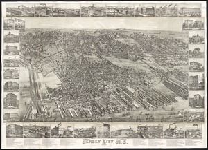
Jersey City, N.J : 1883
4670.
Jetersville and Sailors Creek
4671.
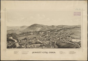
Jewett City, Conn
4672.
Jewett City Textile (Bleachery), Jewett City, Conn. [insurance map]
4673.
J.H. Colton's topographical map of North and South Carolina : a large portion of Georgia & part of adjoining states
4674.
J.H. Colton's Topographical map of seat of war in Virginia, Maryland, &c
4675.
J.M.E. Riedel's new street number guide map of Fort Wayne
4676.
John Hancock office and parking garage complex, Boston, Massachusetts
4677.
The Johnans. Turner farm
4678.
Johnson's Colorado ; Johnson's Indian Territory
4679.
Johnson's Florida
4680.
Johnson's map of New York and the adjacent cities
‹ Prev
Next ›
1
2
…
230
231
232
233
234
235
236
237
238
…
708
709


![Jewett City Textile (Bleachery), Jewett City, Conn. [insurance map]](https://bpldcassets.blob.core.windows.net/derivatives/images/commonwealth:2r36vc13c/image_thumbnail_300.jpg)