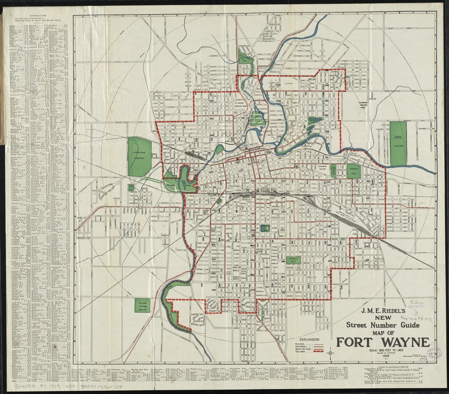
J.M.E. Riedel's new street number guide map of Fort Wayne
Item Information
- Title:
- J.M.E. Riedel's new street number guide map of Fort Wayne
- Title (alt.):
-
New street number guide map of Fort Wayne
J.M.E. Riedel's Pocket map of Fort Wayne, Indiana
Pocket map of Fort Wayne, Indiana
- Description:
-
Shows radial distances, railroad, interurban and streetcar lines.
- Creator:
- Riedel, J. M. E
- Date:
-
[ca. 1919]
- Format:
-
Maps/Atlases
- Location:
-
Boston Public Library
Norman B. Leventhal Map & Education Center - Collection (local):
-
Norman B. Leventhal Map & Education Center Collection
- Subjects:
-
Railroads--Indiana--Fort Wayne--Maps
Street-railroads--Indiana--Fort Wayne--Maps
Fort Wayne (Ind.)--Maps
- Places:
-
IndianaAllen (county)Fort Wayne
- Extent:
- 1 map : col. ; 48 x 50 cm., on sheet 54 x 61 cm., folded in cover 19 x 11 cm.
- Terms of Use:
-
No known copyright restrictions.
No known restrictions on use.
- Publisher:
-
[Fort Wayne, Ind.] :
J.M.E. Riedel
- Scale:
-
Scale [1:19,200]. 1600 ft. to 1 inch
- Language:
-
English
- Notes:
-
Approved by Frank M. Randall, city civil engineer.
Indexed.
- Identifier:
-
06_01_011159
- Call #:
-
G4094.F7 1919 .R54
- Barcode:
-
39999065681031


