Toggle navigation
LMEC Home
Exhibitions
Georeferencing
Tools for Teachers
Collections
My Favorites
Sign Up / Log In
Search
Search the map portal
Map Collection
Map Collection
Map Sets
Search
Search
Search for
Search In
All Fields
Creator
Title
Subject
Place
Search All Digital Collections
Advanced Search
49 Results
My Search
Start Over
Date
1945
Remove constraint Date: <span class='single'>1945</span>
Filter your Search
Place
North and Central America
26
United States
24
Asia
16
Philippines
9
Massachusetts
7
Boston
6
Suffolk (county)
6
New England
5
more
Place
»
Topic
Fire risk assessment
7
Insurance surveys
7
Textile factories
5
New England--Maps--Early works to 1800--Facsimiles
3
Boston (Mass.)--Maps
2
Factories
2
Java (Indonesia)--Maps
2
Lesser Sunda Islands--Maps
2
more
Topic
»
Date
1945
[remove]
49
Date range begin
–
Date range end
Current results range from
1770
to
1999
1945
to
1945
49
Creator
United States. Office of Strategic Services. Research and Analysis Branch
19
Associated Factory Mutual Fire Insurance Companies
7
United States. Office of Strategic Services. Reproduction Branch
5
Chase, Ernest Dudley, 1878-1966
2
Diercke, Carl, 1842-1913
2
Boston (Mass.). Board of Election Commissioners
1
Boston (Mass.). Department of Parks. Board of Commissioners
1
Culverwell, Tom
1
more
Creator
»
Format
Maps/Atlases
48
Photographs
1
Georeferenced
Yes
1
No
48
Collection
Norman B. Leventhal Map & Education Center Collection
40
American Textile History Museum Image Collection
7
Boston and New England Maps
3
American Revolutionary War-Era Maps
1
Applied Geographics, Inc. Records
1
Lucius Beebe Memorial Library Historic Maps
1
Sidney R. Knafel Map Collection at Phillips Academy
1
Urban Maps
1
Available to use
No known restrictions
41
Search Constraints
Sort by relevance
relevance
title
date (asc)
date (desc)
Number of results to display per page
20 per page
10
per page
20
per page
50
per page
100
per page
View results as:
grid view
map view
Search Results
21.
Java and Madoera principal estate regions showing major products
22.
Lesser Sunda Islands, distribution of population
23.
Lesser Sunda Islands Indonesian Ethnic groups and Christian missions
24.
A map of New England and New York
25.
Map of the Back Bay Fens showing the public ways bordering and crossing them and the neighboring newly laid out parts of...
26.
A mapp of New England
27.
New England Briar Pipe Company and/or The Reiss-Premier Corporation and/or New England Brush Company, Inc., Penacook, N.H....
28.
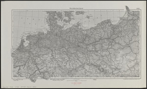
Norddeutschland
29.
North Adams Tanning Corporation, et al, North Adams, Mass. [insurance map]
30.
Pampanga
31.
Philippine Islands : [outline map]
32.
A pictorial map of North America
33.
Pictorial map of the American continent : featuring the Pan American Highway and showing some of the natural resources, scenic...
34.
Plan of corner of Centry & Beacon St's -- 1741
35.
Plan of the burnt district : showing proposed improvements in streets. Nov. 12th 1872
36.
Los recursos de los Estados Unidos
37.
A small map of the sea coast of New England together with the outlines of several of the provinces lying thereon, 1738
38.
The south part of New-England, as it is planted this yeare, 1635
39.
Süddeutschland, Österreich, Schweiz und östliches Frankreich
40.
Sumatra wegenkaart
‹ Prev
Next ›
1
2
3


![New England Briar Pipe Company and/or The Reiss-Premier Corporation and/or New England Brush Company, Inc., Penacook, N.H. [insurance map]](https://bpldcassets.blob.core.windows.net/derivatives/images/commonwealth:ww72c022m/image_thumbnail_300.jpg)
![North Adams Tanning Corporation, et al, North Adams, Mass. [insurance map]](https://bpldcassets.blob.core.windows.net/derivatives/images/commonwealth:9880vw966/image_thumbnail_300.jpg)


