Toggle navigation
LMEC Home
Exhibitions
Georeferencing
Tools for Teachers
Collections
My Favorites
Sign Up / Log In
Search
Search the map portal
Map Collection
Map Collection
Map Sets
Search
Search
Search for
Search In
All Fields
Creator
Title
Subject
Place
Search All Digital Collections
Advanced Search
69 Results
My Search
Start Over
Date
1909
Remove constraint Date: <span class='single'>1909</span>
Filter your Search
Place
North and Central America
59
United States
52
Massachusetts
23
Boston
14
Suffolk (county)
14
Europe
5
Mexico
5
New England
5
more
Place
»
Topic
Boston (Mass.)--Maps
6
Immigrants--Massachusetts--Boston
3
Massachusetts--Maps
3
New England--Maps--Early works to 1800--Facsimiles
3
Real property--Massachusetts--Boston--Maps
3
Braintree (Mass.)--Maps
2
Brighton (Boston, Mass.)--Maps
2
Chiapas (Mexico)--Maps
2
more
Topic
»
Date
1909
[remove]
69
Date range begin
–
Date range end
Current results range from
1770
to
1999
1909
to
1909
69
Creator
Walker Lith. & Pub. Co
6
Walker Lith. & Pub. Co.
5
Fisk, E. F.
4
Blanchard, Rufus, 1821-1904
2
Bromley, George Washington
2
Bromley, Walter Scott
2
Geological Survey of Canada
2
International Correspondence Schools
2
more
Creator
»
Format
Maps/Atlases
65
Photographs
3
Prints
2
Georeferenced
Yes
9
No
60
Collection
Norman B. Leventhal Map & Education Center Collection
59
Boston and New England Maps
6
Urban Maps
6
Massachusetts Real Estate Atlases
5
Robert E. Diefenbach Map Collection at Phillips Academy
3
Mapping Boston Collection
2
American Revolutionary War-Era Maps
1
American Textile History Museum Image Collection
1
more
Collection
»
Available to use
No known restrictions
60
Creative Commons license
2
Search Constraints
Sort by relevance
relevance
title
date (asc)
date (desc)
Number of results to display per page
20 per page
10
per page
20
per page
50
per page
100
per page
View results as:
grid view
map view
Search Results
21.
A draught of St. John's harbour : with the soundings
22.
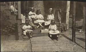
Family of Mrs. Donovan, Roxbury
23.
A geological map of Ohio
24.
Der Hafen von Hamburg
25.
Index diagram of sheets for the International map on the scale of 1:1,000,000
26.
Map eleventh division railway mail service
27.
Map of Boston : Dec. 1, 1908
28.
Map of Boston and suburbs
29.
Map of Cape Cod and vicinity
30.
Map of Cape Nome and adjacent mining dists
31.
Map of Fort Leavenworth, Kansas and vicinity
32.
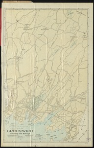
Map of Greenwich, township and borough, Fairfield County, Connecticut
33.
Map of maneuver ground, Massachusetts, 1909
34.
A map of New England and New York
35.
Map of the Back Bay Fens showing the public ways bordering and crossing them and the neighboring newly laid out parts of...
36.
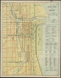
Map of the business center of Chicago
37.
Map of the existing and proposed circumferential thoroughfares of the district
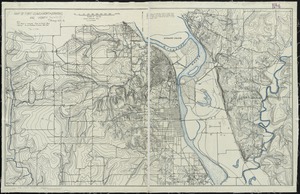
38.
Map of the existing and proposed radial thoroughfares of the district and their connections
39.
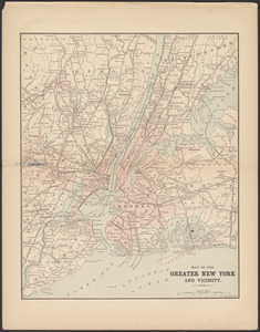
Map of the greater New York and vicinity
40.
Map seventh division railway mail service
‹ Prev
Next ›
1
2
3
4