Toggle navigation
LMEC Home
Exhibitions
Georeferencing
Tools for Teachers
Collections
My Favorites
Sign Up / Log In
Search
Search the map portal
Map Collection
Map Collection
Map Sets
Search
Search
Search for
Search In
All Fields
Creator
Title
Subject
Place
Search All Digital Collections
Advanced Search
50 Results
My Search
Start Over
Date
1732
Remove constraint Date: <span class='single'>1732</span>
Filter your Search
Place
North and Central America
24
United States
14
Europe
7
Africa
6
North America
5
World
5
New York
4
South America
4
more
Place
»
Topic
World maps--Early works to 1800
5
North America--Maps--Early works to 1800
3
Africa--Maps--Early works to 1800
2
Maryland--Maps--Early works to 1800
2
North Carolina--Maps--Early works to 1800
2
South America--Maps--Early works to 1800
2
Virginia--Maps--Early works to 1800
2
Western Hemisphere--Maps--Early works to 1800
2
more
Topic
»
Date
1732
[remove]
50
Date range begin
–
Date range end
Current results range from
1699
to
1800
1732
to
1732
50
Creator
Moll, Herman, d. 1732
22
Bowles, John, 1701-1779
9
Bowles, Thomas, 1694-1773
9
L'Isle, Guillaume de, 1675-1726
3
Nolin, Jean Baptiste, 1686-1762
3
Burghers, M.
2
Royal United Services Institute for Defence and Security Studies
2
Amherst, Jeffery Amherst, Baron, 1717-1797
1
more
Creator
»
Format
Maps/Atlases
50
Manuscripts
3
Georeferenced
Yes
6
No
44
Collection
Norman B. Leventhal Map & Education Center Collection
37
American Revolutionary War-Era Maps
10
William L. Clements Library Collection
7
British Library Collection
2
MacLean Collection Map Library
2
Boston and New England Maps
1
Library of Congress Collection
1
Lucius Beebe Memorial Library Historic Maps
1
more
Collection
»
Available to use
No known restrictions
38
Creative Commons license
3
Search Constraints
Sort by relevance
relevance
title
date (asc)
date (desc)
Number of results to display per page
20 per page
10
per page
20
per page
50
per page
100
per page
View results as:
grid view
map view
Search Results
21.
A map of the North Pole with all the territories that lye near it, known to us &c. According to the latest discoveries, and...
22.
A map of the West-Indies &c. Mexico or New Spain : also ye trade winds, and ye several tracts made by ye galeons and flota from...
23.
Mappe-monde
24.
Mappmonde ou description generale du globe terrestre
25.
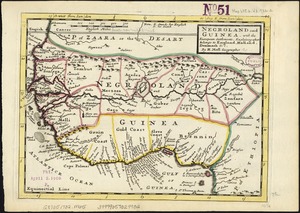
Negroland and Guinea : with the European settlements explaining what belongs to England, Holland, Denmark &c
26.
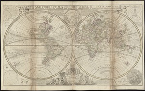
A new and correct map of the world, laid down according to the newest discoveries, and from the most exact observations
27.
New Found Land, St. Laurence Bay, the fishing banks, Acadia, and part of New Scotland
28.
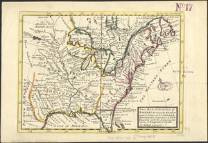
A new map of North America shewing its principal divisions, chief cities, townes, rivers, mountains &c
29.
A new map of the terraqueous globe according to the latest discoveries and most general divisions of it into continents and oceans
30.
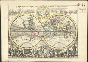
A new map of the whole world with the trade winds according to ye latest and most exact observations
31.
A new map of ye north parts of America claimed by France under ye names of Louisiana, Mississipi, Canada & new France with the...
32.
Part of modern Orange County
33.
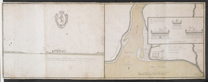
Plan du fort de Chouéghen de la Riviere Et de terrain aux Environs au Sud du Lac Ontario
34.
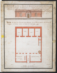
PLAN du Rex de Chausee des Batiments de la Prison, ayant dix Toises de largeur et Treize toises et demi de longeur
35.
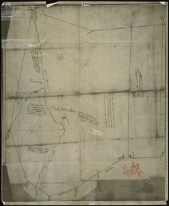
Plan of north precinct, Reading, 1732 : showing precinct boundaries, rivers, and location of meeting house
36.
A plan of Port Royal harbour in Carolina with the proposed forts, depth of water &c
37.
A pocket companion of Ireland : containing all the cities, market towns, boroughs, all ye great roads, and principal cross...
38.
River valley with several foothills and swamp
39.
The roads of ye south part of Great Britain, called England and Wales : Containing all ye cities, market towns, post towns,...
40.
Shinsen zouho Kyo oezu
‹ Prev
Next ›
1
2
3