Toggle navigation
LMEC Home
Exhibitions
Georeferencing
Tools for Teachers
Collections
My Favorites
Sign Up / Log In
Search
Search the map portal
Map Collection
Map Collection
Map Sets
Search
Search
Search for
Search In
All Fields
Creator
Title
Subject
Place
Search All Digital Collections
Advanced Search
67 Results
My Search
Start Over
g1059
Remove constraint g1059
Filter your Search
Place
North and Central America
33
South America
29
Brazil
10
United States
10
Canada
7
Chile
7
Argentina
6
North America
6
more
Place
»
Topic
Nautical charts--Early works to 1800
33
Coasts--Chile--Maps--Early works to 1800
6
Coasts--Argentina--Maps--Early works to 1800
5
Antilles, Greater--Maps--Early works to 1800
4
Antilles, Lesser--Maps--Early works to 1800
4
New England--Maps--Early works to 1800
4
West Indies--Maps--Early works to 1800
4
Atlantic Coast (North America)--Maps--Early works to 1800
3
more
Topic
»
Date
Date range begin
–
Date range end
Current results range from
1620
to
1672
View distribution
Creator
Dudley, Robert, Sir, 1574-1649
33
Lucini, Antonio Francesco, b. 1605
33
Goos, Pieter, ca. 1616-1675
12
Seller, John, fl. 1658-1698
8
Doncker, Hendrick, 1626-1699
7
Allard, Huych, 1625-1691
5
Roussin, Augustin
1
Wit, Frederik de.
1
Format
Maps/Atlases
67
Manuscripts
1
Georeferenced
Yes
4
No
63
Collection
Norman B. Leventhal Map & Education Center Collection
67
Maritime Charts and Atlases
47
Available to use
No known restrictions
67
Search Constraints
Sort by relevance
relevance
title
date (asc)
date (desc)
Number of results to display per page
20 per page
10
per page
20
per page
50
per page
100
per page
View results as:
grid view
map view
Search Results
21.
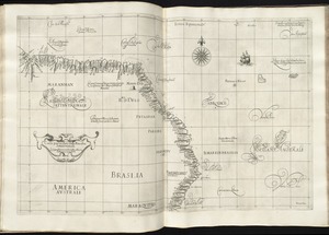
Carta particolare della Brasilia settentrionale
22.
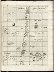
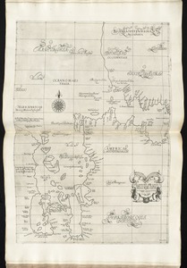
Carta particolare della costa del' Peru parte australe con parte di Cili
23.
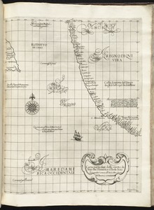
Carta particolare della costa di America Australe che comincia al C. di Matas sin al C. di Galegos
24.
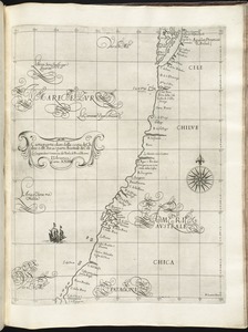
Carta particolare della costa di Chilue è di Chica è parte australe di Cili
25.
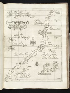
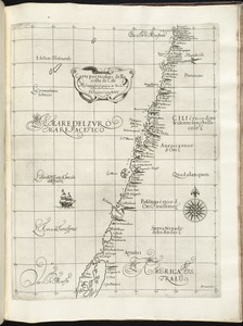
Carta particolare della costa di Cili
26.
Carta particolare della costa di Florida è di Virginia
27.
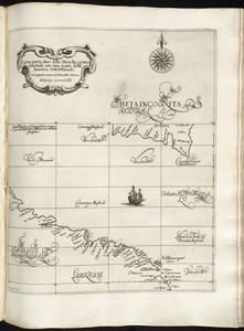
Carta particolare della Meta Incognita Australe con una parte della America Settentrionale
28.
Carta particolare della nuoua Belgia è parte della nuoua Anglia
29.
Carta particolare della parte ocidentale della nuova Spagnia, è del la California
30.
Carta particolare della terra nuoua con la Gran Baia et il Fiume Grande della Canida
31.
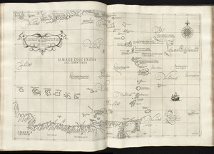
Carta particolare dell'India Ocidentale, con la terra ferma dal' capo di Paria sin al' capo S. Romano
32.
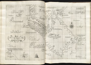
Carta particolare dell'Isola Ispaniola è S. Gioni. nel'India ocidentle. con l'Isola Intorno
33.
Carta particolare dello istreto e mare iscoperto de Hen. Hudson Ingilese nel. 1611
34.
Carta particolare dello stretto di Iezo fra l'America è l'isola Iezo
35.
Carta particolare dello Stretto di Magellano è di Maire
36.
A chart of the Caribe islands
37.
A Chart of the north part of America, describing the sea coast of Groenland, Dawies Streights, Baffins Bay, Hudsons Streights,...
38.
A chart of the sea coast of Brazil from Cape St. Augustine to the straights of Magellan, & in the South Sea, from the latitud...
39.
A chart of the South Sea
40.
A chart of the West Indies from Cape Cod to the River Oronoque
‹ Prev
Next ›
1
2
3
4