Toggle navigation
LMEC Home
Exhibitions
Georeferencing
Tools for Teachers
Collections
My Favorites
Sign Up / Log In
Search
Search the map portal
Map Collection
Map Collection
Map Sets
Search
Search
Search for
Search In
All Fields
Creator
Title
Subject
Place
Search All Digital Collections
Advanced Search
46 Results
My Search
Start Over
1940
Remove constraint 1940
Filter your Search
Place
North and Central America
30
United States
30
Asia
10
Massachusetts
8
Philippines
8
Boston
4
Bristol (county)
4
Suffolk (county)
4
more
Place
»
Topic
Fire risk assessment
8
Insurance surveys
8
United States--Maps
7
Textile factories
5
Immigrants--Massachusetts--Boston
3
Pictorial maps
3
Cape Cod (Mass.)--Maps
2
Industries--United States--Maps
2
more
Topic
»
Date
Date range begin
–
Date range end
Current results range from
1830
to
1991
View distribution
Creator
United States. Office of Strategic Services. Research and Analysis Branch
9
Associated Factory Mutual Fire Insurance Companies
7
Hine, Lewis Wickes, 1874-1940
3
Chase, Ernest Dudley, 1878-1966
2
Covarrubias, Miguel, 1904-1957
2
Massachusetts. State Planning Board
2
Pacific House (Monterey, Calif.)
2
Arkwright Mutual Insurance Company
1
more
Creator
»
Format
Maps/Atlases
43
Photographs
3
Georeferenced
Yes
1
No
45
Collection
Norman B. Leventhal Map & Education Center Collection
34
American Textile History Museum Image Collection
8
Boston and New England Maps
5
Applied Geographics, Inc. Records
2
Massachusetts Real Estate Atlases
2
David Judkins Weaver Papers
1
Lucius Beebe Memorial Library Historic Maps
1
Maritime Charts and Atlases
1
more
Collection
»
Available to use
No known restrictions
34
Search Constraints
Sort by relevance
relevance
title
date (asc)
date (desc)
Number of results to display per page
20 per page
10
per page
20
per page
50
per page
100
per page
View results as:
grid view
map view
Search Results
21.
Cavite
22.
Pampanga
23.
Tayabas (northern part)
24.
Tayabas (southern part)
25.
Zambales
26.
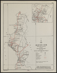
Ilocos Sur : northern portion
27.
Massachusetts tourists map : showing tourways, picnic sites, beaches, and camp grounds
28.
Art forms of the Pacific area
29.
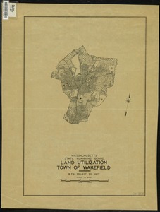
Land Utilization : Town of Wakefield
30.
Rural cultural regions in the United States
31.
Boston Elevated Railway system route map
32.
Fayal Id., Horta and Pim Bays ; Azores, Fayal Channel
33.
America the wonderland : a pictorial map of the United States
34.
Peoples of the Pacific
35.
P.W.A. and industry : how benefits are spread
36.
United Air Lines mainliner vacation map : the main line airway to the nation's greatesst vacationlands east and west
37.
The United States as viewed by California (very unofficial)
38.
A good-natured map of the United States : setting forth the services of the Greyhound Lines and a few principal connecting bus...
39.
A map of Cape Cod
40.
A picture chart of Cape Cod, Martha's Vineyard and Nantucket
‹ Prev
Next ›
1
2
3