Toggle navigation
LMEC Home
Exhibitions
Georeferencing
Tools for Teachers
Collections
My Favorites
Sign Up / Log In
Search
Search the map portal
Map Collection
Map Collection
Map Sets
Search
Search
Search for
Search In
All Fields
Creator
Title
Subject
Place
Search All Digital Collections
Advanced Search
13385 Results
Filter your Search
Place
North and Central America
9,353
United States
7,286
Suffolk (county)
1,664
Boston
1,621
Europe
1,035
Canada
949
Massachusetts
875
New York
534
more
Place
»
Topic
Boston (Mass.)--Maps
741
City planning--Massachusetts--Boston--Maps
418
United States--History--Revolution, 1775-1783--Maps
329
United States--Maps
315
Urban renewal--Massachusetts--Boston--Maps
254
Real property--Massachusetts--Boston--Maps
252
Massachusetts--Maps
219
Insurance surveys
197
more
Topic
»
Date
Date range begin
–
Date range end
Current results range from
1482
to
2023
View distribution
Creator
United States. Hydrographic Office
595
Boston Redevelopment Authority
403
Des Barres, Joseph F. W. (Joseph Frederick Wallet), 1722-1824
247
Royal United Services Institute for Defence and Security Studies
160
Jefferys, Thomas, -1771
154
George, III, King of Great Britain, 1738-1820
152
George, IV, King of Great Britain, 1762-1830
151
O.H. Bailey & Co
148
more
Creator
»
Format
Maps/Atlases
13,205
Manuscripts
985
Prints
102
Books
49
Drawings/Illustrations
44
Photographs
15
Objects/Artifacts
13
Documents
7
more
Format
»
Georeferenced
Yes
979
No
12,406
Collection
Norman B. Leventhal Map Center Collection
8,891
American Revolutionary War-Era Maps
3,305
Boston and New England Maps
2,804
Urban Maps
2,397
Maritime Charts and Atlases
1,150
William L. Clements Library Collection
910
Library of Congress Collection
618
Boston Redevelopment Authority Collection
475
more
Collection
»
Available to use
No known restrictions
9,952
Creative Commons license
1,677
Search Constraints
Sort by date (asc)
relevance
title
date (asc)
date (desc)
Number of results to display per page
20 per page
10
per page
20
per page
50
per page
100
per page
View results as:
grid view
map view
Search Results
2841.
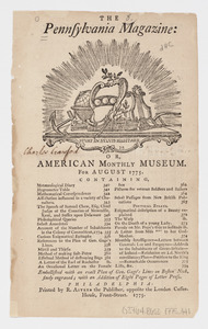
The Pennsylvania Magazine: or, American Monthly Museum : for August 1775 : [table of contents]
2842.
Plan de New-York et des environs
2843.
Plan du Havre et de la barre de Ste. Marie par les Angloises appellée Amélia, ainsi que de la Barre dans la Floride orientale
2844.
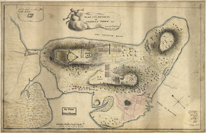
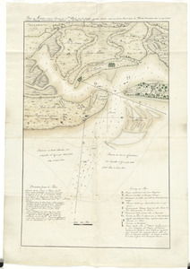
A Plan oe [i.e. of] the British lines on Boston Neck in August 1775
2845.
Plan of Boston & vicinity
2846.
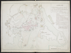
A PLAN of BOSTON and its Environs shewing the true Situation of His Majesty's Troops, and also those of the Rebels; likewise...
2847.
Plan of Charles Town, with the intrenchments, and encampment of His Majesty's troops, after the action of the 17th. June 1775
2848.
Plan of Ferryland Harbour and Capeling Bay In Newfoundland
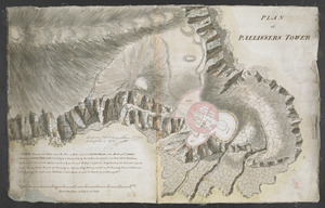
2849.
PLAN of PALLISSERS TOWER
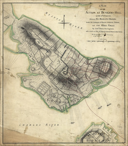
2850.
A plan of the action at Bunkers-Hill, on the 17th. of June, 1775 : between His Majesty's troops under the command of Major...
2851.
Plan of the action which happen'd 17th. June 1775, at Charles Town, N. America
2852.
A Plan of the Battle of Bunker Hill
2853.
Plan of the battle, on Bunker's Hill : fought on the 17th of June 1775
2854.
Plan of the battle, on Bunker's Hill : fought on the 17th of June 1775
2855.
A plan of the bay and harbor of Boston : surveyed agreeably to the orders and instructions of the Right Honorable the Lords...
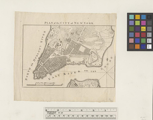
2856.
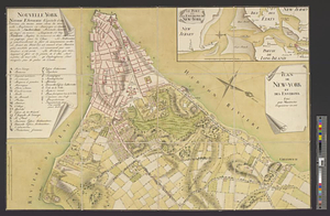
Plan of the city of New York
2857.
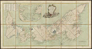
A plan of the city of New-York & its environs to Greenwich, on the North or Hudsons River, and to Crown Point, on the East or...
2858.
A plan of the city of New-York & its environs to Greenwich, on the North or Hudsons River, and to Crown Point, on the East or...
2859.
Plan of the heights of Charles Town, &c
2860.
A plan of the island of St. John with the divisions of the counties, parishes, & the lots as granted by government, likewise...
‹ Prev
Next ›
1
2
…
139
140
141
142
143
144
145
146
147
…
669
670
![A Plan oe [i.e. of] the British lines on Boston Neck in August 1775](https://bpldcassets.blob.core.windows.net/derivatives/images/commonwealth:z603vj41n/image_thumbnail_300.jpg)


![A plan of the city of New-York & its environs to Greenwich, on the North or Hudsons River, and to Crown Point, on the East or Sound River, shewing the several streets, publick buildings, docks, fort & battery, with the true form & course of the commanding grounds, with and without the town : survey'd in the winter, 1775 [i.e. 1766]](https://bpldcassets.blob.core.windows.net/derivatives/images/commonwealth:z603vs09b/image_thumbnail_300.jpg)
![A plan of the city of New-York & its environs to Greenwich, on the North or Hudsons River, and to Crown Point, on the East or Sound River, shewing the several streets, publick buildings, docks, fort & battery, with the true form & course of the commanding grounds, with and without the town : survey'd in the winter, 1775 [i.e. 1766]](https://bpldcassets.blob.core.windows.net/derivatives/images/commonwealth:6t053q479/image_thumbnail_300.jpg)