Toggle navigation
LMEC Home
Exhibitions
Georeferencing
Tools for Teachers
Collections
My Favorites
Sign Up / Log In
Search
Search the map portal
Map Collection
Map Collection
Map Sets
Search
Search
Search for
Search In
All Fields
Creator
Title
Subject
Place
Search All Digital Collections
Advanced Search
324 Results
My Search
Start Over
Date
1915
to
1919
Remove constraint Date: <span class='from'>1915</span> to <span class='to'>1919</span>
Filter your Search
Place
North and Central America
185
United States
165
Europe
94
Massachusetts
42
Boston
23
Suffolk (county)
23
France
21
Asia
20
more
Place
»
Topic
France--Maps
16
Europe--Maps
13
New England--Maps--Early works to 1800--Facsimiles
12
Real property--Massachusetts--Boston--Maps
11
Balkan Peninsula--Maps
10
Boston (Mass.)--Maps
10
Landowners--Massachusetts--Boston--Maps
10
United States--Maps
10
more
Topic
»
Date
1915
to
1919
[remove]
324
Date range begin
–
Date range end
Current results range from
1770
to
1999
1915
to
1915
84
1916
to
1916
79
1917
to
1917
92
1918
to
1918
105
1919
to
1919
104
Creator
American Geographical Society of New York
36
Gross, Alexander, 1879-1958
27
Bromley, George Washington
15
Bromley, Walter Scott
15
C.S. Hammond & Company
12
Geological Survey (U.S.)
11
Richard Mayer (Firm)
11
G.W. Bromley & Co.
10
more
Creator
»
Format
Maps/Atlases
321
Photographs
3
Books
2
Manuscripts
1
Georeferenced
Yes
36
No
288
Collection
Norman B. Leventhal Map & Education Center Collection
303
Urban Maps
15
Boston and New England Maps
14
Massachusetts Real Estate Atlases
13
Robert E. Diefenbach Map Collection at Phillips Academy
5
American Textile History Museum Image Collection
2
American Revolutionary War-Era Maps
1
Sidney R. Knafel Map Collection at Phillips Academy
1
Available to use
No known restrictions
307
Creative Commons license
1
Search Constraints
Sort by relevance
relevance
title
date (asc)
date (desc)
Number of results to display per page
20 per page
10
per page
20
per page
50
per page
100
per page
View results as:
grid view
map view
Search Results
261.
The Rand-McNally new commercial atlas map of Alabama
262.
Richard Mayer's commercial map of Northern Chili, Bolivia & southern Peru
263.
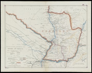
Richard Mayer's commercial map of the republic of Paraguay
264.
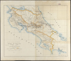
Richard Mayer's commercial of the Republic of Costa Rica
265.
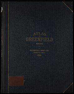
Richards standard atlas of the town of Greenfield, Massachusetts
266.
Romania
267.
Roumania
268.
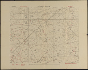
Schaap-balie
269.
Siberia
270.
A small map of the sea coast of New England together with the outlines of several of the provinces lying thereon, 1738
271.
South Africa
272.
The south part of New-England, as it is planted this yeare, 1635
273.
Spartanburg, South Carolina : the city of success ; city map and street directory
274.
State of Illinois
275.
State of Illinois coal fields and producing districts
276.
State of Indiana coal fields and producing districts
277.
State of Kentucky coal fields and producing districts
278.
State of Ohio coal fields and producing districts
279.
State of Tennessee coal fields and producing districts
280.
State of Virginia coal fields and producing districts, September 1919
‹ Prev
Next ›
1
2
…
10
11
12
13
14
15
16
17