Toggle navigation
LMEC Home
Exhibitions
Georeferencing
Tools for Teachers
Collections
My Favorites
Sign Up / Log In
Search
Search the map portal
Map Collection
Map Collection
Map Sets
Search
Search
Search for
Search In
All Fields
Creator
Title
Subject
Place
Search All Digital Collections
Advanced Search
281 Results
My Search
Start Over
1880
Remove constraint 1880
Filter your Search
Place
North and Central America
251
United States
240
Massachusetts
97
Wisconsin
46
Suffolk (county)
41
Boston
39
Worcester (county)
14
Essex (county)
13
more
Place
»
Topic
Manuscript maps
47
Boston (Mass.)--Maps
16
United States--Maps
8
City planning--Massachusetts--Boston--Maps
6
New England--Maps
5
Real property--Massachusetts--Boston--Maps
5
Dorchester (Boston, Mass.)--Maps
4
East Boston (Boston, Mass.)--Maps
4
more
Topic
»
Date
Date range begin
–
Date range end
Current results range from
1756
to
2008
View distribution
Creator
United States. Hydrographic Office
19
Campbell-Copeland, T. (Thomas)
7
Dougal, William H., 1822-1895
7
Harper & Brothers
7
U.S. Lake Survey
7
O.H. Bailey & Co
6
Bigelow, E. H.
5
United States. Topographical Bureau
5
more
Creator
»
Format
Maps/Atlases
279
Manuscripts
92
Books
4
Prints
1
Georeferenced
Yes
20
No
261
Collection
Norman B. Leventhal Map & Education Center Collection
262
Boston and New England Maps
100
Urban Maps
67
Maritime Charts and Atlases
27
Massachusetts Real Estate Atlases
8
American Revolutionary War-Era Maps
5
Robert E. Diefenbach Map Collection at Phillips Academy
5
Campus Maps from Phillips Academy Archives and Special Collections
2
more
Collection
»
Available to use
No known restrictions
266
Creative Commons license
3
Search Constraints
Sort by relevance
relevance
title
date (asc)
date (desc)
Number of results to display per page
20 per page
10
per page
20
per page
50
per page
100
per page
View results as:
grid view
map view
Search Results
221.
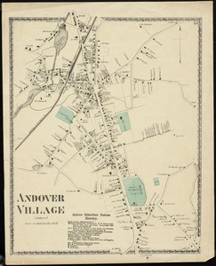
Andover Village : (Andover)
222.
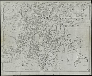
[Manuscript map of New England and eastern Canada, showing the routes of Champlain's voyage]
223.
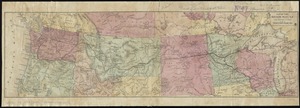
Map of the Northern Pacific R.R. its connections and tributary country
224.
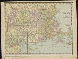
Massachusetts and Rhode Island
225.
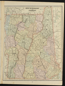
New Hampshire and Vermont
226.
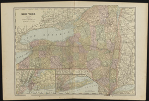
New York
227.
Plan of Hoosac Tunnel Dock and Elevator Company's docks and land in Charlestown, Mass.
228.
Plan of house lots in ward 16 : owned by Saml. B. Pierce & Geo. C. Ludington, Boston, near the Dorchester Station, Norfolk...
229.
Plan of land in Sharon belonging to the Massapoag Lake Company
230.
Plan of real estate belonging to T.W. & J.H. Cox : situated in ward 16, Boston
231.
Plat of lots in Boston (Dorchester Dist.) belonging to B.P. Cunningham
232.
Stoneham, Massachusetts
233.
Ashland & Bayfield
234.
Barron County, Wis.
235.
Brown County, Wis. & Kewaunee County, Wis.
236.
Buffalo County, Wis.
237.
Burnett County, Wis.
238.
Clark County, Wis.
239.
Columbia County, Wis.
240.
Crawford County, Wis.
‹ Prev
Next ›
1
2
…
8
9
10
11
12
13
14
15
![[Manuscript map of New England and eastern Canada, showing the routes of Champlain's voyage]](https://bpldcassets.blob.core.windows.net/derivatives/images/commonwealth:qb98n8061/image_thumbnail_300.jpg)