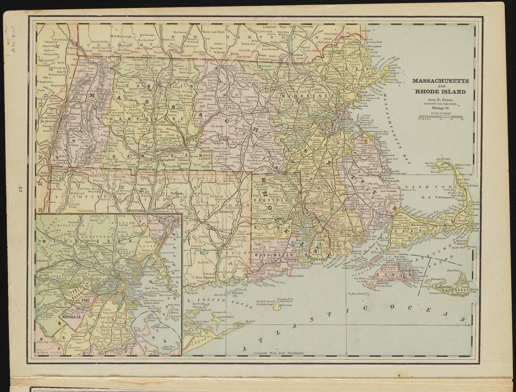
Massachusetts and Rhode Island
Item Information
- Title:
- Massachusetts and Rhode Island
- Cartographer:
- Cram, George Franklin, 1841-1928
- Engraver:
- Cram, George Franklin, 1841-1928
- Name on Item:
-
Geo. F. Cram, engraver and publisher
- Date:
-
1880–1900
- Format:
-
Maps/Atlases
- Location:
-
Phillips Academy
Archives and Special Collections - Collection (local):
-
Robert E. Diefenbach Map Collection
- Places:
-
Massachusetts
Rhode Island
- Extent:
- 1 map : col. ; 25 x 32 cm
- Terms of Use:
-
We believe that this item has no known US copyright restrictions. Though not required, if you want to credit us as the source, please use the following statement, "From The Trustees of Phillips Academy." Doing so helps us track how our collection is used and helps justify freely releasing even more content in the future.
This work is in the public domain under a Creative Commons No Rights Reserved License (CC0).
- Publisher:
-
[Chicago] :
Geo. F. Cram
- Scale:
-
Scale ca. 1:921,600
- Language:
-
English
- Notes:
-
Title from item.
Inset map: Boston.
Map of New York on back.
- Notes (date):
-
Date supplied by cataloger.
- Identifier:
-
2018_044