Toggle navigation
LMEC Home
Exhibitions
Georeferencing
Tools for Teachers
Collections
My Favorites
Sign Up / Log In
Search
Search the map portal
Map Collection
Map Collection
Map Sets
Search
Search
Search for
Search In
All Fields
Creator
Title
Subject
Place
Search All Digital Collections
Advanced Search
237 Results
My Search
Start Over
1870
Remove constraint 1870
Filter your Search
Place
North and Central America
132
United States
114
Europe
85
Massachusetts
59
Boston
39
Germany
39
Suffolk (county)
39
France
34
more
Place
»
Topic
Franco-Prussian War, 1870-1871--Maps
33
Germany--Maps
25
Boston (Mass.)--Maps
21
Europe--Maps
17
France--Maps
17
Real property--Massachusetts--Boston--Maps
11
Land tenure--Massachusetts--Boston--Maps
8
Franco-Prussian War, 1870-1871--Aerial views
7
more
Topic
»
Date
Date range begin
–
Date range end
Current results range from
1783
to
1952
View distribution
Creator
United States. Hydrographic Office
13
Beers, F. W. (Frederick W.)
12
Hellfarth, C.
9
Justus Perthes (Firm : Gotha, Germany)
9
Petermann, A. (August), 1822-1878
8
Shurcliff, Arthur A. (Arthur Asahel), 1870-1957
8
G.W. Bacon & Co.
7
Anderson, Alexander, 1775-1870
6
more
Creator
»
Format
Maps/Atlases
233
Books
3
Manuscripts
3
Prints
2
Documents
1
Objects/Artifacts
1
Georeferenced
Yes
19
No
218
Collection
Norman B. Leventhal Map & Education Center Collection
222
Urban Maps
66
Boston and New England Maps
58
Maritime Charts and Atlases
21
American Revolutionary War-Era Maps
8
American Antiquarian Society Collection
5
Mapping Boston Collection
4
Massachusetts Real Estate Atlases
3
more
Collection
»
Available to use
No known restrictions
219
Creative Commons license
5
Search Constraints
Sort by relevance
relevance
title
date (asc)
date (desc)
Number of results to display per page
20 per page
10
per page
20
per page
50
per page
100
per page
View results as:
grid view
map view
Search Results
221.
New map of the American overland route showing its connections, and land grants of 30,000,000 acres
222.
Russell's map of Paris and fortifications
223.
Columbia lays aside her laurels to mourn at the burning of her birth-place
224.
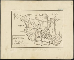
A new and accurate plan of the town of Boston in New England
225.
Plan of house lots in ward 16 : owned by Saml. B. Pierce & Geo. C. Ludington, Boston, near the Dorchester Station, Norfolk...
226.
Plan of real estate belonging to T.W. & J.H. Cox : situated in ward 16, Boston
227.
Plat of lots in Boston (Dorchester Dist.) belonging to B.P. Cunningham
228.
Bird's-eye view of Boston, United States
229.
Boston Clinton Fitchburg and Mansfield Framingham Lowell Railroads, and connections
230.
China
231.
[Map of New England, 31st]
232.
Map showing the lines of canals & rail roads owned, leased & operated by the Delaware and Hudson Canal and Rail Road Co. with...
233.
Preussen, der Norddeutsche bund und Dänemark
234.
Railway map of the New England states, engraved expressly for the Pathfinder railway guide
235.
Globes
236.
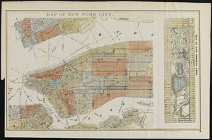
Map of New York City
237.
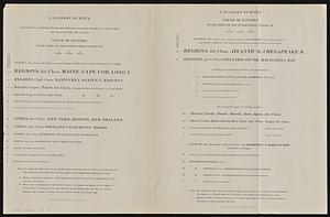
U.S. Coast Survey classification and rules for the miscellaneous lettering of names &c. on the map, not connected with title or...
‹ Prev
Next ›
1
2
…
8
9
10
11
12


![[Map of New England, 31st]](https://bpldcassets.blob.core.windows.net/derivatives/images/commonwealth:wd3763094/image_thumbnail_300.jpg)