Toggle navigation
LMEC Home
Exhibitions
Georeferencing
Tools for Teachers
Collections
My Favorites
Sign Up / Log In
Search
Search the map portal
Map Collection
Map Collection
Map Sets
Search
Search
Search for
Search In
All Fields
Creator
Title
Subject
Place
Search All Digital Collections
Advanced Search
1475 Results
My Search
Start Over
Subject
"Boston (Mass.)--Maps"
Remove constraint Subject: "Boston (Mass.)--Maps"
Filter your Search
Place
North and Central America
1,474
United States
1,472
Suffolk (county)
1,391
Boston
1,387
Massachusetts
1,090
Boston Harbor
125
Roxbury
89
Charlestown
71
more
Place
»
Topic
Boston (Mass.)--Maps
741
City planning--Massachusetts--Boston--Maps
407
Urban renewal--Massachusetts--Boston--Maps
245
Real property--Massachusetts--Boston--Maps
243
Landowners--Massachusetts--Boston--Maps
160
Buildings--Massachusetts--Boston--Maps
121
Land use--Massachusetts--Boston--Maps
98
Roxbury (Boston, Mass.)--Maps
88
more
Topic
»
Date
Date range begin
–
Date range end
Current results range from
1689
to
2023
View distribution
Creator
Boston Redevelopment Authority
386
Bromley, George Washington
69
Bromley, Walter Scott
68
G.W. Bromley & Co.
46
Geo. H. Walker & Co
28
Boston (Mass.). Engineering Dept
21
Boynton, George W., d. 1884
21
Sampson, Davenport & Co
21
more
Creator
»
Format
Maps/Atlases
1,472
Manuscripts
50
Drawings/Illustrations
5
Posters
1
Prints
1
Georeferenced
Yes
140
No
1,335
Collection
Boston and New England Maps
1,200
Urban Maps
1,011
Norman B. Leventhal Map & Education Center Collection
994
Boston Redevelopment Authority Collection
449
American Revolutionary War-Era Maps
129
Mapping Boston Collection
52
Massachusetts Real Estate Atlases
38
Maritime Charts and Atlases
28
more
Collection
»
Available to use
No known restrictions
1,292
Creative Commons license
116
Search Constraints
Sort by relevance
relevance
title
date (asc)
date (desc)
Number of results to display per page
20 per page
10
per page
20
per page
50
per page
100
per page
View results as:
grid view
map view
Search Results
221.
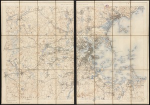
Plan of Boston and its vicinity
222.
A plan of the town and chart of the harbour of Boston exhibiting a view of the islands castle forts and entrances into the said...
223.
The town & harbour of Boston &c.
224.
Washington Street corridor : South Cove to Forest Hills
225.
Atlas of the city of Boston : Roxbury : from actual surveys and official plans
226.
Charlestown Navy Yard master plan
227.
Map of Boston in the state of Massachusetts
228.
Map of Dorchester
229.
Map of the country about Boston
230.
Map of the town of Roxbury
231.
Plan of Charlestown
232.
Plan of Charlestown
233.
Plan of Charlestown peninsula in the state of Massachusetts
234.
Plan of Dorchester
235.
Plan of the city of Charlestown
236.
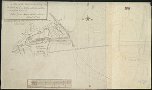
A plan of the town dock, formerly called Bendalls Dock, in Boston, with the buildings round & flats before it
237.
Plan of the town of Brighton
238.
Plan of the town of Dorchester
239.
Roxbury
240.
Map of Hyde Park and Milton
‹ Prev
Next ›
1
2
…
8
9
10
11
12
13
14
15
16
…
73
74