Toggle navigation
LMEC Home
Exhibitions
Georeferencing
Tools for Teachers
Collections
My Favorites
Sign Up / Log In
Search
Search the map portal
Map Collection
Map Collection
Map Sets
Search
Search
Search for
Search In
All Fields
Creator
Title
Subject
Place
Search All Digital Collections
Advanced Search
1227 Results
My Search
Start Over
More Like
commonwealth-oai:xk81pj70h
Remove constraint More Like: commonwealth-oai:xk81pj70h
Filter your Search
Place
North and Central America
1,192
United States
933
Canada
226
New York
193
Quebec
111
Pennsylvania
61
New Jersey
54
Nova Scotia
48
more
Place
»
Topic
United States--Maps
330
United States--History--Revolution, 1775-1783--Maps
305
United States--History--French and Indian War, 1754-1763--Maps
151
Saint Lawrence River--Maps
44
Elections--United States--Maps
36
Railroads--United States--Maps
34
Canada--Maps
29
Newport (R.I.)--Maps
27
more
Topic
»
Date
Date range begin
–
Date range end
Current results range from
1700
to
2023
View distribution
Creator
Paullin, Charles Oscar, 1868 or 1869-1944
70
Wright, John Kirtland, 1891-1969
70
Rocque, Mary Ann
29
Bellin, Jacques Nicolas, 1703-1772
26
Holland, Samuel, 1728-1801
25
Montrésor, John, 1736-1799
25
Jefferys, Thomas, -1771
24
Clinton, Henry, Sir, 1738?-1795
19
more
Creator
»
Format
Maps/Atlases
1,209
Drawings/Illustrations
11
Documents
5
Prints
3
Books
1
Manuscripts
1
Objects/Artifacts
1
Posters
1
Georeferenced
Yes
65
No
1,162
Collection
American Revolutionary War-Era Maps
939
William L. Clements Library Collection
909
Norman B. Leventhal Map & Education Center Collection
288
American Antiquarian Society Collection
20
MacLean Collection Map Library
9
David Judkins Weaver Papers
2
Mapping Boston Collection
2
Applied Geographics, Inc. Records
1
more
Collection
»
Available to use
No known restrictions
213
Creative Commons license
5
Search Constraints
Sort by relevance
relevance
title
date (asc)
date (desc)
Number of results to display per page
20 per page
10
per page
20
per page
50
per page
100
per page
View results as:
grid view
map view
Search Results
441.
A chorographical map of the country round Philadelphia = Carte particuliere des environs de Philadelphia
442.
A chorographical map of the northern department of North-America : drawn from the latest and most accurate observations
443.
City of St. Augustine and environs
444.
The coast from St. Johns, New Brunswick, to Goldsborough Bay, Maine
445.
The coast of Maine from modern Portland to Desert Island
446.
Coast of Senegal
447.
Ye commencement for draft of New York Island
448.
The communication between the Iberville and the river Mississippe
449.
A compleat plan of part of the province of Pennsylvania East and West Jersey shewing the transactions of the royal army under...
450.
Confluence of the James River, York River, and Chesapeake Bay
451.
Continuation of the Grande Riviere with the village of Fariole lying near Cape Torment on the north shore
452.
Continuation of the River Chaudière &c.
453.
Continuation of the River Chaudière from where it falls into the St. Lawrence, as laid down in the lower plan, to the village...
454.
Continuation of the River Chaudière joining to A
455.
Continuation of the River Chaudière joining to B
456.
Copie de la carte de Monsieur Klam ou l'on voit les sources e la riviere d'Orange suivant de nouvelles observation
457.
Copy of a plan of the river Iberville from Lake Maurepas to the forks, with part of the Comit and Amit : taken from engineer...
458.
Copy of a plan of York harbour with the soundings, shoals &c. surveyed by order of Lt Governor Simcoe
459.
A correct plan of the environs of Quebec, and of the battle fought on the 13th September, 1759 : together with a particular...
460.
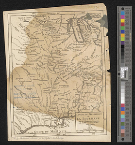
Cours du Mississipi et la Louisiane
‹ Prev
Next ›
1
2
…
19
20
21
22
23
24
25
26
27
…
61
62