Toggle navigation
LMEC Home
Exhibitions
Georeferencing
Tools for Teachers
Collections
My Favorites
Sign Up / Log In
Search
Search the map portal
Map Collection
Map Collection
Map Sets
Search
Search
Search for
Search In
All Fields
Creator
Title
Subject
Place
Search All Digital Collections
Advanced Search
987 Results
My Search
Start Over
More Like
commonwealth-oai:v405x789b
Remove constraint More Like: commonwealth-oai:v405x789b
Filter your Search
Place
North and Central America
959
United States
698
Canada
206
New York
194
Quebec
111
Rhode Island
83
Massachusetts
80
Pennsylvania
61
more
Place
»
Topic
United States--History--Revolution, 1775-1783--Maps
330
United States--History--French and Indian War, 1754-1763--Maps
149
Rhode Island--Maps
50
Saint Lawrence River--Maps
43
Massachusetts--Maps
40
Newport (R.I.)--Maps
28
Connecticut--Maps
26
New York (State)--Maps
25
more
Topic
»
Date
Date range begin
–
Date range end
Current results range from
1700
to
1981
View distribution
Creator
Rocque, Mary Ann
29
Holland, Samuel, 1728-1801
25
Jefferys, Thomas, -1771
25
Montrésor, John, 1736-1799
25
Bellin, Jacques Nicolas, 1703-1772
24
Clinton, Henry, Sir, 1738?-1795
19
Robert Sayer and John Bennett (Firm)
16
Hills, John, active 1777-1819
13
more
Creator
»
Format
Maps/Atlases
971
Drawings/Illustrations
11
Documents
5
Manuscripts
4
Objects/Artifacts
1
Prints
1
Georeferenced
Yes
17
No
970
Collection
American Revolutionary War-Era Maps
934
William L. Clements Library Collection
909
Norman B. Leventhal Map & Education Center Collection
56
Boston and New England Maps
43
Maps from AAS
9
David Judkins Weaver Papers
4
Newberry Library Collection
3
Urban Maps
3
more
Collection
»
Available to use
No known restrictions
57
Creative Commons license
5
Search Constraints
Sort by relevance
relevance
title
date (asc)
date (desc)
Number of results to display per page
20 per page
10
per page
20
per page
50
per page
100
per page
View results as:
grid view
map view
Search Results
581.
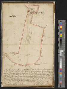
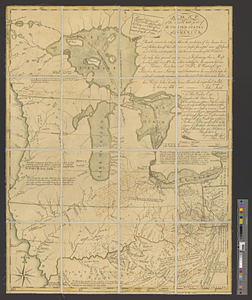
Map of the country adjacent to Fort [Franklin] on French Creek
582.
A map of the country between Will's Creek & Monongahela River shewing the rout and encampments of the English army, in 1755
583.
A map of the Delaware and Chesapeak bays with the peninsula between them
584.
Map of the European settlements in North America
585.
A map of the farm and a draught of the buildings thereon, in West-town Township, Chester Co. Pennsylvania, belonging to the...
586.
A map of the farm of Wm. Wilson esqr. in Clermont ... : surveyed May 3d, 1799
587.
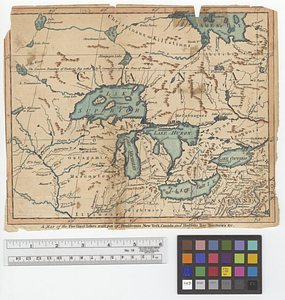
A map of the five Great Lakes with part of Pensilvania, New York, Canada and Hudsons Bay territories &c.
588.
A map of the French settlements in North America
589.
A map of the Indian nations in the southern department, 1766
590.
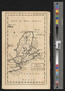
A map of the island of Cape Breton
591.
A map of the isthmus of Panama drawn from Spanish surveys
592.
A map of the lakes & Hudsons Bay
593.
A map of the lakes & Hudsons Bay
594.
Map of the middle states of America : comprehends New-York, New-Jersey, Pennsylvania, Delaware, and the territory N:W: of Ohio
595.
Map of the middle states of America : comprehends New-York, New-Jersey, Pennsylvania, Delaware, and the territory N:W: of Ohio
596.
A map of the north west parts of the United States of America
597.
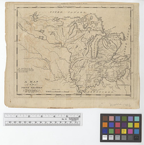
A map of the North Western Territory
598.
A map of the northern and middle states; comprehending the western territory and the British dominions in North America from...
599.
Map of the northern part of the United States of America
600.
A map of the province of Massachusetts Bay, and colony of Rhode Island, with part of Connecticut, New Hampshire, and Vermont
‹ Prev
Next ›
1
2
…
26
27
28
29
30
31
32
33
34
…
49
50
![Map of the country adjacent to Fort [Franklin] on French Creek](https://bpldcassets.blob.core.windows.net/derivatives/metadata/commonwealth-oai:2v240r691/image_thumbnail_300.jpg)