Toggle navigation
LMEC Home
Exhibitions
Georeferencing
Tools for Teachers
Collections
My Favorites
Sign Up / Log In
Search
Search the map portal
Map Collection
Map Collection
Map Sets
Search
Search
Search for
Search In
All Fields
Creator
Title
Subject
Place
Search All Digital Collections
Advanced Search
985 Results
My Search
Start Over
More Like
commonwealth-oai:rv046r891
Remove constraint More Like: commonwealth-oai:rv046r891
Filter your Search
Place
North and Central America
957
United States
694
Canada
206
New York
201
Quebec
112
Pennsylvania
91
New Jersey
80
Massachusetts
50
more
Place
»
Topic
United States--History--Revolution, 1775-1783--Maps
330
United States--History--French and Indian War, 1754-1763--Maps
149
Pennsylvania--Maps
50
Saint Lawrence River--Maps
43
New Jersey--Maps
40
New York (State)--Maps
34
Newport (R.I.)--Maps
27
Hudson River (N.Y. and N.J.)--Maps
22
more
Topic
»
Date
Date range begin
–
Date range end
Current results range from
1700
to
1921
View distribution
Creator
Rocque, Mary Ann
29
Holland, Samuel, 1728-1801
26
Bellin, Jacques Nicolas, 1703-1772
25
Jefferys, Thomas, -1771
25
Montrésor, John, 1736-1799
25
Clinton, Henry, Sir, 1738?-1795
19
Robert Sayer and John Bennett (Firm)
16
Hills, John, active 1777-1819
13
more
Creator
»
Format
Maps/Atlases
969
Drawings/Illustrations
11
Documents
5
Manuscripts
5
Prints
1
Georeferenced
Yes
20
No
965
Collection
American Revolutionary War-Era Maps
943
William L. Clements Library Collection
909
Norman B. Leventhal Map & Education Center Collection
47
Maps from AAS
13
Boston and New England Maps
5
MacLean Collection Map Library
5
Urban Maps
4
Newberry Library Collection
3
more
Collection
»
Available to use
No known restrictions
49
Creative Commons license
5
Search Constraints
Sort by relevance
relevance
title
date (asc)
date (desc)
Number of results to display per page
20 per page
10
per page
20
per page
50
per page
100
per page
View results as:
grid view
map view
Search Results
361.
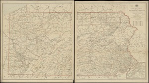
Pennsylvania
362.
Post route map of the state of Pennsylvania showing post offices and the intermediate distances on mail routes in operation on...
363.
Post route map of the state of Pennsylvania showing post offices with the intermediate distances on mail routes in operation on...
364.
Rail road map of Pennsylvania
365.
Rail road map of Pennsylvania
366.
Sketch showing a feasible canal route, Allegheny River to Lake Erie.
367.
The state of Pennsylvania : reduced with permission from Reading Howells map
368.
The tourist's pocket map of Pennsylvania : exhibiting its internal improvements, roads, distances, &c
369.
An accurate map of the United States of America : according to the Treaty of Peace of 1783
370.
Atlas to Marshall's life of Washington
371.
Boston its environs and harbour, : with the rebels works raised against that town in 1775, from the observations of Lieut. Page...
372.
Boston with its environs
373.
Carte de l'affaire de Montmouth, ou le Général Washington commandon l'armée Americaine, et le Général Clinton l'armée...
374.
Carte nouvelle des posséssions angloises en Amérique dressée pour l'intelligence de la guerre présente et divisée suivant les...
375.
Centennial map of Concord, 1775-1875
376.
[Chart of Boston Harbor and the surrounding areas]
377.
Gen. Washington's Revolutionary campaign war map : after a survey ordered by him showing the position of his army in defence of...
378.
Map of the seat of the late war at Boston in the state of Massachusetts
379.
A Map of the seat of the late war at Boston in the state of Massachusetts
380.
Map of the vicinity of Yorktown, Virginia, 1881
‹ Prev
Next ›
1
2
…
15
16
17
18
19
20
21
22
23
…
49
50


![[Chart of Boston Harbor and the surrounding areas]](https://bpldcassets.blob.core.windows.net/derivatives/images/commonwealth:6108vs71d/image_thumbnail_300.jpg)