Toggle navigation
LMEC Home
Exhibitions
Georeferencing
Tools for Teachers
Collections
My Favorites
Sign Up / Log In
Search
Search the map portal
Map Collection
Map Collection
Map Sets
Search
Search
Search for
Search In
All Fields
Creator
Title
Subject
Place
Search All Digital Collections
Advanced Search
937 Results
My Search
Start Over
More Like
commonwealth-oai:qb98rb90g
Remove constraint More Like: commonwealth-oai:qb98rb90g
Filter your Search
Place
North and Central America
907
United States
648
Canada
210
New York
203
Quebec
113
Pennsylvania
60
New Jersey
54
Nova Scotia
48
more
Place
»
Topic
United States--History--Revolution, 1775-1783--Maps
305
United States--History--French and Indian War, 1754-1763--Maps
162
Saint Lawrence River--Maps
43
Hudson River (N.Y. and N.J.)--Maps
29
New York (State)--Maps
27
Newport (R.I.)--Maps
27
Québec (Québec)--Maps
21
Louisbourg (N.S.)--Maps
20
more
Topic
»
Date
Date range begin
–
Date range end
Current results range from
1700
to
1921
View distribution
Creator
Rocque, Mary Ann
29
Jefferys, Thomas, -1771
28
Holland, Samuel, 1728-1801
26
Montrésor, John, 1736-1799
25
Bellin, Jacques Nicolas, 1703-1772
24
Clinton, Henry, Sir, 1738?-1795
19
Robert Sayer and John Bennett (Firm)
15
Orme, Robert, -1781
14
more
Creator
»
Format
Maps/Atlases
921
Drawings/Illustrations
11
Documents
5
Prints
1
Georeferenced
No
937
Collection
American Revolutionary War-Era Maps
923
William L. Clements Library Collection
909
Norman B. Leventhal Map & Education Center Collection
18
American Antiquarian Society Collection
4
Richard H. Brown Revolutionary War Map Collection at Mount Vernon
4
MacLean Collection Map Library
1
New-York Historical Society Collection
1
Available to use
No known restrictions
19
Creative Commons license
4
Search Constraints
Sort by relevance
relevance
title
date (asc)
date (desc)
Number of results to display per page
20 per page
10
per page
20
per page
50
per page
100
per page
View results as:
grid view
map view
Search Results
1.
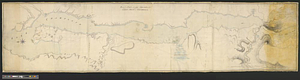
Plan of the river &c from Albany to Oswego in America
2.
Hudson's River from New York to Albany
3.
Fort Edward to Ticonderoga
4.
French draught of Lake Champlain & Lake George with remarks of an English prisoner who return'd from Quebec to Fort Edward by...
5.
Crown Point to Fort Edward, New York
6.
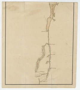
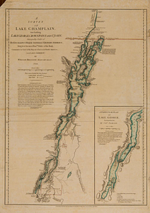
A survey of Lake Champlain, including Lake George, Crown Point and St. John : surveyed by order of his excellency Major-General...
7.
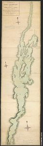
Lake Champlain
8.
Plan of part of Lake Champlain from Crown Point to Tienderoga
9.
A survey of Lake Champlain including Crown Point and St: John's : surveyed by order of his excellency Major Genl: Sir Jeffery...
10.
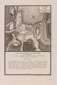
Attaques du fort William-Henri en Amérique par les troupes français aux ordres du Marquis de Montcalm prise de ce fort le 7...
11.
British attack upon Ticonderoga, July 7 & 8, 1758
12.
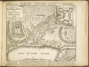
A plan of Fort William Henry and the English camps & retrenchments with the French different camps and attack there upon
13.
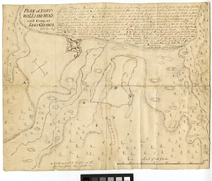
Plan of Fort-William-Henry and camp, at Lake George
14.
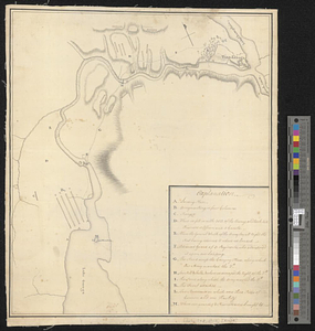
Plan of the encampment, intrenchment with theier [sic] environs at Lake George
15.
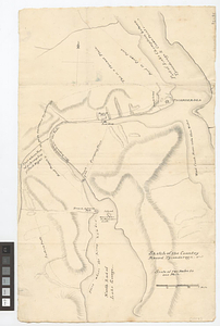
Sketch of the country round Tyconderoga
16.
Lake George, Lake Champlain, the Adirondacks
17.
The attack and defeat of the American fleet under Benedict Arnold, by the kings fleet commanded by Captn. Thos. Pringle, upon...
18.
Carte du gouvernement de Montréal
19.
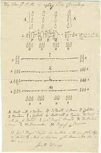
The order of battle in crossing Lake Champlane
20.
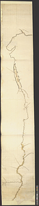
Distances North River
‹ Prev
Next ›
1
2
3
4
5
…
46
47


![Plan of the encampment, intrenchment with theier [sic] environs at Lake George](https://bpldcassets.blob.core.windows.net/derivatives/metadata/commonwealth-oai:v9800134b/image_thumbnail_300.jpg)