Toggle navigation
LMEC Home
Exhibitions
Georeferencing
Tools for Teachers
Collections
My Favorites
Sign Up / Log In
Search
Search the map portal
Map Collection
Map Collection
Map Sets
Search
Search
Search for
Search In
All Fields
Creator
Title
Subject
Place
Search All Digital Collections
Advanced Search
971 Results
My Search
Start Over
More Like
commonwealth-oai:gt54qm25d
Remove constraint More Like: commonwealth-oai:gt54qm25d
Filter your Search
Place
North and Central America
943
United States
683
New York
227
Canada
205
Quebec
111
Pennsylvania
61
New Jersey
60
Massachusetts
51
more
Place
»
Topic
United States--History--Revolution, 1775-1783--Maps
330
United States--History--French and Indian War, 1754-1763--Maps
149
Manhattan (New York, N.Y.)--Maps
51
Saint Lawrence River--Maps
43
Newport (R.I.)--Maps
27
New York (N.Y.)--Maps
26
New York (State)--Maps
24
Hudson River (N.Y. and N.J.)--Maps
21
more
Topic
»
Date
Date range begin
–
Date range end
Current results range from
1700
to
1939
View distribution
Creator
Rocque, Mary Ann
29
Holland, Samuel, 1728-1801
25
Jefferys, Thomas, -1771
25
Montrésor, John, 1736-1799
25
Bellin, Jacques Nicolas, 1703-1772
24
Clinton, Henry, Sir, 1738?-1795
19
Robert Sayer and John Bennett (Firm)
16
Hills, John, active 1777-1819
13
more
Creator
»
Format
Maps/Atlases
955
Drawings/Illustrations
11
Documents
5
Manuscripts
4
Prints
1
Georeferenced
Yes
10
No
961
Collection
American Revolutionary War-Era Maps
930
William L. Clements Library Collection
909
Norman B. Leventhal Map & Education Center Collection
42
Urban Maps
26
Maps from AAS
7
Boston and New England Maps
5
New-York Historical Society Collection
3
Newberry Library Collection
3
more
Collection
»
Available to use
No known restrictions
45
Creative Commons license
5
Search Constraints
Sort by relevance
relevance
title
date (asc)
date (desc)
Number of results to display per page
20 per page
10
per page
20
per page
50
per page
100
per page
View results as:
grid view
map view
Search Results
1.
Kings Bridge
2.
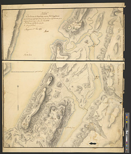
Plan des environs de Kingsbridge jusqu'au Fort Knyphausen avec les ouvrages de fortification faites dans l'année 1779 & de ceux...
3.
A map of the country adjacent to Kingsbridge, surveyed by order of his excellency General Sir Henry Clinton K.B., commander in...
4.
Part of the modern counties of Westchester and Bronx
5.
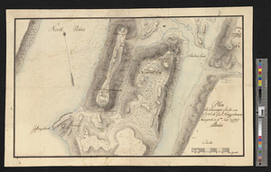
Plan des ouvrages faites en front du fort Knyphausen, New Yorck ce 4 me. Novr 1779
6.
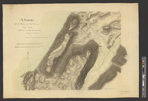
A survey of the defile and that part of York Island adjacent to Fort Knyphausen
7.
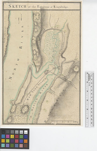
Sketch of the environs of King's bridge
8.
The New York campaign of 1776
9.
The New York campaign of 1776
10.
British troop dispositions in and near New York City, July and August 1781
11.
British troop dispositions in and near New York City, Sept. 2d 1781
12.
Disposition of the British forces on Long Island, Staten Island, and Manhattan Island, under Cornwallis and Knyphausen
13.
Map of New York I. with the adjacent rocks and other remarkable parts of Hell-Gate
14.
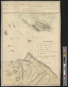
Plan of the narrows of Hell Gate, on the East River near which batteries of cannon, and morters, were erected on Long Island :...
15.
Ye commencement for draft of New York Island
16.
The Delancey lands on Manhattan Island
17.
Land holdings on Kip's Bay, Manhattan Island
18.
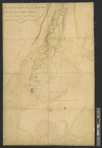
A topographical sketch of the island of New York, with part of the circumjacent country : November 1775
19.
Affaire de Monmouth ce 28me Juin 1778
20.
American camp at Valley Forge
‹ Prev
Next ›
1
2
3
4
5
…
48
49