Toggle navigation
LMEC Home
Exhibitions
Georeferencing
Tools for Teachers
Collections
My Favorites
Sign Up / Log In
Search
Search the map portal
Map Collection
Map Collection
Map Sets
Search
Search
Search for
Search In
All Fields
Creator
Title
Subject
Place
Search All Digital Collections
Advanced Search
1692 Results
My Search
Start Over
More Like
commonwealth-oai:d504wj83v
Remove constraint More Like: commonwealth-oai:d504wj83v
Filter your Search
Place
North and Central America
1,665
United States
1,403
Suffolk (county)
758
Boston
750
Massachusetts
703
Canada
205
New York
195
Quebec
111
more
Place
»
Topic
Boston (Mass.)--Maps
752
United States--History--Revolution, 1775-1783--Maps
307
United States--History--French and Indian War, 1754-1763--Maps
149
City planning--Massachusetts--Boston--Maps
105
Real property--Massachusetts--Boston--Maps
99
Landowners--Massachusetts--Boston--Maps
74
Boston Harbor (Mass.)--Maps
67
Urban renewal--Massachusetts--Boston--Maps
63
more
Topic
»
Date
Date range begin
–
Date range end
Current results range from
1700
to
2023
View distribution
Creator
Boston Redevelopment Authority
114
Rocque, Mary Ann
29
Geo. H. Walker & Co
28
Holland, Samuel, 1728-1801
25
Montrésor, John, 1736-1799
25
Bellin, Jacques Nicolas, 1703-1772
24
Jefferys, Thomas, -1771
24
Boynton, George W., d. 1884
21
more
Creator
»
Format
Maps/Atlases
1,676
Drawings/Illustrations
11
Manuscripts
9
Documents
5
Posters
1
Prints
1
Georeferenced
Yes
100
No
1,592
Collection
American Revolutionary War-Era Maps
924
William L. Clements Library Collection
909
Norman B. Leventhal Map & Education Center Collection
654
Boston and New England Maps
617
Urban Maps
490
Boston Redevelopment Authority Collection
121
Mapping Boston Collection
27
Massachusetts Real Estate Atlases
12
more
Collection
»
Available to use
No known restrictions
719
Creative Commons license
41
Search Constraints
Sort by relevance
relevance
title
date (asc)
date (desc)
Number of results to display per page
20 per page
10
per page
20
per page
50
per page
100
per page
View results as:
grid view
map view
Search Results
1181.
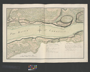
Parish of St. Michelle. Parish of St. John Baptist. Parish of St. Vertier
1182.
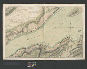
Parish of St. Nicholas. The Parish of St. Augustin
1183.
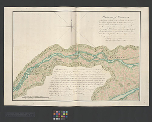
Parish of Terbone
1184.
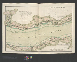
Parish of the Ecureuils. Parish of Point aux Trembles. Parish of St. Antoine. Parish of St. Croix
1185.
Parish of Varrenes. Parish of Pointe aux Trembles. Parish of La Chenais
1186.
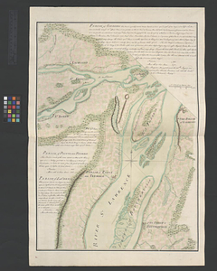
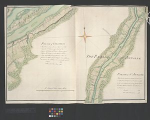
Parish of Vercheres. Parish of St. Antoine
1187.
Part of modern Brunswick County
1188.
Part of modern Brunswick County
1189.
Part of modern Charleston County
1190.
Part of modern Monmouth County, 1778
1191.
Part of modern Orange County
1192.
Part of modern Rockingham County
1193.
Part of modern Rockingham County (N.H.) and Essex County (Mass.)
1194.
Part of modern Westchester County
1195.
Part of modern Westchester County
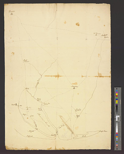
1196.
Part of modern Westchester County
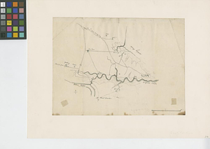
1197.
Part of modern Westmoreland County
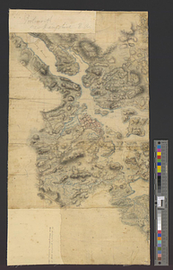
1198.
Part of Monmouth County, New Jersey
1199.
Part of the Anticosti Island; Mingan Island; Mignan Harbor
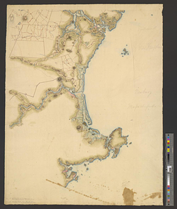
1200.
Part of the city of New York, 27th Augt: 1778 [and] part of Long Island
‹ Prev
Next ›
1
2
…
56
57
58
59
60
61
62
63
64
…
84
85


![Part of the city of New York, 27th Augt: 1778 [and] part of Long Island](https://bpldcassets.blob.core.windows.net/derivatives/metadata/commonwealth-oai:6d573t30q/image_thumbnail_300.jpg)