Toggle navigation
LMEC Home
Exhibitions
Georeferencing
Tools for Teachers
Collections
My Favorites
Sign Up / Log In
Search
Search the map portal
Map Collection
Map Collection
Map Sets
Search
Search
Search for
Search In
All Fields
Creator
Title
Subject
Place
Search All Digital Collections
Advanced Search
937 Results
My Search
Start Over
More Like
commonwealth-oai:bv73gz08m
Remove constraint More Like: commonwealth-oai:bv73gz08m
Filter your Search
Place
North and Central America
911
United States
651
Canada
205
New York
196
Quebec
111
Pennsylvania
65
New Jersey
57
Nova Scotia
48
more
Place
»
Topic
United States--History--Revolution, 1775-1783--Maps
305
United States--History--French and Indian War, 1754-1763--Maps
149
Saint Lawrence River--Maps
43
New York (State)--Maps
29
Middle Atlantic States--Maps
27
Newport (R.I.)--Maps
27
Pennsylvania--Maps
24
Hudson River (N.Y. and N.J.)--Maps
21
more
Topic
»
Date
Date range begin
–
Date range end
Current results range from
1700
to
1969
View distribution
Creator
Rocque, Mary Ann
29
Holland, Samuel, 1728-1801
25
Jefferys, Thomas, -1771
25
Montrésor, John, 1736-1799
25
Bellin, Jacques Nicolas, 1703-1772
24
Clinton, Henry, Sir, 1738?-1795
19
Robert Sayer and John Bennett (Firm)
16
Hills, John, active 1777-1819
13
more
Creator
»
Format
Maps/Atlases
921
Drawings/Illustrations
11
Documents
5
Manuscripts
1
Prints
1
Georeferenced
Yes
5
No
932
Collection
American Revolutionary War-Era Maps
916
William L. Clements Library Collection
909
Norman B. Leventhal Map & Education Center Collection
21
MacLean Collection Map Library
6
New York Public Library Collection
1
Available to use
No known restrictions
21
Creative Commons license
1
Search Constraints
Sort by relevance
relevance
title
date (asc)
date (desc)
Number of results to display per page
20 per page
10
per page
20
per page
50
per page
100
per page
View results as:
grid view
map view
Search Results
1.
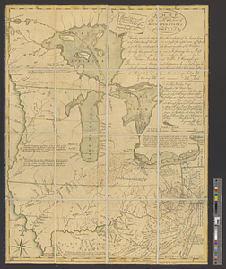
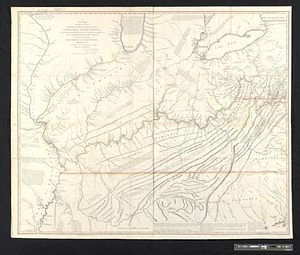
Map of the middle states of America : comprehends New-York, New-Jersey, Pennsylvania, Delaware, and the territory N:W: of Ohio
2.
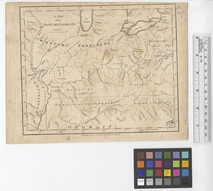
A map of the back settlements
3.
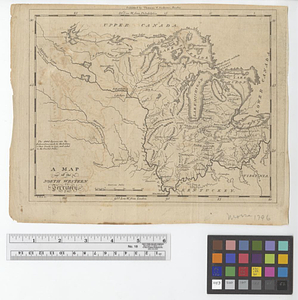
A map of the north west parts of the United States of America
4.
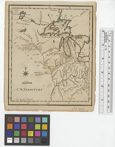
A map of the North Western Territory
5.
N. W. Territory
6.
A new map of the western parts of Virginia, Pennsylvania, Maryland and North Carolina; comprehending the river Ohio, and all...
7.
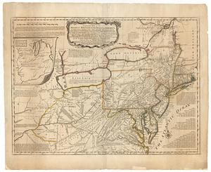
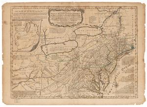
A general map of the middle British colonies, in America; viz Virginia, Maryland, Delaware, Pensilvania, New-Jersey, New-York,...
8.
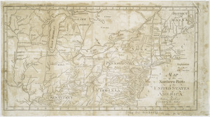
Map of the northern parts of the United States of America
9.
Map of the states of Ohio, Indiana and Illinois with the settled parts of Michigan & Wisconsin
10.
Ohio and N.W. Territory
11.
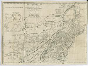
Carte générale des etats de Virginie, Maryland, Delaware, Pensilvanie, Nouveau-Jersey, New-York, Connecticut et Isle de Rhodes...
12.
Colton's Georgetown and the city of Washington : the capital of the United States of America ; Colton's map showing part of...
13.
A descriptive map of the region within one hundred miles of the capital of the United States : portraying the principal events...
14.
A general map of the Middle British Colonies in America viz. Virginia, Maryland, Delaware, Pensilvania, of Aquanishuonigy the...
15.
A general map of the Middle British Colonies in America viz. Virginia, Maryland, Delaware, Pensilvania, of Aquanishuonigy the...
16.
Kaart van Nieuw Nederland : behoorende tot de door het Provinciaal Utrechtsch genootschap bekroonde verhandeling
17.
The Keystone group : a new railroad, post-office, township and district map of Pennsylvania, New Jersey, Delaware, Maryland,...
18.
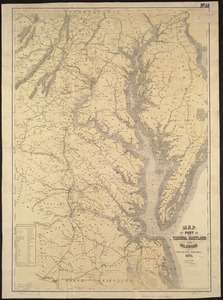
Map of part of Virginia, Maryland and Delaware from the best authorities
19.
Map of the Boston and Northwestern, Massachusetts Central, and Boston and Poughkeepsie Railroads and their connections
20.
Map of the country embracing the several routes examined with a view to a national road from Washington to Lake Ontario
‹ Prev
Next ›
1
2
3
4
5
…
46
47