Toggle navigation
LMEC Home
Exhibitions
Georeferencing
Tools for Teachers
Collections
My Favorites
Sign Up / Log In
Search
Search the map portal
Map Collection
Map Collection
Map Sets
Search
Search
Search for
Search In
All Fields
Creator
Title
Subject
Place
Search All Digital Collections
Advanced Search
1000 Results
My Search
Start Over
More Like
commonwealth-oai:b2777s68s
Remove constraint More Like: commonwealth-oai:b2777s68s
Filter your Search
Place
North and Central America
972
United States
704
Canada
206
New York
201
Quebec
112
Pennsylvania
91
New Jersey
79
Nova Scotia
48
more
Place
»
Topic
United States--History--Revolution, 1775-1783--Maps
330
United States--History--French and Indian War, 1754-1763--Maps
149
Pennsylvania--Maps
50
Saint Lawrence River--Maps
43
New Jersey--Maps
40
New York (State)--Maps
34
Newport (R.I.)--Maps
27
Maryland--Maps
25
more
Topic
»
Date
Date range begin
–
Date range end
Current results range from
1700
to
1921
View distribution
Creator
Rocque, Mary Ann
29
Holland, Samuel, 1728-1801
26
Bellin, Jacques Nicolas, 1703-1772
25
Jefferys, Thomas, -1771
25
Montrésor, John, 1736-1799
25
Clinton, Henry, Sir, 1738?-1795
19
Robert Sayer and John Bennett (Firm)
16
Kitchin, Thomas, 1719-1784
13
more
Creator
»
Format
Maps/Atlases
984
Drawings/Illustrations
11
Documents
5
Manuscripts
5
Prints
1
Georeferenced
Yes
27
No
973
Collection
American Revolutionary War-Era Maps
945
William L. Clements Library Collection
909
Norman B. Leventhal Map & Education Center Collection
60
American Antiquarian Society Collection
15
MacLean Collection Map Library
6
Boston and New England Maps
5
Urban Maps
5
Newberry Library Collection
3
more
Collection
»
Available to use
No known restrictions
62
Creative Commons license
5
Search Constraints
Sort by relevance
relevance
title
date (asc)
date (desc)
Number of results to display per page
20 per page
10
per page
20
per page
50
per page
100
per page
View results as:
grid view
map view
Search Results
481.
Continuation of the Grande Riviere with the village of Fariole lying near Cape Torment on the north shore
482.
Continuation of the River Chaudière &c.
483.
Continuation of the River Chaudière from where it falls into the St. Lawrence, as laid down in the lower plan, to the village...
484.
Continuation of the River Chaudière joining to A
485.
Continuation of the River Chaudière joining to B
486.
Copie de la carte de Monsieur Klam ou l'on voit les sources e la riviere d'Orange suivant de nouvelles observation
487.
Copy of a plan of the river Iberville from Lake Maurepas to the forks, with part of the Comit and Amit : taken from engineer...
488.
Copy of a plan of York harbour with the soundings, shoals &c. surveyed by order of Lt Governor Simcoe
489.
A correct plan of the environs of Quebec, and of the battle fought on the 13th September, 1759 : together with a particular...
490.
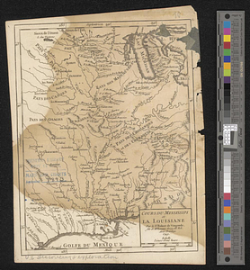
Cours du Mississipi et la Louisiane
491.
Crown Point to Fort Edward, New York
492.
Dartmouth
493.
The Delancey lands on Manhattan Island
494.
Discription [sic] of the roads about White Plains
495.
The district of Main from the latest surveys
496.
A draught of a route from Québec to Fort Halifax on the River Kennebec and back again to Québec by the rivers Chaudière and...
497.
Draught of a tract of land situate in Bucks County, in the Commonwealth of Pennsylvania divided in three parts, called...
498.
A draught of Massiac Lake, Maurepas, part of the river Amitt and the river Ibberville : copy from Lieut Ph: Pittman
499.
A draught of Ship & Catt islands and the opposite coast
500.
A draught of the barr off Mobile & Dauphine Island
‹ Prev
Next ›
1
2
…
21
22
23
24
25
26
27
28
29
…
49
50


![Discription [sic] of the roads about White Plains](https://bpldcassets.blob.core.windows.net/derivatives/metadata/commonwealth-oai:w3767301r/image_thumbnail_300.jpg)