Toggle navigation
LMEC Home
Exhibitions
Georeferencing
Tools for Teachers
Collections
My Favorites
Sign Up / Log In
Search
Search the map portal
Map Collection
Map Collection
Map Sets
Search
Search
Search for
Search In
All Fields
Creator
Title
Subject
Place
Search All Digital Collections
Advanced Search
923 Results
My Search
Start Over
More Like
commonwealth-oai:3t949n71p
Remove constraint More Like: commonwealth-oai:3t949n71p
Filter your Search
Place
North and Central America
893
United States
636
Canada
208
New York
193
Quebec
111
Pennsylvania
60
New Jersey
54
Nova Scotia
48
more
Place
»
Topic
United States--History--Revolution, 1775-1783--Maps
305
United States--History--French and Indian War, 1754-1763--Maps
162
Saint Lawrence River--Maps
43
Newport (R.I.)--Maps
27
New York (State)--Maps
25
Hudson River (N.Y. and N.J.)--Maps
21
Québec (Québec)--Maps
21
Louisbourg (N.S.)--Maps
20
more
Topic
»
Date
Date range begin
–
Date range end
Current results range from
1700
to
1900
View distribution
Creator
Rocque, Mary Ann
29
Jefferys, Thomas, -1771
28
Holland, Samuel, 1728-1801
25
Montrésor, John, 1736-1799
25
Bellin, Jacques Nicolas, 1703-1772
24
Clinton, Henry, Sir, 1738?-1795
19
Robert Sayer and John Bennett (Firm)
15
Orme, Robert, -1781
14
more
Creator
»
Format
Maps/Atlases
907
Drawings/Illustrations
11
Documents
5
Prints
1
Georeferenced
No
923
Collection
American Revolutionary War-Era Maps
922
William L. Clements Library Collection
909
Norman B. Leventhal Map & Education Center Collection
5
Richard H. Brown Revolutionary War Map Collection at Mount Vernon
4
American Antiquarian Society Collection
3
MacLean Collection Map Library
1
New-York Historical Society Collection
1
Available to use
No known restrictions
6
Creative Commons license
4
Search Constraints
Sort by relevance
relevance
title
date (asc)
date (desc)
Number of results to display per page
20 per page
10
per page
20
per page
50
per page
100
per page
View results as:
grid view
map view
Search Results
61.
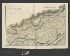
Parish of Old Lorette
62.
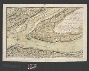
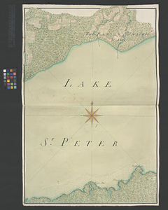
The Parish of Omachis
63.
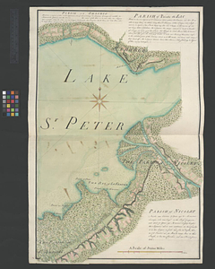
Parish of Omchis. Parish of Pointe du Lac. Parish of Nicolet
64.
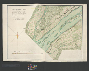
Parish of Repentigny
65.
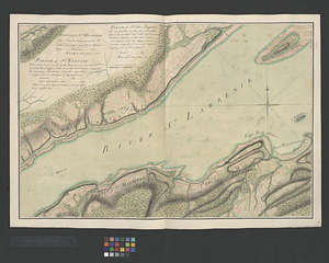
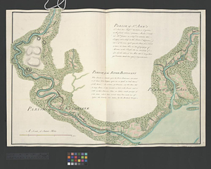
Parish of St. Ann's. Parish of the River Batiscant
66.
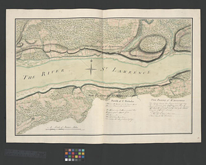
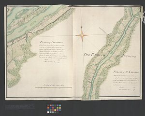
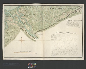
Parish of St. Antoine. Parish of St. Francois
67.
Parish of St. Charles
68.
Parish of St. Charles
69.
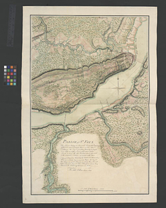
Parish of St. Foix
70.
Parish of St. Joachim. Parish of St. Famille. Parish of St. Anne. Parish of St. François
71.
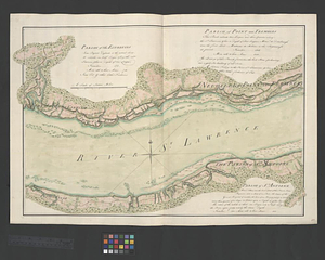
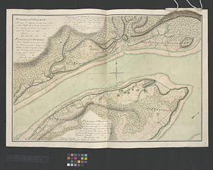
Parish of St. Joseph [of Masquinonge]. Parish of the River du Loup
72.
Parish of St. Lawrence. Parish of Beaumont. Parish of St. Peter
73.
Parish of St. Michelle. Parish of St. John Baptist. Parish of St. Vertier
74.
Parish of St. Nicholas. The Parish of St. Augustin
75.
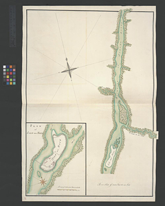
Parish of the Ecureuils. Parish of Point aux Trembles. Parish of St. Antoine. Parish of St. Croix
76.
Parish of Vercheres. Parish of St. Antoine
77.
Part of the Richelieu River showing Fort de St. Ieant
78.
Part of the Richelieu River showing Isle aux Noix
79.
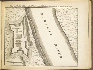
Plan and profile of retrenched work round Harkemeis house at ye German Flats 1756
80.
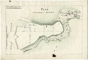
Plan de la pointe à Rochefort
‹ Prev
Next ›
1
2
3
4
5
6
7
8
…
46
47
![Parish of St. Joseph [of Masquinonge]. Parish of the River du Loup](https://bpldcassets.blob.core.windows.net/derivatives/metadata/commonwealth-oai:8336n077h/image_thumbnail_300.jpg)