Toggle navigation
LMEC Home
Exhibitions
Georeferencing
Tools for Teachers
Collections
My Favorites
Sign Up / Log In
Search
Search the map portal
Map Collection
Map Collection
Map Sets
Search
Search
Search for
Search In
All Fields
Creator
Title
Subject
Place
Search All Digital Collections
Advanced Search
1014 Results
My Search
Start Over
More Like
commonwealth-oai:3r078t62x
Remove constraint More Like: commonwealth-oai:3r078t62x
Filter your Search
Place
North and Central America
988
United States
726
Canada
206
New York
201
Quebec
112
Pennsylvania
90
New Jersey
79
Virginia
73
more
Place
»
Topic
United States--History--Revolution, 1775-1783--Maps
308
United States--History--French and Indian War, 1754-1763--Maps
149
Pennsylvania--Maps
50
Virginia--Maps
47
Saint Lawrence River--Maps
43
New Jersey--Maps
40
Maryland--Maps
37
New York (State)--Maps
34
more
Topic
»
Date
Date range begin
–
Date range end
Current results range from
1700
to
1988
View distribution
Creator
Rocque, Mary Ann
29
Bellin, Jacques Nicolas, 1703-1772
26
Holland, Samuel, 1728-1801
26
Montrésor, John, 1736-1799
25
Jefferys, Thomas, -1771
24
Clinton, Henry, Sir, 1738?-1795
19
Robert Sayer and John Bennett (Firm)
15
Hills, John, active 1777-1819
13
more
Creator
»
Format
Maps/Atlases
998
Drawings/Illustrations
11
Documents
5
Manuscripts
2
Prints
1
Georeferenced
Yes
39
No
975
Collection
American Revolutionary War-Era Maps
934
William L. Clements Library Collection
909
Norman B. Leventhal Map & Education Center Collection
86
Maps from AAS
13
MacLean Collection Map Library
5
Urban Maps
2
David Judkins Weaver Papers
1
New York Public Library Collection
1
Available to use
No known restrictions
86
Creative Commons license
1
Search Constraints
Sort by relevance
relevance
title
date (asc)
date (desc)
Number of results to display per page
20 per page
10
per page
20
per page
50
per page
100
per page
View results as:
grid view
map view
Search Results
281.
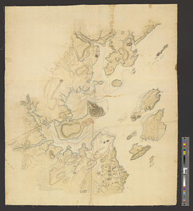
Eastern section of the United States
282.
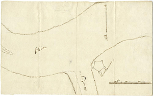
Ensign Nathan Mc:Dowell's draft of the water of big Beaver &c to Lake Erie
283.
Etats Unis de l'Amerique
284.
An exact ground plan of Fort Edward at Pesaquid taken from a survey and laid down by a scale of 60 feet to one inch
285.
An exact map of Nova Scotia, Newfoundland, gulf and river St. Laurence, and coast of Labrador from the latest observations 1777
286.
An exact map of the five Great Lakes, with part of Pensilvania, New York, Canada and Hudsons Bay territories from the best surveys
287.
Exact plan of General Gage's lines on Boston Neck in America
288.
Explanation of the references
289.
Falmouth, Maine
290.
Flatbush
291.
La Floride divisée en Floride et Caroline
292.
Flynt Jenkins sold to Taylor Foster &c plans 1778
293.
Fort Bedford
294.
Fort Edward to Ticonderoga
295.
Fort Germain and neighboring posts
296.
Fort Halifax and the Kennebec River : Québec July 25th, 1761
297.
Fort Harmar at the Ohio and Muskingum Rivers, ca. 1786
298.
Fort Independence to Slaughter's Landing
299.
Fort Lafayette and Verplank Point
300.
Fort Lee
‹ Prev
Next ›
1
2
…
11
12
13
14
15
16
17
18
19
…
50
51