Toggle navigation
LMEC Home
Exhibitions
Georeferencing
Tools for Teachers
Collections
My Favorites
Sign Up / Log In
Search
Search the map portal
Map Collection
Map Collection
Map Sets
Search
Search
Search for
Search In
All Fields
Creator
Title
Subject
Place
Search All Digital Collections
Advanced Search
1007 Results
My Search
Start Over
More Like
commonwealth-oai:2b88vb28r
Remove constraint More Like: commonwealth-oai:2b88vb28r
Filter your Search
Place
North and Central America
977
United States
709
Canada
209
New York
200
Quebec
112
Pennsylvania
90
Virginia
73
New Jersey
62
more
Place
»
Topic
United States--History--Revolution, 1775-1783--Maps
306
United States--History--French and Indian War, 1754-1763--Maps
162
Pennsylvania--Maps
50
Virginia--Maps
47
Saint Lawrence River--Maps
43
Maryland--Maps
37
New York (State)--Maps
33
Newport (R.I.)--Maps
27
more
Topic
»
Date
Date range begin
–
Date range end
Current results range from
1700
to
1931
View distribution
Creator
Rocque, Mary Ann
29
Jefferys, Thomas, -1771
27
Bellin, Jacques Nicolas, 1703-1772
26
Holland, Samuel, 1728-1801
25
Montrésor, John, 1736-1799
25
Clinton, Henry, Sir, 1738?-1795
19
Robert Sayer and John Bennett (Firm)
15
Hills, John, active 1777-1819
13
more
Creator
»
Format
Maps/Atlases
991
Drawings/Illustrations
11
Documents
5
Manuscripts
1
Prints
1
Georeferenced
Yes
28
No
979
Collection
American Revolutionary War-Era Maps
939
William L. Clements Library Collection
909
Norman B. Leventhal Map & Education Center Collection
76
American Antiquarian Society Collection
14
Richard H. Brown Revolutionary War Map Collection at Mount Vernon
4
MacLean Collection Map Library
3
Urban Maps
2
New-York Historical Society Collection
1
Available to use
No known restrictions
77
Creative Commons license
4
Search Constraints
Sort by relevance
relevance
title
date (asc)
date (desc)
Number of results to display per page
20 per page
10
per page
20
per page
50
per page
100
per page
View results as:
grid view
map view
Search Results
161.
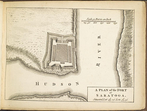
A plan of the fort at Saratoga : situated lat. 43 20' lon. 73 30'
162.
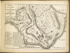
Plan of the fort at Tienderoga at the head of Lake Champlain, 1758
163.
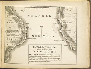
Plan of the narrows about 10 miles from New York
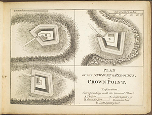
164.
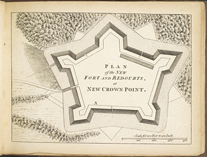
Plan of the new fort & redoubts, at Crown Point
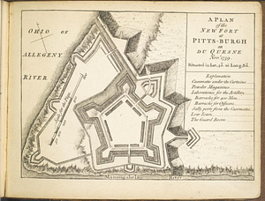
165.
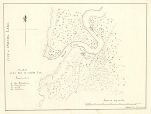
Plan of the new fort and redoubts, at New Crown Point
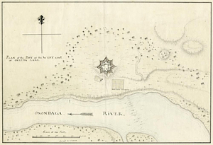
166.
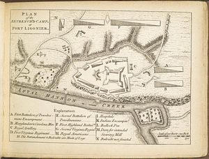
A plan of the new fort at Pitts-Burgh or Du Quesne Novr. 1759 : situated in lat. 40 20' long. 80
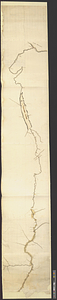
167.
Plan of the post at Oneida Lake
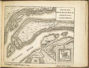
168.
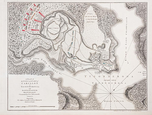
Plan of the post at the west end of Oneida Lake
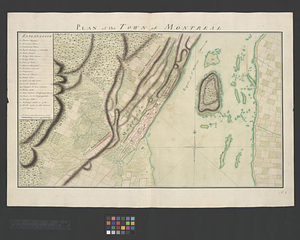
169.
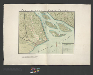
Plan of the retrench'd camp, at Fort Ligonier
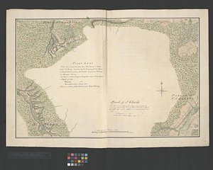
170.
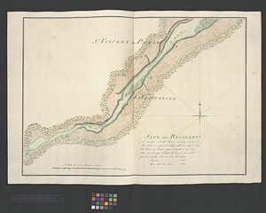
Plan of the river &c from Albany to Oswego in America
171.
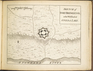
A plan of the river St. Laurence, from Sillery to the fall of Montmerenci, with the operations of the siege of Quebec; under...
172.
A plan of the Royal Block House, with the environs at Fort Edward
173.
A plan of the town and fort of Carillon at Ticonderoga : with the attack made by the British army commanded by Genl....
174.
Plan of the town of Montreal
175.
Plan of the town of Three Rivers
176.
Point Levi. Parish of St. Charles
177.
Sault aux Recollets
178.
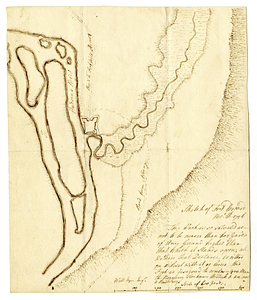
Scetch [sic] of the blockhouse at the east of Oneda Lake
179.
Sketch of Fort Brewerton at the west end of Oneda Lake
180.
Sketch of Fort Edward, Novr. 30th, 1756
‹ Prev
Next ›
1
2
…
5
6
7
8
9
10
11
12
13
…
50
51

![Scetch [sic] of the blockhouse at the east of Oneda Lake](https://bpldcassets.blob.core.windows.net/derivatives/metadata/commonwealth-oai:zs2626251/image_thumbnail_300.jpg)