Toggle navigation
LMEC Home
Exhibitions
Georeferencing
Tools for Teachers
Collections
My Favorites
Sign Up / Log In
Search
Search the map portal
Map Collection
Map Collection
Map Sets
Search
Search
Search for
Search In
All Fields
Creator
Title
Subject
Place
Search All Digital Collections
Advanced Search
441 Results
My Search
Start Over
More Like
commonwealth:z603vv806
Remove constraint More Like: commonwealth:z603vv806
Filter your Search
Place
North and Central America
367
United States
300
New England
97
Canada
48
New York
44
Middle Atlantic
40
North America
39
Suffolk (county)
38
more
Place
»
Topic
New England--Maps--Early works to 1800
97
Middle Atlantic States--Maps--Early works to 1800
38
United States--History--Revolution, 1775-1783--Maps--Early works to 1800
38
North America--Maps--Early works to 1800
27
Northeastern States--Maps--Early works to 1800
19
Boston (Mass.)--History--Revolution, 1775-1783--Maps--Early works to 1800
18
United States--Maps--Early works to 1800
15
Indians of North America--Maps--Early works to 1800
14
more
Topic
»
Date
Date range begin
–
Date range end
Current results range from
1617
to
1999
View distribution
Creator
Jefferys, Thomas, -1771
38
Faden, William, 1749-1836
36
Le Rouge, Georges-Louis
24
Sayer, Robert, 1725-1794
24
Des Barres, Joseph F. W. (Joseph Frederick Wallet), 1722-1824
22
Jefferys, Thomas, d. 1771
14
Robert Sayer and John Bennett (Firm)
12
Korn, Christoph Heinrich, 1726-1783
10
more
Creator
»
Format
Maps/Atlases
398
Prints
32
Manuscripts
27
Drawings/Illustrations
9
Books
2
Georeferenced
Yes
21
No
420
Collection
American Revolutionary War-Era Maps
386
Richard H. Brown Revolutionary War Map Collection at Mount Vernon
293
Norman B. Leventhal Map & Education Center Collection
89
Boston and New England Maps
37
Mapping Boston Collection
24
MacLean Collection Map Library
15
Maritime Charts and Atlases
15
Sidney R. Knafel Map Collection at Phillips Academy
15
more
Collection
»
Available to use
Creative Commons license
337
No known restrictions
69
Search Constraints
Sort by relevance
relevance
title
date (asc)
date (desc)
Number of results to display per page
20 per page
10
per page
20
per page
50
per page
100
per page
View results as:
grid view
map view
Search Results
241.
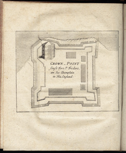
Crown Point : sonst Fort St. Frederic, am See Champlain in Neu England
242.
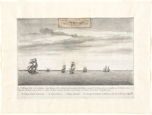
Le Cte. d'Estaing laisse deux vaisseaux et trois frégates de son escadre à la poursuite de la frégate Anglaise la Mairmaide,...
243.
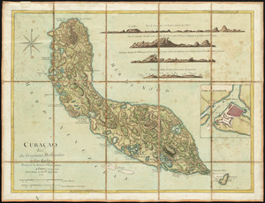
Curaçao : tiré des originaux Hollandois de Van Keulen ; dressé sur les dernieres observations
244.
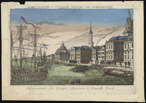
Débarquement des troupes Angloises à Nouvelle Yorck
245.
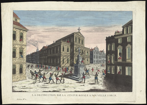
La destruction de la statue royale a Nouvelle Yorck
246.
[Dorchester Neck]
247.
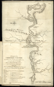
A draught of the Cherokee Country : on the west side of the Twenty Four Mountains, commonly called Over the Hills
248.
[Ein grund-riss von der Festung Duquessne wie sie ausgesehen hat, ehe sie die Frankosen zerstoren aben, und zum theil noch...
249.
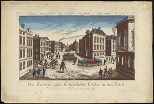
Der einzug der königlichen völcker in Neu Yorck
250.
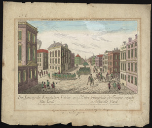
Der einzug der königlichen völcker in Neu Yorck = : L'entré triumphale de troupes royales á Nouvelle Yorck
251.
Exact plan of General Gage's lines on Boston Neck in America
252.
A front view of the lines taken from the advanced post near Browns house : A view of the harbour of Boston taken from Fort Hill...
253.
A general map of North America : in which is express'd the several new roads, forts, engagements, &c, taken from actual surveys...
254.
A general map of the middle British colonies, in America : viz Virginia, Màriland, Dèlaware, Pensilvania, New-Jersey,...
255.
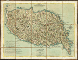
La Grenade : divisée par paroisses
256.
Grundriss der stadt Philadelphia
257.
Grundriss des nördlichen theils der Neujorks Insel : nebst den am 16. Novbr. 1776. eroberten Fort Washington nun das Fort...
258.
The harbour and part of the town of Havannah : The entrance of Havannah, from within the harbour
259.
Isle St. Christophe ou St. Kitts
260.
Isle St. Vincent
‹ Prev
Next ›
1
2
…
9
10
11
12
13
14
15
16
17
…
22
23
![[Dorchester Neck]](https://bpldcassets.blob.core.windows.net/derivatives/images/commonwealth:dz010v59b/image_thumbnail_300.jpg)
![[Ein grund-riss von der Festung Duquessne wie sie ausgesehen hat, ehe sie die Frankosen zerstoren aben, und zum theil noch aussiehet]](https://bpldcassets.blob.core.windows.net/derivatives/images/commonwealth:z603vv49q/image_thumbnail_300.jpg)