Toggle navigation
LMEC Home
Exhibitions
Georeferencing
Tools for Teachers
Collections
My Favorites
Sign Up / Log In
Search
Search the map portal
Map Collection
Map Collection
Map Sets
Search
Search
Search for
Search In
All Fields
Creator
Title
Subject
Place
Search All Digital Collections
Advanced Search
494 Results
My Search
Start Over
More Like
commonwealth:z603vv06x
Remove constraint More Like: commonwealth:z603vv06x
Filter your Search
Place
North and Central America
263
United States
178
North America
176
South America
49
Canada
43
New York
34
Suffolk (county)
31
Boston
29
more
Place
»
Topic
North America--Maps--Early works to 1800
180
South America--Maps--Early works to 1800
46
United States--Maps--Early works to 1800
20
Boston (Mass.)--History--Revolution, 1775-1783--Maps--Early works to 1800
16
Great Britain--Colonies--America--Maps--Early works to 1800
15
Canada--Maps--Early works to 1800
14
New England--Maps--Early works to 1800
11
United States--History--French and Indian War, 1754-1763--Maps--Early works to 1800
11
more
Topic
»
Date
Date range begin
–
Date range end
Current results range from
1528
to
1850
View distribution
Creator
Jefferys, Thomas, -1771
40
Faden, William, 1749-1836
34
Sayer, Robert, 1725-1794
29
Le Rouge, Georges-Louis
24
Des Barres, Joseph F. W. (Joseph Frederick Wallet), 1722-1824
21
Moll, Herman, d. 1732
18
Mitchell, John, 1711-1768
14
Korn, Christoph Heinrich, 1726-1783
11
more
Creator
»
Format
Maps/Atlases
451
Prints
32
Manuscripts
25
Drawings/Illustrations
9
Books
2
Georeferenced
Yes
17
No
477
Collection
American Revolutionary War-Era Maps
392
Richard H. Brown Revolutionary War Map Collection at Mount Vernon
293
Norman B. Leventhal Map Center Collection
150
New York Public Library Collection
32
Mapping Boston Collection
9
Sidney R. Knafel Map Collection at Phillips Academy
8
Boston and New England Maps
6
Maritime Charts and Atlases
4
more
Collection
»
Available to use
Creative Commons license
339
No known restrictions
144
Search Constraints
Sort by date (desc)
relevance
title
date (asc)
date (desc)
Number of results to display per page
20 per page
10
per page
20
per page
50
per page
100
per page
View results as:
grid view
map view
Search Results
461.
A chart of the sea coast of Brazil from Cape St. Augustine to the straights of Magellan, & in the South Sea, from the latitud...
462.
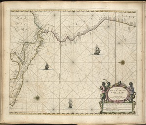
Pascaerte van Nova Hispania, Chili, Peru, en Guatimala
463.
Paskaerte van Nova Granada en t'Eylandt California
464.
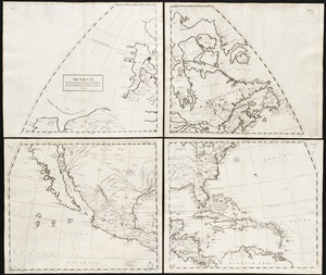
Mexicum in hac forma in lucem
465.
Novissima et accuratissima totius Americae descriptio
466.
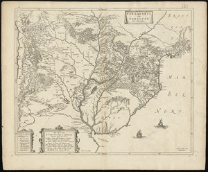
Paraquaria vulgo Paraguay : cum adjacentibus
467.
Pas-caert van Terra Nova, Nova Francia, Nieuw-Engeland en de groote rivier van Canada
468.
America : with those known parts in that unknowne worlde both people and manner of buildings discribed and inlarged
469.
Noua et accurata totius Americae tabula
470.
Le Canada, ou Nouvelle France, &c : ce qui est le plus advance vers le Septentrion est tiré de diverses relations des Anglois,...
471.
Le Nouveau Mexique et la Floride : tirées de diverses cartes, et relations
472.
Le Paraguayr, Le Chili, La Terre, et les Isles Magellanicques : tirées de diverses rélations
473.
Le Perou : et le cours de la rivière Amazone, depuis ses sources jusques à la mer
474.
Americae pars meridionalis
475.
Americae pars meridionalis
476.
Guiana sive Amazonum regio
477.
America Septentrionalis
478.
America septentrionalis
479.
Americae pars meridionalis
480.
Noua Anglia, Nouum Belgium, et Virginia
‹ Prev
Next ›
1
2
…
20
21
22
23
24
25