Toggle navigation
LMEC Home
Exhibitions
Georeferencing
Tools for Teachers
Collections
My Favorites
Sign Up / Log In
Search
Search the map portal
Map Collection
Map Collection
Map Sets
Search
Search
Search for
Search In
All Fields
Creator
Title
Subject
Place
Search All Digital Collections
Advanced Search
345 Results
My Search
Start Over
More Like
commonwealth:z603vt11k
Remove constraint More Like: commonwealth:z603vt11k
Filter your Search
Place
North and Central America
278
United States
209
Pennsylvania
40
New York
36
Suffolk (county)
31
Boston
29
Canada
27
North America
27
more
Place
»
Topic
Pennsylvania--Maps--Early works to 1800
37
Maryland--Maps--Early works to 1800
22
Virginia--Maps--Early works to 1800
20
North America--Maps--Early works to 1800
18
Boston (Mass.)--History--Revolution, 1775-1783--Maps--Early works to 1800
16
New Jersey--Maps--Early works to 1800
12
Delaware--Maps--Early works to 1800
10
Middle Atlantic States--Maps--Early works to 1800
10
more
Topic
»
Date
Date range begin
–
Date range end
Current results range from
1638
to
1799
View distribution
Creator
Faden, William, 1749-1836
33
Jefferys, Thomas, -1771
33
Le Rouge, Georges-Louis
23
Sayer, Robert, 1725-1794
23
Des Barres, Joseph F. W. (Joseph Frederick Wallet), 1722-1824
22
Korn, Christoph Heinrich, 1726-1783
11
Raspe, Gabriel Nicolaus, 1712-1785
11
Robert Sayer and John Bennett (Firm)
10
more
Creator
»
Format
Maps/Atlases
302
Prints
32
Manuscripts
25
Drawings/Illustrations
9
Books
2
Georeferenced
Yes
15
No
330
Collection
American Revolutionary War-Era Maps
336
Richard H. Brown Revolutionary War Map Collection at Mount Vernon
293
Norman B. Leventhal Map & Education Center Collection
27
MacLean Collection Map Library
13
New York Public Library Collection
7
Boston and New England Maps
4
Maritime Charts and Atlases
4
British Library Collection
3
more
Collection
»
Available to use
Creative Commons license
304
No known restrictions
27
Search Constraints
Sort by relevance
relevance
title
date (asc)
date (desc)
Number of results to display per page
20 per page
10
per page
20
per page
50
per page
100
per page
View results as:
grid view
map view
Search Results
1.
Map of part of Pennsylvania & Maryland intended to illustrate proposals for a communication between the waters of the Delaware...
2.
PLAN OF THE PENINSULA OF CHESOPEAK BAY
3.
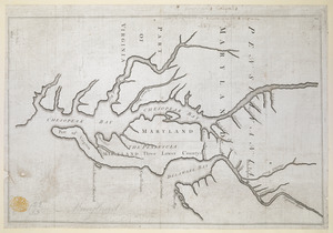
A map of the country between Will's Creek & Monongahela River shewing the rout and encampments of the English army in 1755
4.
A map exhibiting a general view of the roads and inland navigation of Pennsylvania, and part of the adjacent states :...
5.
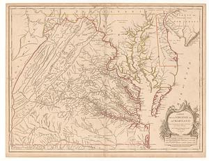
Carte de la Virginie, du Maryland et de l'etat de Delaware
6.
Carte de la Virginie et du Maryland
7.
A general map of the Middle British Colonies in America viz. Virginia, Maryland, Delaware, Pensilvania, New-Jersey New York,...
8.
A New map of the province of Maryland in North America
9.
The states of Maryland and Delaware, from the latest surveys
10.
A map of the country between Will's Creek & Monongahela River shewing the rout and encampments of the English army in 1755
11.
A New and accurate map of Virginia : and part of Maryland and Pennsylvania
12.
A new map of Virginia, Mary-land and the improved parts of Penn-sylvania & New Jersey
13.
A map of the most inhabited part of Virginia containing the whole province of Maryland with part of Pensilvania, New Jersey and...
14.
Carte des environs du Fort Pitt et de la nouvelle province Indiana : dediée a M. Franklin
15.
A topographical plan of that part of the Indian-country through which Colonel Bouquet marched in the year, 1764
16.
Delaware, from the best authorities
17.
A map of that part of America where a degree of latitude was measured for the Royal Society
18.
Proposed Maryland / Pennsylvania Boundary
19.
Carte de la Virginie et du Maryland
20.
A draught of Virginia from the Capes to York in York River and to Kuiquotan or Hamton in James River
‹ Prev
Next ›
1
2
3
4
5
…
17
18