Toggle navigation
LMEC Home
Exhibitions
Georeferencing
Tools for Teachers
Collections
My Favorites
Sign Up / Log In
Search
Search the map portal
Map Collection
Map Collection
Map Sets
Search
Search
Search for
Search In
All Fields
Creator
Title
Subject
Place
Search All Digital Collections
Advanced Search
409 Results
My Search
Start Over
More Like
commonwealth:z603vr69k
Remove constraint More Like: commonwealth:z603vr69k
Filter your Search
Place
North and Central America
330
United States
233
Canada
99
North America
45
Suffolk (county)
35
Boston
33
New York
33
New England
17
more
Place
»
Topic
Canada--Maps--Early works to 1800
79
United States--History--Revolution, 1775-1783--Maps--Early works to 1800
38
United States--Maps--Early works to 1800
38
North America--Maps--Early works to 1800
31
Boston (Mass.)--History--Revolution, 1775-1783--Maps--Early works to 1800
18
New England--Maps--Early works to 1800
15
Northeastern States--Maps--Early works to 1800
11
Antilles, Greater--Maps--Early works to 1800
10
more
Topic
»
Date
Date range begin
–
Date range end
Current results range from
1576
to
1800
View distribution
Creator
Faden, William, 1749-1836
38
Jefferys, Thomas, -1771
33
Le Rouge, Georges-Louis
24
Des Barres, Joseph F. W. (Joseph Frederick Wallet), 1722-1824
21
Sayer, Robert, 1725-1794
19
Bellin, Jacques Nicolas, 1703-1772
16
Robert Sayer and John Bennett (Firm)
14
Korn, Christoph Heinrich, 1726-1783
11
more
Creator
»
Format
Maps/Atlases
366
Prints
32
Manuscripts
24
Drawings/Illustrations
9
Books
2
Georeferenced
Yes
13
No
396
Collection
American Revolutionary War-Era Maps
393
Richard H. Brown Revolutionary War Map Collection at Mount Vernon
293
Norman B. Leventhal Map & Education Center Collection
48
MacLean Collection Map Library
40
Boston and New England Maps
8
Library and Archives Canada Collection
8
Maritime Charts and Atlases
5
New York Public Library Collection
5
more
Collection
»
Available to use
Creative Commons license
305
No known restrictions
52
Search Constraints
Sort by relevance
relevance
title
date (asc)
date (desc)
Number of results to display per page
20 per page
10
per page
20
per page
50
per page
100
per page
View results as:
grid view
map view
Search Results
301.
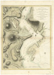
Plan of the attack of the Forts Clinton & Montgomery, upon Hudsons River which were stormed by His Majestys forces under the...
302.
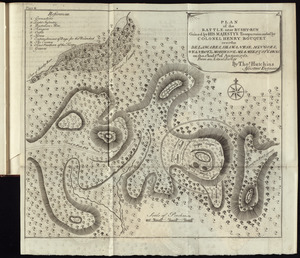
Plan of the battle near Bushy-Run gained by His Majesty's troops commanded by Colonel Henry Bouquet over the Delawares,...
303.
Plan of the battle, on Bunker's Hill : fought on the 17th of June 1775
304.
[Plan of the battles of Saratoga]
305.
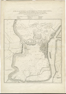
A plan of the city and environs of Philadelphia : with the works and encampments of His Majesty's forces under the command of...
306.
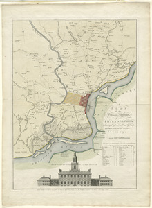
A plan of the city and environs of Philadelphia
307.
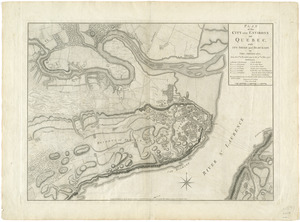
Plan of the city and environs of Quebec, with its siege and blockade by the Americans, from the 8th of December 1775 to the...
308.
A plan of the city of New-York & its environs to Greenwich, on the North or Hudsons River, and to Crown Point, on the East or...
309.
A plan of the city of Philadelphia, the capital of Pennsylvania, from an actual survey
310.
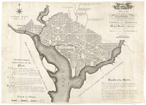
Plan of the city of Washington in the territory of Columbia, ceded by the states of Virginia and Maryland to the United States...
311.
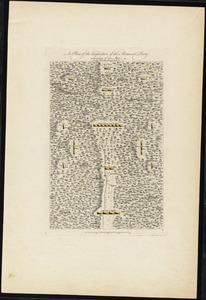
A plan of the disposition of the advanced party consisting of 400 men : to defend the workers in making the road
312.
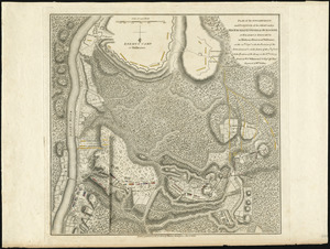
Plan of the encampment and position of the army under His Excelly. Lt. General Burgoyne at Bræmus Heights on Hudson's River...
313.
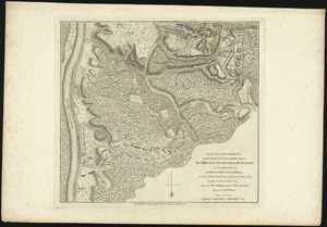
Plan of the encampment and position of the army under His Excelly. Lt. General Burgoyne at Swords House on Hudson's River near...
314.
A plan of the encampment of the detachment from the little Meadows
315.
A plan of the entrance of Chesapeak Bay, with James and York rivers : wherein are shewn the respective positions (in the...
316.
A plan of the field of battle and disposition of the troops, as they were on the march at the time of the attack on the 9th of...
317.
Plan of the island of Bequia laid down by actual survey under the direction of the honorable the Commissioners for the Sale of...
318.
Plan of the island of Dominica laid down by actual survey under the direction of the honorable the Commissioners for the Sale...
319.
A plan of the island of St. John with the divisions of the counties, parishes, & the lots as granted by government, likewise...
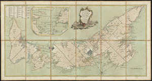
320.
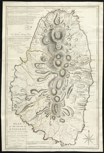
Plan of the island of St. Vincent laid down by actual survey under the direction of the honorable the Commissioners for the...
‹ Prev
Next ›
1
2
…
12
13
14
15
16
17
18
19
20
21

![[Plan of the battles of Saratoga]](https://bpldcassets.blob.core.windows.net/derivatives/images/commonwealth:z603vw07d/image_thumbnail_300.jpg)
![A plan of the city of New-York & its environs to Greenwich, on the North or Hudsons River, and to Crown Point, on the East or Sound River, shewing the several streets, publick buildings, docks, fort & battery, with the true form & course of the commanding grounds, with and without the town : survey'd in the winter, 1775 [i.e. 1766]](https://bpldcassets.blob.core.windows.net/derivatives/images/commonwealth:z603vs09b/image_thumbnail_300.jpg)