Toggle navigation
LMEC Home
Exhibitions
Georeferencing
Tools for Teachers
Collections
My Favorites
Sign Up / Log In
Search
Search the map portal
Map Collection
Map Collection
Map Sets
Search
Search
Search for
Search In
All Fields
Creator
Title
Subject
Place
Search All Digital Collections
Advanced Search
409 Results
My Search
Start Over
More Like
commonwealth:z603vr69k
Remove constraint More Like: commonwealth:z603vr69k
Filter your Search
Place
North and Central America
330
United States
233
Canada
99
North America
45
Suffolk (county)
35
Boston
33
New York
33
New England
17
more
Place
»
Topic
Canada--Maps--Early works to 1800
79
United States--History--Revolution, 1775-1783--Maps--Early works to 1800
38
United States--Maps--Early works to 1800
38
North America--Maps--Early works to 1800
31
Boston (Mass.)--History--Revolution, 1775-1783--Maps--Early works to 1800
18
New England--Maps--Early works to 1800
15
Northeastern States--Maps--Early works to 1800
11
Antilles, Greater--Maps--Early works to 1800
10
more
Topic
»
Date
Date range begin
–
Date range end
Current results range from
1576
to
1800
View distribution
Creator
Faden, William, 1749-1836
38
Jefferys, Thomas, -1771
33
Le Rouge, Georges-Louis
24
Des Barres, Joseph F. W. (Joseph Frederick Wallet), 1722-1824
21
Sayer, Robert, 1725-1794
19
Bellin, Jacques Nicolas, 1703-1772
16
Robert Sayer and John Bennett (Firm)
14
Korn, Christoph Heinrich, 1726-1783
11
more
Creator
»
Format
Maps/Atlases
366
Prints
32
Manuscripts
24
Drawings/Illustrations
9
Books
2
Georeferenced
Yes
13
No
396
Collection
American Revolutionary War-Era Maps
393
Richard H. Brown Revolutionary War Map Collection at Mount Vernon
293
Norman B. Leventhal Map & Education Center Collection
48
MacLean Collection Map Library
40
Boston and New England Maps
8
Library and Archives Canada Collection
8
Maritime Charts and Atlases
5
New York Public Library Collection
5
more
Collection
»
Available to use
Creative Commons license
305
No known restrictions
52
Search Constraints
Sort by relevance
relevance
title
date (asc)
date (desc)
Number of results to display per page
20 per page
10
per page
20
per page
50
per page
100
per page
View results as:
grid view
map view
Search Results
1.
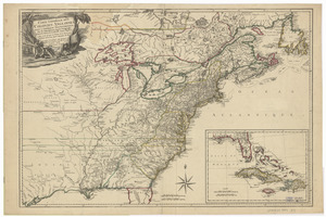
Théatre de la guerre en Amerique, avec les Isles Antilles : projetté et assujettie aux observations
2.
Théatre de la guerre en Amerique, avec les Isles Antilles : projetté et assujettie aux observations
3.
Carte générale des colonies Angloises : dans l'Amérique Septentrionale
4.
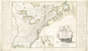
A new and accurate map of the present seat of war in North America
5.
Theatre de la guerre en Amerique
6.
The theatre of war in North America, with the roads, and tables, of the superficial contents, distances, &ca
7.
Allgemeine charte von Nord America als den sitz des krieges zwischen den Konigl. Engl. truppen u:den provinzialen
8.
L'Amerique Septentrionale
9.
Carte de l'Amérique Septle. pour servir à l'intelligence de la guerre entre les Anglois et les insurgents
10.
Carte des Etats-Unis d'Amérique, et du cours du Mississippi : rédigée d'après différentes cartes et relations Anglaises et...
11.
Carte des Etats-Unis de l'Amerique suivant le Traité de Paix de 1783
12.
Carte generale des colonies angloises dans l'Amerique Septentrionale pour l'intelligence de la guerre presente : d'apres des...
13.
Karte von Neu England, Neu Yorck und Pensilvanien
14.
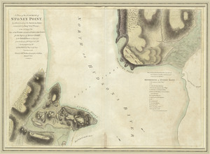
A plan of the surprise of Stoney Point, by a detachment of the American army commanded by Brigr. Genl. Wayne, on the 15th July...
15.
Suite du theatre de la guerre dans l'Amérique Septentrionale y compris le Golfe du Méxique
16.
Carte du Canada et des Etats-Unis de l'Amérique Septentrionale
17.
Carte d'une partie du Nord Amerique dans la quelle se trouvent les isles et les provinces suivantes : l'Isle de la Terre-Neuve...
18.
[Alleen de Caribische Eilanden, vervat in 't groot]
19.
Carta particolare del'Isola di Cuba è di Iamaica con il capo della Florida è l'Isola Intorno
20.
Carta particolare dell'Isola Ispaniola è S. Gioni. nel'India ocidentle. con l'Isola Intorno
‹ Prev
Next ›
1
2
3
4
5
…
20
21


![[Alleen de Caribische Eilanden, vervat in 't groot]](https://bpldcassets.blob.core.windows.net/derivatives/images/commonwealth:st74cw59p/image_thumbnail_300.jpg)

