Toggle navigation
LMEC Home
Exhibitions
Georeferencing
Tools for Teachers
Collections
My Favorites
Sign Up / Log In
Search
Search the map portal
Map Collection
Map Collection
Map Sets
Search
Search
Search for
Search In
All Fields
Creator
Title
Subject
Place
Search All Digital Collections
Advanced Search
151 Results
My Search
Start Over
More Like
commonwealth:z603vr10w
Remove constraint More Like: commonwealth:z603vr10w
Filter your Search
Place
North and Central America
107
United States
89
Middle Atlantic
37
Virginia
37
North America
36
Maryland
21
New England
21
Pennsylvania
15
more
Place
»
Topic
Middle Atlantic States--Maps--Early works to 1800
38
Virginia--Maps--Early works to 1800
38
North America--Maps--Early works to 1800
30
Maryland--Maps--Early works to 1800
22
New England--Maps--Early works to 1800
21
Pennsylvania--Maps--Early works to 1800
15
United States--Maps--Early works to 1800
15
Northeastern States--Maps--Early works to 1800
12
more
Topic
»
Date
Date range begin
–
Date range end
Current results range from
1590
to
1899
View distribution
Creator
Jefferys, Thomas, -1771
8
Kitchin, Thomas, 1719-1784
7
Lodge, John, -1796
6
Sayer, Robert, 1725-1794
6
Gibson, J. (John), active 1750-1792
5
Hinton, John, -1781
5
Russell, John, active 1733-1795
5
Anville, Jean Baptiste Bourguignon d', 1697-1782
4
more
Creator
»
Format
Maps/Atlases
151
Manuscripts
2
Georeferenced
Yes
9
No
142
Collection
American Revolutionary War-Era Maps
118
New York Public Library Collection
78
Norman B. Leventhal Map & Education Center Collection
42
MacLean Collection Map Library
9
Mapping Boston Collection
8
Richard H. Brown Revolutionary War Map Collection at Mount Vernon
7
Sidney R. Knafel Map Collection at Phillips Academy
6
Maritime Charts and Atlases
5
more
Collection
»
Available to use
Creative Commons license
100
No known restrictions
36
Search Constraints
Sort by relevance
relevance
title
date (asc)
date (desc)
Number of results to display per page
20 per page
10
per page
20
per page
50
per page
100
per page
View results as:
grid view
map view
Search Results
21.
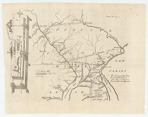
La Pensilvania, la Nuova York, il Jersey Settentrio[na]le : con la parte occidentale del Connecticut, Massachusset-s-bay e...
22.
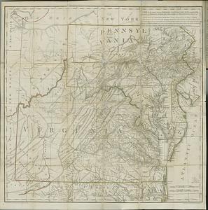
[A map of part of Pennsylvania & Maryland intended to shew, at one view, the several places proposed for opening a...
23.
A map of Maryland with the Delaware counties and the southern part of New Jersey &c
24.
Map of part of Pennsylvania & Maryland intended to illustrate proposals for a communication between the waters of the Delaware...
25.
A New map of the province of Maryland in North America
26.
PLAN OF THE PENINSULA OF CHESOPEAK BAY
27.
The states of Maryland and Delaware, from the latest surveys
28.
Americæ pars, nunc Virginia dicta, primum ab Anglis inuenta, sumtibus Dn. Walteri Raleigh, equestris ordinis Viri, Anno Dn̄i....
29.
Carte des environs du Fort Pitt et de la nouvelle province Indiana : dediée a M. Franklin
30.
A map of the country between Albemarle Sound, and Lake Erie, comprehending the whole of Virginia, Maryland, Delaware and...
31.
Map of the western parts of the colony of Virginia
32.
Map of the western parts of the colony of Virginia, as far as the Mississipi
33.
MAP of the Western parts of the COLONY of VIRGINIA, as far as the Mississipi
34.
Map of the western parts of the colony of Virginia as far as the Mississipi
35.
A new and accurate map of the province of Virginia in North America
36.
A new map of the western parts of Virginia, Pennsylvania, Maryland and North Carolina : comprehending the river Ohio, and all...
37.
A new map of Virginia from the best authorities
38.
Noua Anglia, Nouum Belgium, et Virginia
39.
Partie meridionale des possessions angloise en Amerique
40.
A plan of the entrance of Chesapeak Bay, with James and York Rivers : wherein are shown the respective positions (in the...
‹ Prev
Next ›
1
2
3
4
5
6
7
8
![La Pensilvania, la Nuova York, il Jersey Settentrio[na]le](https://bpldcassets.blob.core.windows.net/derivatives/images/commonwealth:z603vq53g/image_thumbnail_300.jpg)
![[A map of part of Pennsylvania & Maryland intended to shew, at one view, the several places proposed for opening a communication between the waters of the Delaware & Chesopeak Bays]](https://bpldcassets.blob.core.windows.net/derivatives/images/commonwealth:z603vt12v/image_thumbnail_300.jpg)