Toggle navigation
LMEC Home
Exhibitions
Georeferencing
Tools for Teachers
Collections
My Favorites
Sign Up / Log In
Search
Search the map portal
Map Collection
Map Collection
Map Sets
Search
Search
Search for
Search In
All Fields
Creator
Title
Subject
Place
Search All Digital Collections
Advanced Search
161 Results
My Search
Start Over
More Like
commonwealth:z603vn03v
Remove constraint More Like: commonwealth:z603vn03v
Filter your Search
Place
North and Central America
139
United States
87
Rhode Island
21
Canada
13
Massachusetts
11
Connecticut
10
San Juan
8
Florida
7
more
Place
»
Topic
Manuscript maps--Early works to 1800
138
Rhode Island--Maps--Early works to 1800
15
Connecticut--Maps--Early works to 1800
10
Massachusetts--Maps--Early works to 1800
10
Añasco (P.R.)--Maps--Early works to 1800
6
Coasts--Florida--Maps--Early works to 1800
6
Coasts--Puerto Rico--Añasco--Maps--Early works to 1800
6
Coasts--Puerto Rico--Mayagüez--Maps--Early works to 1800
6
more
Topic
»
Date
Date range begin
–
Date range end
Current results range from
1700
to
1909
View distribution
Creator
Dumont de Montigny
14
Adlum, John, 1759-1836
9
Bingham, William, 1752-1804
9
Des Barres, Joseph F. W. (Joseph Frederick Wallet), 1722-1824
7
De Brahm, John Gerar William, 1717-approximately 1799
4
Real Escuela de Navegación (Cádiz, Spain)
4
Bew, John, -1793
2
Dampierre, chevalier de, fl. 1756
2
more
Creator
»
Format
Maps/Atlases
161
Manuscripts
140
Georeferenced
Yes
3
No
158
Collection
American Revolutionary War-Era Maps
155
Library of Congress Collection
97
Newberry Library Collection
39
Maritime Charts and Atlases
24
Norman B. Leventhal Map & Education Center Collection
18
Boston and New England Maps
12
Urban Maps
8
Sidney R. Knafel Map Collection at Phillips Academy
4
more
Collection
»
Available to use
Creative Commons license
99
No known restrictions
18
Search Constraints
Sort by relevance
relevance
title
date (asc)
date (desc)
Number of results to display per page
20 per page
10
per page
20
per page
50
per page
100
per page
View results as:
grid view
map view
Search Results
21.
Plan du detroit de Belle Isle et du Golphe St. Laurent pour la coste du nord
22.
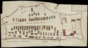
Plan du Fort du Sault de St. Louis et du village des sauvages Iroquois
23.
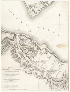
A plan of York Town and Gloucester, in the province of Virginia, shewing the works constructed for the defence of those posts...
24.
A plan of the town of Newport in the province of Rhode Island
25.
A plan of the town of Newport in the province of Rhode Island
26.
A chart of the harbour of Rhode Island and Narraganset Bay
27.
A chart of the harbour of Rhode Island and Narraganset Bay
28.
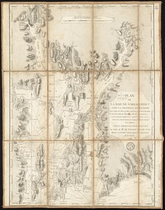
Plan de la baie de Narraganset dans la Nouvelle Angleterre : avec toutes les îles qu'elle renferme parmi lesquelles se...
29.
Maps illustrating cruises of John Paul Jones in British waters : [Great Britain and Ireland]
30.
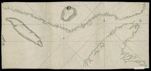
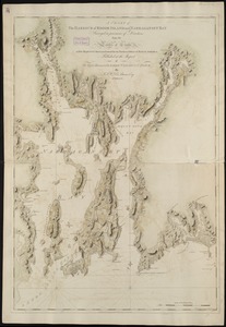
[Coast of New England from Chatham Harbor to Naragansett Bay]
31.
[Coast of New England from Chatham Harbor to Naragansett Bay]
32.
A map of the colonies of Connecticut and Rhode Island, divided into counties & townships, from the best authorities
33.
A map of the colony of Rhode Island : with the adjacent parts of Connecticut, Massachusetts Bay, &c
34.
A map of the country adjacent to the north boundary line of the colony of Rhode Island as the same was run by commissioners...
35.
A map of the province of Massachusets Bay and colony of Rhode Island, with part of Connecticut, New Hampshire, and Vermont
36.
A map of the province of Massachusets Bay and colony of Rhode Island, with part of Connecticut, New Hampshire, and Vermont
37.
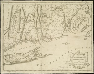
A new and accurate map of Connecticut and Rhode Island, from the best authorities
38.
A new and accurate map of the colony of Massachusets Bay, in North America, from a late survey
39.
A new and accurate map of the colony of Massachusets Bay, in North America, from a late survey
40.
A new and accurate map of the present seat of war in North America : from a late survey
‹ Prev
Next ›
1
2
3
4
5
6
…
8
9


![[Coast of New England from Chatham Harbor to Naragansett Bay]](https://bpldcassets.blob.core.windows.net/derivatives/images/commonwealth:7h149x27g/image_thumbnail_300.jpg)
![[Coast of New England from Chatham Harbor to Naragansett Bay]](https://bpldcassets.blob.core.windows.net/derivatives/images/commonwealth:7h149z37x/image_thumbnail_300.jpg)