Toggle navigation
LMEC Home
Exhibitions
Georeferencing
Tools for Teachers
Collections
My Favorites
Sign Up / Log In
Search
Search the map portal
Map Collection
Map Collection
Map Sets
Search
Search
Search for
Search In
All Fields
Creator
Title
Subject
Place
Search All Digital Collections
Advanced Search
26 Results
My Search
Start Over
More Like
commonwealth:z603vh430
Remove constraint More Like: commonwealth:z603vh430
Filter your Search
Place
North and Central America
21
Canada
13
United States
9
Nova Scotia
6
Halifax Harbour
5
Halifax
4
North America
3
Bedford Bay
2
more
Place
»
Topic
Nova Scotia--Maps--Early works to 1800
5
Halifax Harbour (N.S.)--Maps--Early works to 1800
4
Acadia--Maps--Early works to 1800
3
Halifax (N.S.)--Maps--Early works to 1800
3
Nautical charts--Nova Scotia--Halifax Harbour--Early works to 1800
3
North America--Maps--Early works to 1800
3
Bedford Bay (N.S.)--Maps--Early works to 1800
2
Coasts--Nova Scotia--Maps--Early works to 1800
2
more
Topic
»
Date
Date range begin
–
Date range end
Current results range from
1750
to
1808
View distribution
Creator
Des Barres, Joseph F. W. (Joseph Frederick Wallet), 1722-1824
3
Dury, Andrew
2
Sayer, Robert, 1725-1794
2
Abernethie
1
Anburey, Thomas
1
Bellin, Jacques Nicolas, 1703-1772
1
Caldwall, James, 1739-1819
1
Chabert, Joseph Bernard, marquis de, 1724-1805
1
more
Creator
»
Format
Maps/Atlases
26
Manuscripts
2
Georeferenced
Yes
1
No
25
Collection
American Revolutionary War-Era Maps
25
Boston Athenaeum, Cartographic Collection
15
Norman B. Leventhal Map Center Collection
6
Maritime Charts and Atlases
3
Richard H. Brown Revolutionary War Map Collection at Mount Vernon
3
Boston and New England Maps
1
Library of Congress Collection
1
New-York Historical Society Collection
1
more
Collection
»
Available to use
Creative Commons license
13
No known restrictions
7
Search Constraints
Sort by title
relevance
title
date (asc)
date (desc)
Number of results to display per page
10 per page
10
per page
20
per page
50
per page
100
per page
View results as:
grid view
map view
Search Results
1.
Carte de la Nouvelle Angleterre, Nouvelle Yorck, et Pensilvanie : pour servir à l'Histoire générale des voyages
2.
Carte d'une partie de l'Amérique Septentrionale
3.
A chart of the Atlantic Ocean : its islands and the adjacent continents: In which the British Dominions in Europe and America,...
4.
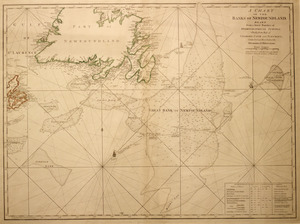
A chart of the Banks of Newfoundland
5.
A chart of the harbour of Halifax in Nova Scotia : with Jebucto Bay and Cape Sambro also the islands, ledges of rocks, shoals &...
6.
A draught of the harbour of Hallifax and the adjacent coast in Nova Scotia
7.
Halifax Harbour ... Catch Harbour ... small vessels only
8.
Halifax Harbour ... Catch Harbour ... small vessels only
9.
Karte von dem Ostlichen-Stucke von Neu Franckreich oder Canada in America : besonders aber Acadia und Neu Schottland
10.
Map for the interior travels through America : delineating the march of the army
‹ Prev
Next ›
1
2
3