Toggle navigation
LMEC Home
Exhibitions
Georeferencing
Tools for Teachers
Collections
My Favorites
Sign Up / Log In
Search
Search the map portal
Map Collection
Map Collection
Map Sets
Search
Search
Search for
Search In
All Fields
Creator
Title
Subject
Place
Search All Digital Collections
Advanced Search
639 Results
My Search
Start Over
More Like
commonwealth:z603vh006
Remove constraint More Like: commonwealth:z603vh006
Filter your Search
Place
North and Central America
597
United States
443
Canada
151
Quebec
73
New York
60
North America
32
Saint Lawrence River
27
West Indies
23
more
Place
»
Topic
United States--Maps
330
United States--History--French and Indian War, 1754-1763--Maps
162
Canada--Maps
55
Elections--United States--Maps
36
Railroads--United States--Maps
34
North America--Maps
30
Saint Lawrence River--Maps
27
West Indies--Maps
24
more
Topic
»
Date
Date range begin
–
Date range end
Current results range from
1750
to
2023
View distribution
Creator
Paullin, Charles Oscar, 1868 or 1869-1944
70
Wright, John Kirtland, 1891-1969
70
Rocque, Mary Ann
24
Jefferys, Thomas, -1771
18
Geological Survey (U.S.)
15
Orme, Robert, -1781
14
Reid, John, 1764?-1828
11
Bellin, Jacques Nicolas, 1703-1772
10
more
Creator
»
Format
Maps/Atlases
636
Manuscripts
13
Prints
3
Books
1
Objects/Artifacts
1
Posters
1
Georeferenced
Yes
77
No
562
Collection
American Revolutionary War-Era Maps
325
Norman B. Leventhal Map & Education Center Collection
317
William L. Clements Library Collection
167
American Antiquarian Society Collection
138
MacLean Collection Map Library
11
Richard H. Brown Revolutionary War Map Collection at Mount Vernon
4
Boston and New England Maps
3
David Judkins Weaver Papers
2
more
Collection
»
Available to use
No known restrictions
243
Creative Commons license
10
Search Constraints
Sort by relevance
relevance
title
date (asc)
date (desc)
Number of results to display per page
20 per page
10
per page
20
per page
50
per page
100
per page
View results as:
grid view
map view
Search Results
181.
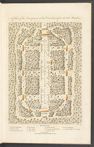
A plan of the encampment of the detachment from the Little Meadows
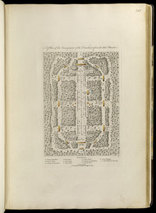
182.
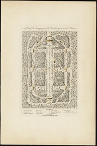
A plan of the encampment of the detachment from the little Meadows
183.
A plan of the encampment of the detachment from the little Meadows
184.
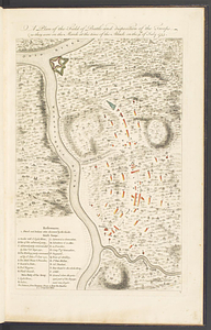
A plan of the field of battle and disposition of the troops, as they were on the march at the time of the attack on the 9th of...
185.
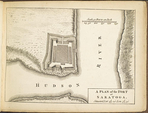
A plan of the fort at Saratoga : situated lat. 43 20' lon. 73 30'
186.
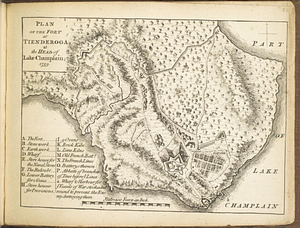
Plan of the fort at Tienderoga at the head of Lake Champlain, 1758
187.
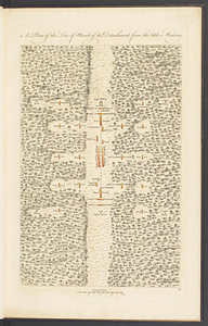
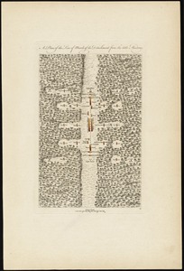
A plan of the line of march of the detachment from the Little Meadows
188.
A plan of the line of march of the detachment from the little Meadows
189.
A plan of the line of march of the detachment from the little Meadows
190.
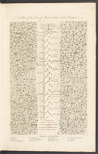
A plan of the line of march with the whole baggage
191.
A plan of the line of march with the whole baggage
192.
A plan of the line of march with the whole baggage
193.
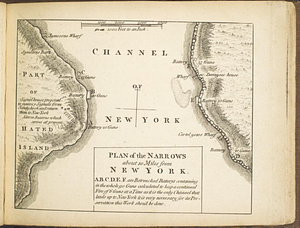
Plan of the narrows about 10 miles from New York
194.
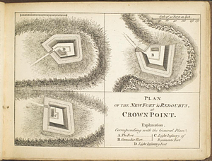
Plan of the new fort & redoubts, at Crown Point
195.
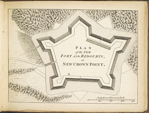
Plan of the new fort and redoubts, at New Crown Point
196.
A plan of the new fort at Pitts-Burgh or Du Quesne Novr. 1759 : situated in lat. 40 20' long. 80
197.
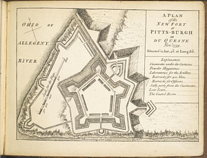
Plan of the post at Oneida Lake
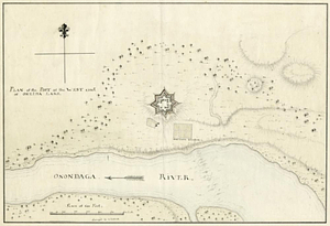
198.
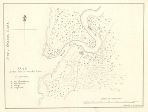
Plan of the post at the west end of Oneida Lake
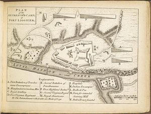
199.
Plan of the retrench'd camp, at Fort Ligonier
200.
Plan of the river &c from Albany to Oswego in America
‹ Prev
Next ›
1
2
…
6
7
8
9
10
11
12
13
14
…
31
32