Toggle navigation
LMEC Home
Exhibitions
Georeferencing
Tools for Teachers
Collections
My Favorites
Sign Up / Log In
Search
Search the map portal
Map Collection
Map Collection
Map Sets
Search
Search
Search for
Search In
All Fields
Creator
Title
Subject
Place
Search All Digital Collections
Advanced Search
448 Results
My Search
Start Over
More Like
commonwealth:z603vg948
Remove constraint More Like: commonwealth:z603vg948
Filter your Search
Place
North and Central America
411
United States
355
Canada
36
North America
29
West Indies
23
New York
13
Boston
11
New England
11
more
Place
»
Topic
United States--Maps
327
Elections--United States--Maps
36
Railroads--United States--Maps
34
North America--Maps
28
Canada--Maps
25
West Indies--Maps
24
Population density--United States--Maps
14
New England--Maps
11
more
Topic
»
Date
Date range begin
–
Date range end
Current results range from
1750
to
2023
View distribution
Creator
Paullin, Charles Oscar, 1868 or 1869-1944
70
Wright, John Kirtland, 1891-1969
70
Geological Survey (U.S.)
15
Reid, John, 1764?-1828
11
Farwell, John Whittemore, 1843-1929
9
Bellin, Jacques Nicolas, 1703-1772
8
Carleton, Osgood, 1742-1816
8
Kitchin, Thomas, 1719-1784
8
more
Creator
»
Format
Maps/Atlases
446
Manuscripts
13
Prints
2
Books
1
Objects/Artifacts
1
Posters
1
Georeferenced
Yes
75
No
373
Collection
Norman B. Leventhal Map & Education Center Collection
285
American Revolutionary War-Era Maps
162
American Antiquarian Society Collection
138
William L. Clements Library Collection
14
MacLean Collection Map Library
10
David Judkins Weaver Papers
2
Mapping Boston Collection
2
Applied Geographics, Inc. Records
1
more
Collection
»
Available to use
No known restrictions
210
Creative Commons license
6
Search Constraints
Sort by relevance
relevance
title
date (asc)
date (desc)
Number of results to display per page
20 per page
10
per page
20
per page
50
per page
100
per page
View results as:
grid view
map view
Search Results
241.
Public lands of the United States, 1910
242.
P.W.A. and industry : how benefits are spread
243.
P.W.A. in action
244.
PWA rebuilds the nation
245.
Radio map of the United States
246.
Radio reference map of the United States
247.
Rail road map of the southern states shewing the southern & southwestern railway connections with Philadelphia
248.
Railroad distance map of the United States, Mexico & Canada
249.
Rainfall-chart of the United States : showing the distribution by isohyetal curves of the mean precipitation in rain ...
250.
Rambles through our country : an instructive geographical game for the young
251.
Rand McNally & Co's new commercial map of Europe
252.
Rand McNally & Co's new railroad and county map of the United States and Dominion of Canada
253.
Reconstruction Act, March 2, 1867, Vote on passage over President's veto
254.
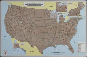
Recreational opportunities at Federal Energy Regulatory Commission licensed hydropower projects
255.
Los recursos de los Estados Unidos
256.
Relief map of Canada and the United States
257.
Rock Island-Frisco lines and Chicago & Eastern Illinois R.R : traverse the richest and most prosperous commonwealths in the Union
258.
Schonberg's imperial map of the United States and Canada : constructed, drawn and compiled from the latest and best authorities...
259.
Skeleton map of rail-roads between Cape Canso and St. Louis
260.
Skeleton map showing the rail roads completed and in progress in the United States and their connection as proposed with the...
‹ Prev
Next ›
1
2
…
9
10
11
12
13
14
15
16
17
…
22
23