Toggle navigation
LMEC Home
Exhibitions
Georeferencing
Tools for Teachers
Collections
My Favorites
Sign Up / Log In
Search
Search the map portal
Map Collection
Map Collection
Map Sets
Search
Search
Search for
Search In
All Fields
Creator
Title
Subject
Place
Search All Digital Collections
Advanced Search
274 Results
My Search
Start Over
More Like
commonwealth:z603vg73h
Remove constraint More Like: commonwealth:z603vg73h
Filter your Search
Place
North and Central America
238
United States
180
New York
83
Pennsylvania
50
New Jersey
37
Canada
27
New England
22
North America
17
more
Place
»
Topic
New York (State)--Maps
81
Pennsylvania--Maps
50
New Jersey--Maps
37
United States--History--Revolution, 1775-1783--Maps
28
New England--Maps
24
Railroads--New York (State)--Maps
20
United States--Maps
20
Canada--Maps
17
more
Topic
»
Date
Date range begin
–
Date range end
Current results range from
1700
to
1976
View distribution
Creator
Reid, John, 1764?-1828
11
Kitchin, Thomas, 1718-1784
10
Farwell, John Whittemore, 1843-1929
9
Bellin, Jacques Nicolas, 1703-1772
8
Carleton, Osgood, 1742-1816
8
United States. Post Office Dept
7
Carey, Mathew, 1760-1839
6
Gibson, J. (John), active 1750-1792
6
more
Creator
»
Format
Maps/Atlases
274
Manuscripts
12
Georeferenced
Yes
31
No
243
Collection
American Revolutionary War-Era Maps
196
American Antiquarian Society Collection
138
Norman B. Leventhal Map & Education Center Collection
82
William L. Clements Library Collection
50
Boston and New England Maps
14
MacLean Collection Map Library
1
Maritime Charts and Atlases
1
Massachusetts Historical Society Map Collection
1
more
Collection
»
Available to use
No known restrictions
83
Creative Commons license
3
Search Constraints
Sort by relevance
relevance
title
date (asc)
date (desc)
Number of results to display per page
20 per page
10
per page
20
per page
50
per page
100
per page
View results as:
grid view
map view
Search Results
61.
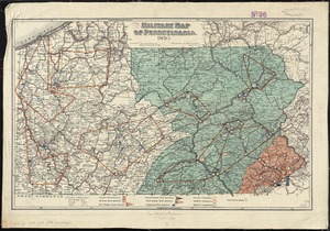
Military map of Pennsylvania
62.
A new county map of the state of Pennsylvania and adjoining states : showing the route of the Central & other rail roads &c....
63.
The new war map of Virginia, Maryland & Pennsylvania
64.
Oil and gas fields of Pennsylvania
65.
Part of the modern counties of Philadelphia, Bucks, Chester, Montgomery, Lehigh, Northampton, Lancaster, and Lebanon
66.
Part of the modern counties of Philadelphia, Bucks, Montgomery, Delaware, Chester, and Lancaster in Pennsylvania; New Castle in...
67.
Pennsylvania
68.
Pennsylvania
69.
Plan of the Indian countrys through which the troops marchd in 1764 under the command of Col. Henry Bouquet
70.
A plan of the river Ohio from Fort Pitt to the Mississipi : by order of ye chief engineer
71.
Post route map of the state of Pennsylvania showing post offices and the intermediate distances on mail routes in operation on...
72.
Post route map of the state of Pennsylvania showing post offices with the intermediate distances on mail routes in operation on...
73.
Progress of the British army from Elk River to Philadelphia, 1777
74.
Rail road map of Pennsylvania
75.
Rail road map of Pennsylvania
76.
Sketch from information of the different roads about Freehold in the Jerseys
77.
A sketch of the several Indian roads leading from Fort Pitt to Sioto, Lake Erie &c. : takn. from a draft (made on a tour thro'...
78.
Sketch showing a feasible canal route, Allegheny River to Lake Erie.
79.
The state of Pennsylvania : reduced with permission from Reading Howells map
80.
The tourist's pocket map of Pennsylvania : exhibiting its internal improvements, roads, distances, &c
‹ Prev
Next ›
1
2
3
4
5
6
7
8
…
13
14