Toggle navigation
LMEC Home
Exhibitions
Georeferencing
Tools for Teachers
Collections
My Favorites
Sign Up / Log In
Search
Search the map portal
Map Collection
Map Collection
Map Sets
Search
Search
Search for
Search In
All Fields
Creator
Title
Subject
Place
Search All Digital Collections
Advanced Search
350 Results
My Search
Start Over
More Like
commonwealth:z603vg40z
Remove constraint More Like: commonwealth:z603vg40z
Filter your Search
Place
North and Central America
314
United States
256
New England
117
New York
84
Pennsylvania
51
Canada
33
Massachusetts
25
New Jersey
18
more
Place
»
Topic
New England--Maps
120
New York (State)--Maps
81
Pennsylvania--Maps
50
Railroads--New England--Maps
50
United States--Maps
22
Railroads--New York (State)--Maps
21
United States--History--Revolution, 1775-1783--Maps
21
Massachusetts--Maps
20
more
Topic
»
Date
Date range begin
–
Date range end
Current results range from
1700
to
2015
View distribution
Creator
Kitchin, Thomas, 1718-1784
11
Reid, John, 1764?-1828
11
Farwell, John Whittemore, 1843-1929
9
United States. Post Office Dept
9
Carleton, Osgood, 1742-1816
8
Bellin, Jacques Nicolas, 1703-1772
7
Gibson, J. (John), active 1750-1792
6
Jefferys, Thomas, -1771
6
more
Creator
»
Format
Maps/Atlases
350
Manuscripts
13
Georeferenced
Yes
38
No
312
Collection
American Revolutionary War-Era Maps
189
Norman B. Leventhal Map & Education Center Collection
158
American Antiquarian Society Collection
138
Boston and New England Maps
78
William L. Clements Library Collection
45
Sidney R. Knafel Map Collection at Phillips Academy
4
David Judkins Weaver Papers
3
British Library Collection
2
more
Collection
»
Available to use
No known restrictions
159
Creative Commons license
4
Search Constraints
Sort by relevance
relevance
title
date (asc)
date (desc)
Number of results to display per page
20 per page
10
per page
20
per page
50
per page
100
per page
View results as:
grid view
map view
Search Results
61.
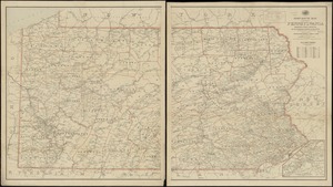
Pennsylvania
62.
Pennsylvania
63.
Plan of the Indian countrys through which the troops marchd in 1764 under the command of Col. Henry Bouquet
64.
A plan of the river Ohio from Fort Pitt to the Mississipi : by order of ye chief engineer
65.
Post route map of the state of Pennsylvania showing post offices and the intermediate distances on mail routes in operation on...
66.
Post route map of the state of Pennsylvania showing post offices with the intermediate distances on mail routes in operation on...
67.
Post route map of the states of Pennsylvania, New Jersey, Delaware, and Maryland and of the District of Columbia with adjacent...
68.
Progress of the British army from Elk River to Philadelphia, 1777
69.
Rail road map of Pennsylvania
70.
Rail road map of Pennsylvania
71.
Seat of war in the environs of Philadelphia
72.
Sketch from information of the different roads about Freehold in the Jerseys
73.
A sketch of the several Indian roads leading from Fort Pitt to Sioto, Lake Erie &c. : takn. from a draft (made on a tour thro'...
74.
Sketch showing a feasible canal route, Allegheny River to Lake Erie.
75.
The state of Pennsylvania : reduced with permission from Reading Howells map
76.
The tourist's pocket map of Pennsylvania : exhibiting its internal improvements, roads, distances, &c
77.
15 lots of 440a each in Great Lot no. 4 of Macomb purchase : 6600 acres within 2 miles of the St. Lawrence Turnpike & 1/2 mile...
78.
An accurate map of New York in North America from a late survey
79.
A chorographical map of the northern department of North-America : drawn from the latest and most accurate observations
80.
Connecticut with portions of New York & Rhode Island
‹ Prev
Next ›
1
2
3
4
5
6
7
8
…
17
18