Toggle navigation
LMEC Home
Exhibitions
Georeferencing
Tools for Teachers
Collections
My Favorites
Sign Up / Log In
Search
Search the map portal
Map Collection
Map Collection
Map Sets
Search
Search
Search for
Search In
All Fields
Creator
Title
Subject
Place
Search All Digital Collections
Advanced Search
495 Results
My Search
Start Over
More Like
commonwealth:xg94m712q
Remove constraint More Like: commonwealth:xg94m712q
Filter your Search
Place
North and Central America
492
United States
489
Suffolk (county)
481
Boston
480
Massachusetts
180
South End
49
Roxbury
47
Downtown Boston
40
more
Place
»
Topic
City planning--Massachusetts--Boston--Maps
418
Urban renewal--Massachusetts--Boston--Maps
253
Boston (Mass.)--Maps
124
Land use--Massachusetts--Boston--Maps
102
Buildings--Massachusetts--Boston--Maps
82
Real property--Massachusetts--Boston--Maps
63
Roxbury (Boston, Mass.)--Maps
43
South End (Boston, Mass.)--Maps
42
more
Topic
»
Date
Date range begin
–
Date range end
Current results range from
1801
to
2023
View distribution
Creator
Boston Redevelopment Authority
369
Downtown Waterfront Corporation
10
Victor Gruen Associates
10
Boston (Mass.). Parks and Recreation Department
9
Sasaki Associates
6
Boston (Mass.). Department of Parks
5
Bromley, George Washington
5
Bromley, Walter Scott
5
more
Creator
»
Format
Maps/Atlases
494
Drawings/Illustrations
3
Manuscripts
1
Prints
1
Georeferenced
Yes
8
No
487
Collection
Boston and New England Maps
485
Urban Maps
469
Boston Redevelopment Authority Collection
438
Norman B. Leventhal Map & Education Center Collection
107
Massachusetts Real Estate Atlases
2
Applied Geographics, Inc. Records
1
Available to use
No known restrictions
491
Creative Commons license
1
Search Constraints
Sort by relevance
relevance
title
date (asc)
date (desc)
Number of results to display per page
20 per page
10
per page
20
per page
50
per page
100
per page
View results as:
grid view
map view
Search Results
301.
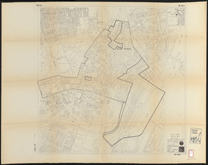
Central business district urban renewal area R-82 : sub area boundaries
302.
City of Boston topographic and planimetric survey
303.
Columbia Point feasibility survey area
304.
Contract documents for the Waterfront Park, Boston, Massachusetts : planting plan
305.
Copley Square : layout and pavement plan with tree numbers added
306.
DEM/BRA Long Wharf master plan : schematic'
307.
Downtown waterfront-Faneuil Hall urban renewal area Massachusetts R-77 : street adjustments
308.
Downtown waterfront-Faneuil Hall urban renewal area Massachusetts R-77 : property
309.
Downtown waterfront-Faneuil Hall urban renewal area Massachusetts R-77 : property
310.
Fenway urban renewal area Massachusetts : disposition parcels
311.
Fenway urban renewal area Massachusetts : disposition parcels
312.
Fenway urban renewal area Massachusetts : building deficiences and proposed treatment area
313.
Fenway urban renewal area Massachusetts : property map
314.
Fenway urban renewal area Massachusetts : existing and proposed zoning
315.
Food distribution center study : Food distribution site study
316.
FPIR/FEIR Olmsted Plaza : a redevelopment of the Sears property, 309 Park Drive/201 Brookline Avenue in the Fenway
317.
General plan : Government Center - Boston - 1959
318.
General plan of Franklin Park
319.
Hancock Woods : as of right plan
320.
Hancock Woods EGA
‹ Prev
Next ›
1
2
…
12
13
14
15
16
17
18
19
20
…
24
25