Toggle navigation
LMEC Home
Exhibitions
Georeferencing
Tools for Teachers
Collections
My Favorites
Sign Up / Log In
Search
Search the map portal
Map Collection
Map Collection
Map Sets
Search
Search
Search for
Search In
All Fields
Creator
Title
Subject
Place
Search All Digital Collections
Advanced Search
8717 Results
My Search
Start Over
More Like
commonwealth:x633f9935
Remove constraint More Like: commonwealth:x633f9935
Filter your Search
Place
North and Central America
5,948
United States
4,866
Massachusetts
2,079
Europe
1,396
Suffolk (county)
1,046
Boston
1,019
Canada
450
Asia
438
more
Place
»
Topic
Boston (Mass.)--Maps
586
United States--Maps
282
Real property--Massachusetts--Boston--Maps
175
Massachusetts--Maps
162
Landowners--Massachusetts--Boston--Maps
133
North America--Maps--Early works to 1800
103
New England--Maps
102
Europe--Maps
79
more
Topic
»
Date
Date range begin
–
Date range end
Current results range from
1482
to
2023
View distribution
Creator
United States. Hydrographic Office
595
O.H. Bailey & Co
148
Des Barres, Joseph F. W. (Joseph Frederick Wallet), 1722-1824
123
United States. Post Office Dept
120
Ptolemy, 2nd cent
100
Walling, Henry Francis, 1825-1888
94
Geological Survey (U.S.)
85
Jefferys, Thomas, -1771
85
more
Creator
»
Format
Maps/Atlases
8,657
Manuscripts
215
Prints
56
Books
36
Objects/Artifacts
10
Drawings/Illustrations
9
Posters
5
Georeferenced
Yes
870
No
7,847
Collection
Norman B. Leventhal Map & Education Center Collection
8,695
Boston and New England Maps
2,233
Urban Maps
2,023
Maritime Charts and Atlases
1,083
American Revolutionary War-Era Maps
638
Boston Redevelopment Authority Collection
87
William L. Clements Library Collection
21
American Antiquarian Society Collection
1
Available to use
No known restrictions
8,553
Creative Commons license
47
Search Constraints
Sort by relevance
relevance
title
date (asc)
date (desc)
Number of results to display per page
20 per page
10
per page
20
per page
50
per page
100
per page
View results as:
grid view
map view
Search Results
1.
Fowler's new map of the Hudson River : with a description of the adjoining country : the distances of the different towns, &c....
2.
A new map of the Hudson River : the post roads between N. York & Albany, the northern and western canals, &c., &c
3.
Willard's new map of the Hudson River
4.
[Willard's new map of the Hudson River for 1844]
5.
Map and profile of the Champlain Canal as made from Lake Champlain to the Hudson River and surveyed thence to the tide at...
6.
Carte pour servir à l'itinéraire pittoresque du fleuve Hudson et des parties latérales de l'Amerique du Nord
7.
Map of the state of New York
8.
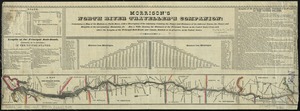
Morrison's North River traveller's companion : containing a map of the Hudson River, with a description of the adjoining...
9.
Map of the Hudson River Rail Road from New York to Albany
10.
Distances North River
11.
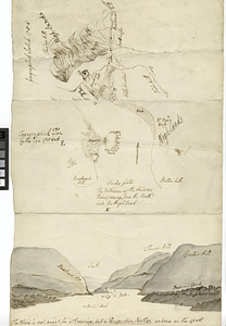
Geographick scetch [sic], 1754
12.
Hudson River from Anthony's Nose to Stony Point
13.
Hudson River from Peekskill to Slaughters Landing
14.
Hudson River from Stony Point to West Point
15.
Hudson River from West Point to Dobbs Ferry
16.
Hudson River highlands at Martelaers Rock
17.
Hudson's River from New York to Albany
18.
Hudson's River from Stony Pt. to Fort Montgomery
19.
Lent's Creek and Baillies Creek
20.
Map from Albany to Crown Point
‹ Prev
Next ›
1
2
3
4
5
…
435
436


![[Willard's new map of the Hudson River for 1844]](https://bpldcassets.blob.core.windows.net/derivatives/images/commonwealth:b8516310f/image_thumbnail_300.jpg)


![Geographick scetch [sic], 1754](https://bpldcassets.blob.core.windows.net/derivatives/metadata/commonwealth-oai:pk02h894n/image_thumbnail_300.jpg)