Toggle navigation
LMEC Home
Exhibitions
Georeferencing
Tools for Teachers
Collections
My Favorites
Sign Up / Log In
Search
Search the map portal
Map Collection
Map Collection
Map Sets
Search
Search
Search for
Search In
All Fields
Creator
Title
Subject
Place
Search All Digital Collections
Advanced Search
8932 Results
My Search
Start Over
More Like
commonwealth:x059cc73c
Remove constraint More Like: commonwealth:x059cc73c
Filter your Search
Place
North and Central America
6,163
United States
5,065
Massachusetts
2,195
Europe
1,396
Suffolk (county)
1,207
Boston
1,180
Canada
450
Asia
438
more
Place
»
Topic
Boston (Mass.)--Maps
752
United States--Maps
282
Massachusetts--Maps
235
Real property--Massachusetts--Boston--Maps
195
City planning--Massachusetts--Boston--Maps
157
Landowners--Massachusetts--Boston--Maps
142
New England--Maps
106
North America--Maps--Early works to 1800
103
more
Topic
»
Date
Date range begin
–
Date range end
Current results range from
1482
to
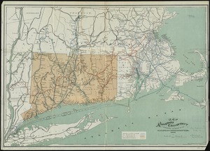
2023
View distribution
Creator
United States. Hydrographic Office
595
Boston Redevelopment Authority
162
O.H. Bailey & Co
148
Des Barres, Joseph F. W. (Joseph Frederick Wallet), 1722-1824
124
United States. Post Office Dept
120
Ptolemy, 2nd cent
100
Walling, Henry Francis, 1825-1888
95
Geological Survey (U.S.)
92
more
Creator
»
Format
Maps/Atlases
8,871
Manuscripts
217
Prints
56
Books
36
Objects/Artifacts
10
Drawings/Illustrations
8
Posters
5
Ephemera
1
Georeferenced
Yes
894
No
8,038
Collection
Norman B. Leventhal Map & Education Center Collection
8,764
Boston and New England Maps
2,402
Urban Maps
2,143
Maritime Charts and Atlases
1,083
American Revolutionary War-Era Maps
657
Boston Redevelopment Authority Collection
194
Mapping Boston Collection
22
Applied Geographics, Inc. Records
21
more
Collection
»
Available to use
No known restrictions
8,706
Creative Commons license
73
Search Constraints
Sort by relevance
relevance
title
date (asc)
date (desc)
Number of results to display per page
20 per page
10
per page
20
per page
50
per page
100
per page
View results as:
grid view
map view
Search Results
61.
Map of the metropolitan district of Boston, Massachusetts : showing the existing public reservations and such new open spaces...
62.
Map showing drives from the Walker-Gordon Laboratory, 203 Claredon St., Boston, to the Laboratory Farm in Wellesley
63.
Map showing the terminal facilities of Boston
64.
Massachusetts official transportation map
65.
Massachusetts official transportation map
66.
Massachusetts Turnpike map : the main street of Massachusetts
67.
Motor routes that intersect the Bay Circuit
68.
New map of the vicinity of Boston, with the dates of settlement, population in 1840, and distance from the capital
69.
Road map, drawn & engraved expressly for Road book of Boston & vicinity
70.
Road map of the Boston District, showing the metropolitan park system
71.
Route map of Massachusetts
72.
Atlas of Massachusetts
73.
Atlas of Massachusetts
74.
EOEA wide area network
75.
Massachusetts and Rhode Island
76.
Diagram of rail roads diverging from Boston : showing the depots and distances
77.
Dinsmore's new railroad map of the United States and the Canadas, showing all the railroads completed and in progress,...
78.
Map of the railroads of Connecticut : to accompany the report of the Railroad Commissioners
79.
The North Shore and part of Middlesex County, Mass
80.
The 100th anniversary map of Abraham Lincoln's visit to Massachusetts, September 11-23, 1848
‹ Prev
Next ›
1
2
3
4
5
6
7
8
…
446
447