Toggle navigation
LMEC Home
Exhibitions
Georeferencing
Tools for Teachers
Collections
My Favorites
Sign Up / Log In
Search
Search the map portal
Map Collection
Map Collection
Map Sets
Search
Search
Search for
Search In
All Fields
Creator
Title
Subject
Place
Search All Digital Collections
Advanced Search
8934 Results
My Search
Start Over
More Like
commonwealth:wd376821f
Remove constraint More Like: commonwealth:wd376821f
Filter your Search
Place
North and Central America
6,165
United States
5,067
Massachusetts
2,195
Europe
1,396
Suffolk (county)
1,210
Boston
1,183
Canada
450
Asia
438
more
Place
»
Topic
Boston (Mass.)--Maps
752
United States--Maps
282
Massachusetts--Maps
235
Real property--Massachusetts--Boston--Maps
195
City planning--Massachusetts--Boston--Maps
159
Landowners--Massachusetts--Boston--Maps
142
New England--Maps
106
North America--Maps--Early works to 1800
103
more
Topic
»
Date
Date range begin
–
Date range end
Current results range from
1482
to
2023
View distribution
Creator
United States. Hydrographic Office
595
Boston Redevelopment Authority
164
O.H. Bailey & Co
148
Des Barres, Joseph F. W. (Joseph Frederick Wallet), 1722-1824
124
United States. Post Office Dept
120
Ptolemy, 2nd cent
100
Walling, Henry Francis, 1825-1888
95
Geological Survey (U.S.)
92
more
Creator
»
Format
Maps/Atlases
8,873
Manuscripts
217
Prints
56
Books
36
Objects/Artifacts
10
Drawings/Illustrations
8
Posters
5
Ephemera
1
Georeferenced
Yes
893
No
8,041
Collection
Norman B. Leventhal Map & Education Center Collection
8,765
Boston and New England Maps
2,406
Urban Maps
2,146
Maritime Charts and Atlases
1,083
American Revolutionary War-Era Maps
657
Boston Redevelopment Authority Collection
196
Mapping Boston Collection
22
Applied Geographics, Inc. Records
21
more
Collection
»
Available to use
No known restrictions
8,709
Creative Commons license
73
Search Constraints
Sort by relevance
relevance
title
date (asc)
date (desc)
Number of results to display per page
20 per page
10
per page
20
per page
50
per page
100
per page
View results as:
grid view
map view
Search Results
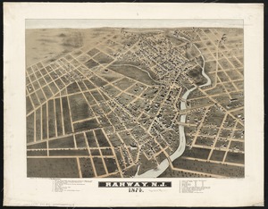
7281.
Rahway, N.J : 1874
7282.
Rail road map of New England & eastern New York
7283.
Rail road map of New England & eastern New York
7284.
Rail road map of Pennsylvania
7285.
Rail road map of Pennsylvania
7286.
Rail road map of the southern states shewing the southern & southwestern railway connections with Philadelphia
7287.
Railroad and county map of Mississippi
7288.
Railroad Commissioners' map of the State of Vermont
7289.
Railroad distance map of the United States, Mexico & Canada
7290.
Railroad map of Illinois
7291.
Railroad map of New England & eastern New York complied from the most authentic sources
7292.
Railroad map of New England, with adjacent portions of New York & Canada
7293.
Railroads of Lithuania, 1939
7294.
Railway and highway map of the famous Berkshire Hills region, showing also villages and points of interest : from official...
7295.
Railway and highway map of the famous Berkshire Hills region, showing also villages and points of interest : from official...
7296.
The railway map of Japan
7297.
Railway map of the British Isles
7298.
Railway map of the New England states, engraved expressly for the Pathfinder railway guide
7299.
Rainfall-chart of the United States : showing the distribution by isohyetal curves of the mean precipitation in rain ...
7300.
Rambles through our country : an instructive geographical game for the young
‹ Prev
Next ›
1
2
…
361
362
363
364
365
366
367
368
369
…
446
447