Toggle navigation
LMEC Home
Exhibitions
Georeferencing
Tools for Teachers
Collections
My Favorites
Sign Up / Log In
Search
Search the map portal
Map Collection
Map Collection
Map Sets
Search
Search
Search for
Search In
All Fields
Creator
Title
Subject
Place
Search All Digital Collections
Advanced Search
8932 Results
My Search
Start Over
More Like
commonwealth:wd3767064
Remove constraint More Like: commonwealth:wd3767064
Filter your Search
Place
North and Central America
6,163
United States
5,067
Massachusetts
2,204
Europe
1,396
Suffolk (county)
1,208
Boston
1,181
Canada
450
Asia
438
more
Place
»
Topic
Boston (Mass.)--Maps
752
United States--Maps
282
Massachusetts--Maps
235
Real property--Massachusetts--Boston--Maps
195
City planning--Massachusetts--Boston--Maps
157
Landowners--Massachusetts--Boston--Maps
142
New England--Maps
106
North America--Maps--Early works to 1800
103
more
Topic
»
Date
Date range begin
–
Date range end
Current results range from
1482
to
2023
View distribution
Creator
United States. Hydrographic Office
595
Boston Redevelopment Authority
162
O.H. Bailey & Co
148
Des Barres, Joseph F. W. (Joseph Frederick Wallet), 1722-1824
124
United States. Post Office Dept
120
Ptolemy, 2nd cent
100
Walling, Henry Francis, 1825-1888
95
Geological Survey (U.S.)
92
more
Creator
»
Format
Maps/Atlases
8,871
Manuscripts
217
Prints
56
Books
36
Objects/Artifacts
10
Drawings/Illustrations
8
Posters
5
Ephemera
1
Georeferenced
Yes
894
No
8,038
Collection
Norman B. Leventhal Map & Education Center Collection
8,765
Boston and New England Maps
2,403
Urban Maps
2,143
Maritime Charts and Atlases
1,083
American Revolutionary War-Era Maps
657
Boston Redevelopment Authority Collection
194
Mapping Boston Collection
22
Applied Geographics, Inc. Records
21
more
Collection
»
Available to use
No known restrictions
8,707
Creative Commons license
73
Search Constraints
Sort by relevance
relevance
title
date (asc)
date (desc)
Number of results to display per page
20 per page
10
per page
20
per page
50
per page
100
per page
View results as:
grid view
map view
Search Results
1501.
Base map of Illinois
1502.
Base-map of the United States
1503.
Bataan
1504.
Batavia
1505.
Bath, Penn
1506.
Baton Rouge
1507.
The battle fields and military positions in the Virginian peninsula : from surveys supplied by officers of the army
1508.
Battle of Brandywine in which the rebels were defeated, September the 11th. 1777, by the army under the command of General Sr....
1509.
Battle of Cerro Gordo, April 17th & 18th 1847
1510.
Battle of Gravelotte, August 18th, 1870
1511.
Battle of Zorndorf
1512.
Battlefield in front of Franklin, Tenn. where the United States forces, consisting of the 4th & 23rd Corps and the Cavalry...
1513.
Battlefield of Chattanooga with the operations of the national forces under the command of Maj. Gen. U.S. Grant during the...
1514.
Battlefield of Chattanooga with the operations of the national forces under the command of Maj. Gen. U.S. Grant during the...
1515.
The battlefield of Fredericksburg
1516.
The battle-field of the nations : a panoramic view of the seat of war in the Danubian provinces, Turkey, Asia Minor, Southern...
1517.
Battlefields in front of Nashville where the United States forces commanded by Major General Geo. H. Thomas defeated and routed...
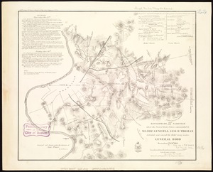
1518.
Battles of Mexico : survey of the line of operations of the U.S. Army, under command of Major General Winfield Scott, on the...
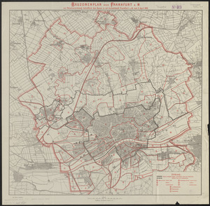
1519.
Bauzonenplan von Frankfurt a. M : zur polizeiverordnung betreffend das bauen in der aufsenstadt Frankfurt a. M. vom 8 April 1910
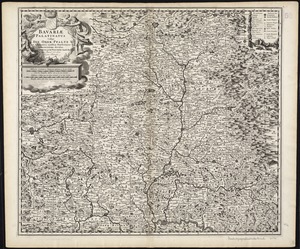
1520.
Bavariae Palatinatus vulgo die Ober-Pfaltz in subjacentes ejusdem praefecturas accuratissime divisus
‹ Prev
Next ›
1
2
…
72
73
74
75
76
77
78
79
80
…
446
447