Toggle navigation
LMEC Home
Exhibitions
Georeferencing
Tools for Teachers
Collections
My Favorites
Sign Up / Log In
Search
Search the map portal
Map Collection
Map Collection
Map Sets
Search
Search
Search for
Search In
All Fields
Creator
Title
Subject
Place
Search All Digital Collections
Advanced Search
9135 Results
My Search
Start Over
More Like
commonwealth:wd376646w
Remove constraint More Like: commonwealth:wd376646w
Filter your Search
Place
North and Central America
6,366
United States
5,282
Massachusetts
2,199
Suffolk (county)
1,470
Boston
1,443
Europe
1,396
Canada
449
Asia
438
more
Place
»
Topic
Boston (Mass.)--Maps
752
City planning--Massachusetts--Boston--Maps
418
United States--Maps
282
Urban renewal--Massachusetts--Boston--Maps
253
Real property--Massachusetts--Boston--Maps
225
Massachusetts--Maps
166
Landowners--Massachusetts--Boston--Maps
144
New England--Maps
104
more
Topic
»
Date
Date range begin
–
Date range end
Current results range from
1482
to
2023
View distribution
Creator
United States. Hydrographic Office
595
Boston Redevelopment Authority
399
O.H. Bailey & Co
148
Des Barres, Joseph F. W. (Joseph Frederick Wallet), 1722-1824
124
United States. Post Office Dept
120
Ptolemy, 2nd cent
100
Walling, Henry Francis, 1825-1888
94
Geological Survey (U.S.)
87
more
Creator
»
Format
Maps/Atlases
9,075
Manuscripts
215
Prints
56
Books
36
Objects/Artifacts
10
Drawings/Illustrations
8
Posters
5
Georeferenced
Yes
885
No
8,250
Collection
Norman B. Leventhal Map & Education Center Collection
8,728
Boston and New England Maps
2,622
Urban Maps
2,404
Maritime Charts and Atlases
1,083
American Revolutionary War-Era Maps
638
Boston Redevelopment Authority Collection
454
Mapping Boston Collection
20
Massachusetts Real Estate Atlases
18
more
Collection
»
Available to use
No known restrictions
8,932
Creative Commons license
70
Search Constraints
Sort by relevance
relevance
title
date (asc)
date (desc)
Number of results to display per page
20 per page
10
per page
20
per page
50
per page
100
per page
View results as:
grid view
map view
Search Results
61.
South Boston urban renewal area r-51 : existing and proposed public facilities
62.
Boston urban wilds
63.
Boston Harbor Mass : Charles River from Brookline Street bridge to Market Street bridge
64.
Boston Harbor, Mass : map of Charles River from Brookline Street bridge to its mouth
65.
Charles River
66.
Charles River embankment : Boston district
67.
Map of Charles River showing principal sources of pollution
68.
Map of the lower portion of Charles River showing principal sources of pollution
69.
[Plan for proposed Charles River Park]
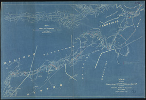
70.
Plan of Charles River : from the Waltham line to Boston harbor
71.
Sketch plan showing the existing and proposed public reservations upon the banks of the Charles between Waltham line and...
72.
1975 general land use plan
73.
Boston thorofare plan existing routes and proposals
74.
Campus High School urban renewal area Mass. r- : locality map blighted areas
75.
Campus High School urban renewal area Mass. r- : locality map important features
76.
Central business district project no Mass r- : existing land use
77.
Central business district project no Mass r- : existing building condition
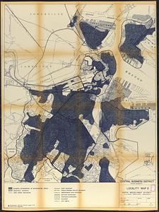
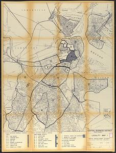
78.
Central business district project no Mass r- : locality map 2
79.
Central business district project no Mass r- : locality map 1
80.
Central business district urban renewal area Massachusetts r-82 : pedestrian circulation
‹ Prev
Next ›
1
2
3
4
5
6
7
8
…
456
457


![[Plan for proposed Charles River Park]](https://bpldcassets.blob.core.windows.net/derivatives/images/commonwealth:cf95jc91c/image_thumbnail_300.jpg)